Category:Sevier County, Utah
Пређи на навигацију
Пређи на претрагу
Counties of Utah: Beaver · Box Elder · Cache · Carbon · Daggett · Davis · Duchesne · Emery · Garfield · Grand · Iron · Juab · Kane · Millard · Morgan · Piute · Rich · Salt Lake · San Juan · Sanpete · Sevier · Summit · Tooele · Uintah · Utah · Wasatch · Washington · Wayne · Weber
county in south-central Utah, United States   | |||||
| Отпремање медија | |||||
| Је | |||||
|---|---|---|---|---|---|
| Названо по | |||||
| Локација | Јута, САД | ||||
| Престоница | |||||
| Настанак |
| ||||
| Насељеност |
| ||||
| Површина |
| ||||
| Различито од | |||||
| званични веб-сајт | |||||
 | |||||
English: Media related to Sevier County, Utah, a county in central Utah, United States.
Поткатегорије
Приказано је 12 поткатегорија; укупно 12.
Медији у категорији „Sevier County, Utah”
Следећих 24 датотека је у овој категорији, од укупно 24.
-
 Watershed work plan, Monroe-Annabella Watershed, Sevier and Piute Counties, Utah (IA CAT91955286).pdf 1.129 × 1.541, 111 страница; 5,72 MB
-
 Cathedral Rock - Pahvant Narrows DyeClan.com - panoramio.jpg 1.952 × 3.264; 1,28 MB
-
 Fall in Utah (15719143625).jpg 5.456 × 3.632; 8,32 MB
-
 Hunting Petroglyph - DyeClan.com - panoramio.jpg 4.000 × 3.000; 4,7 MB
-
 Juniper - panoramio.jpg 3.264 × 4.928; 12,69 MB
-
 Michelle Whelan, Forest Prevention Officer ET5A7467 (29783127664).jpg 5.760 × 3.840; 8,69 MB
-
 Michelle Whelan, Forest Prevention Officer ET5A7471 (30327517121).jpg 5.760 × 3.840; 8,59 MB
-
 Michelle Whelan, Forest Prevention Officer ET5A7472 (30116650090).jpg 5.760 × 3.840; 7,25 MB
-
 Monroe Canyon in the Fall dyeclan.com - panoramio.jpg 2.448 × 3.264; 5,03 MB
-
 Monrovian Park Sign, DyeClan.com - panoramio.jpg 4.000 × 3.000; 4,99 MB
-
 NRCSUT03012 - Utah (6395)(NRCS Photo Gallery).jpg 1.500 × 2.100; 6,06 MB
-
 NRCSUT03012 - Utah (6395)(NRCS Photo Gallery).tif 1.500 × 2.100; 12,02 MB
-
 Potholes in the Pahvant Narrows - panoramio.jpg 2.448 × 3.264; 1,04 MB
-
 Richfield - panoramio.jpg 4.928 × 3.264; 13,64 MB
-
 Rock that Looks Like a Face - panoramio.jpg 3.000 × 4.000; 3,75 MB
-
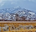 Sevier - panoramio.jpg 2.984 × 2.662; 7,59 MB
-
 Somewhere near Salina - (6293975441).jpg 2.121 × 1.414; 1,01 MB
-
 Somewhere near Salina - (6293976037).jpg 2.121 × 1.414; 3,16 MB
-
 Sunset in Monroe Canyon dyeclan.com - panoramio.jpg 3.264 × 2.448; 2,3 MB
-
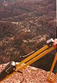 Surveying in the Utah Mountains - panoramio.jpg 667 × 965; 383 kB
-
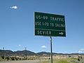 US-89 Traffic-Use I-70 to Salina - panoramio.jpg 3.648 × 2.736; 2,3 MB
-
 USA Sevier County, Utah age pyramid.svg 520 × 600; 8 kB
-
 Utah State Route 118 Between Joseph and Monroe.jpg 4.000 × 3.000; 3,34 MB
-
 Waterfall on Monroe Creek, DyeClan.com - panoramio.jpg 3.000 × 4.000; 4,2 MB

.jpg)


.jpg)
.jpg)
.jpg)


(NRCS_Photo_Gallery).jpg)


.jpg)
.jpg)


