Category:Sevier Lake
Jump to navigation
Jump to search
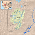
intermittent lake in Millard County, Utah, United States  | |||||
| Upload media | |||||
| Instance of | |||||
|---|---|---|---|---|---|
| Location | Millard County, Utah | ||||
| Area |
| ||||
| Elevation above sea level |
| ||||
| Inflows | |||||
| Basin country | |||||
 | |||||
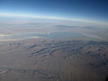
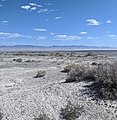
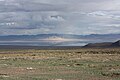
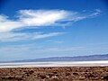
English: Sevier Lake or Sevier Dry Lake — in Millard County, western Utah.
- After flowing southwest in the Sevier Desert, the Sevier River ends in the basin, located in the extreme southwestern area.
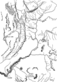
- The Wah Wah Valley Hardpan is adjacent in the Wah Wah Valley, to the southwest border of the dry lakebed.
Media in category "Sevier Lake"
The following 27 files are in this category, out of 27 total.
-
 2017.05.13 09.36.32 IMG 0636 - Flickr - andrey zharkikh.jpg 5,079 × 2,965; 2.68 MB
-
 2017.05.13 09.36.36 IMG 0637 - Flickr - andrey zharkikh.jpg 4,993 × 2,430; 2.5 MB
-
 2017.05.13 09.36.42 IMG 0638 - Flickr - andrey zharkikh.jpg 5,184 × 3,888; 3.59 MB
-
 Fig 30 Diagram of Lake Oscillations inferred from Deposits and Erosions.jpg 1,069 × 596; 50 KB
-
 Fig 31 Sevier Lake in 1872.jpg 536 × 825; 155 KB
-
 Great Basin National Park 102007 091.JPG 1,024 × 599; 110 KB
-
 Millardcounty ut.png 1,024 × 670; 35 KB
-
 Mountain Meadows BHoU-p550.png 1,760 × 3,126; 156 KB
-
 Sevier Dry Lake, Utah (7186832904).jpg 4,000 × 3,000; 1.91 MB
-
 Sevier Lake - Flickr - pellaea (1).jpg 3,648 × 1,561; 1.06 MB
-
 Sevier Lake - Flickr - pellaea.jpg 2,658 × 3,544; 3.62 MB
-
 Sevier Lake - panoramio.jpg 2,160 × 1,440; 541 KB
-
 Sevier Lake Aerial.JPG 4,320 × 3,240; 4.91 MB
-
 Sevier Lake Summer 2019.jpg 3,008 × 3,097; 2.57 MB
-
 Sevier Lake UT.jpg 1,512 × 2,501; 417 KB
-
 Sevier Lake Utah September 2013.JPG 4,272 × 2,848; 4.97 MB
-
 SevierDryLake-2009-ByPhilKonstantin.jpg 800 × 600; 56 KB
-
 SevierLake.JPG 2,592 × 1,936; 1 MB
-
 Sevierrivermap.png 500 × 500; 405 KB
-
 Site of Gunnison Massacre BHoU-p469.png 2,952 × 1,982; 137 KB
-
 Southern Utah map c. 1857, Bancroft p. 550.PNG 332 × 563; 43 KB
-
 Timpanogos Valley BHoU-p13.png 2,870 × 4,082; 225 KB
-
-
-
-

-


.jpg)
.jpg)


_2017.05.13_10.23.44_IMG_9333_-_Flickr_-_andrey_zharkikh.jpg)
_2017.05.13_10.24.20_IMG_9335_-_Flickr_-_andrey_zharkikh.jpg)
_2017.05.13_10.24.32_IMG_9336_-_Flickr_-_andrey_zharkikh.jpg)
_2017.05.13_10.24.49_IMG_9337_-_Flickr_-_andrey_zharkikh.jpg)
_2017.05.13_10.42.24_IMG_9343_-_Flickr_-_andrey_zharkikh.jpg)
Categories:
- Lakes of Utah
- Bodies of water in Millard County, Utah
- Landforms of Millard County, Utah
- Sevier Desert
- Quaternary geology of Utah
- Wah Wah Valley
- Dry lakes of the United States
- Locations along U.S. Route 6 in Millard County, Utah
- Locations along U.S. Route 50 in Millard County, Utah
- Locations along U.S. Route 50 in Utah (1953-1976) in Millard County, Utah
- Locations along Utah State Route 26 (1971-1977) in Millard County, Utah
- Locations along Utah State Route 27 (1927-1977) in Millard County, Utah