Category:Shared bikeways in New Zealand
Jump to navigation
Jump to search
Bikeways in New Zealand where pedestrians are (generally) allowed.
Subcategories
This category has the following 12 subcategories, out of 12 total.
C
G
L
- Lake Esplanade, Queenstown (20 F)
N
S
- Southern Path (2 F)
- State Highway 20 Cycleway (9 F)
T
- Te Ara ki Uta ki Tai (7 F)
- Te Atatu Cycleway (3 F)
W
Media in category "Shared bikeways in New Zealand"
The following 22 files are in this category, out of 22 total.
-
 Albany Lakes And Westfield Albany V.jpg 1,600 × 1,200; 1.06 MB
-
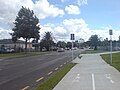
 Bike lanes Auckland 20200228 090512.jpg 4,608 × 3,456; 4.74 MB
-
 Central Park Drive Looking West.jpg 1,600 × 1,200; 246 KB
-
 Cycleway Markings On Quay Street I.jpg 1,600 × 1,200; 337 KB
-
 Cycleway Markings On Quay Street II.jpg 1,600 × 1,200; 315 KB
-
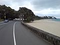 Kohimarama & Tamaki Drive.jpg 1,600 × 1,200; 358 KB
-
 Longburn opening 485 (18720037034).jpg 5,472 × 3,648; 3.41 MB
-
 Longburn opening 498 (18720011984).jpg 5,472 × 3,648; 3.75 MB
-
 Longburn opening 505 (19154913458).jpg 5,472 × 3,648; 4.06 MB
-
 Longburn opening 506 (19336450592).jpg 5,472 × 3,648; 5.34 MB
-
 Nelson Railway Cycleway 031.JPG 3,264 × 2,448; 3.11 MB
-
 Ports of Auckland Fence Path.jpg 1,600 × 1,200; 484 KB
-
 Ports of Auckland Portal Crane.jpg 1,200 × 1,600; 474 KB
-
 Shared Path And T2 Lane On Akoranga.jpg 1,600 × 1,200; 694 KB
-
 Tamaki Drive Cycleway On A Sunny Day.jpg 1,600 × 1,200; 595 KB
-
 Tamaki Drive Cycling Traffic Warning.jpg 1,600 × 1,200; 1.11 MB
-
 Tamaki Drive Looking East From Parnell Bridge.jpg 1,600 × 1,200; 363 KB
-
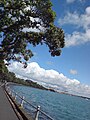 Tamaki Drive Overhanging Pohutukawa.jpg 1,200 × 1,600; 198 KB
-
 Tamaki Drive Sweeping Close To Water.jpg 1,600 × 1,200; 206 KB
-
 Tamaki Drive Walk And Cycleway Seawall.jpg 1,200 × 1,600; 200 KB
-
 Waiheke Island Main Entry Has Cycle Path.jpg 1,600 × 1,200; 1.33 MB
-
 Walking Path Near Pt Chev Interchange.jpg 1,600 × 1,200; 1.06 MB


.jpg)
.jpg)
.jpg)
.jpg)


