Category:Shenington
Jump to navigation
Jump to search
village in Oxfordshire, UK  | |||||
| Upload media | |||||
| Instance of | |||||
|---|---|---|---|---|---|
| Location | Shenington with Alkerton, Cherwell, Oxfordshire, South East England, England | ||||
| official website | |||||
 | |||||
English: Shenington is a village in the civil parish of Shenington with Alkerton west of Banbury. It was an exclave of Gloucestershire until the Counties (Detached Parts) Act 1844 transferred it to Oxfordshire. It is on Oxfordshire's boundary with Warwickshire.
Subcategories
This category has the following 2 subcategories, out of 2 total.
B
- Bell Inn, Shenington (2 F)
T
Media in category "Shenington"
The following 34 files are in this category, out of 34 total.
-
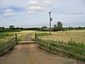 Driveway to Stonepit Cottage - geograph.org.uk - 184818.jpg 640 × 480; 65 KB
-
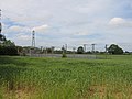 Electricity sub-station - geograph.org.uk - 187342.jpg 640 × 480; 77 KB
-
 Feeding troughs on the grazing land - geograph.org.uk - 461690.jpg 640 × 477; 88 KB
-
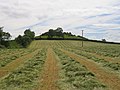 Haymaking at Yarn Hill - geograph.org.uk - 184817.jpg 640 × 480; 81 KB
-
 Long Acre, Shenington - geograph.org.uk - 1568570.jpg 640 × 480; 113 KB
-
 Houses in Shenington - geograph.org.uk - 448969.jpg 640 × 477; 94 KB
-
 Shenington CE primary school - geograph.org.uk - 1568606.jpg 640 × 405; 69 KB
-
 Shenington village green - geograph.org.uk - 448963.jpg 640 × 477; 101 KB
-
 That, children, is a photographer - geograph.org.uk - 461704.jpg 640 × 477; 106 KB
-
 Alkerton Barn - geograph.org.uk - 197849.jpg 640 × 480; 37 KB
-
 Alkerton riding school and church - geograph.org.uk - 461745.jpg 640 × 477; 103 KB
-
 Bridge over Sor Brook - geograph.org.uk - 485958.jpg 640 × 427; 183 KB
-
 Bridleway to Shenington - geograph.org.uk - 198017.jpg 640 × 480; 54 KB
-
 Descent to the shed - geograph.org.uk - 461711.jpg 640 × 477; 99 KB
-
 Dumper and ditch - geograph.org.uk - 461727.jpg 640 × 477; 108 KB
-
 Footbridge and boggy area near Alkerton - geograph.org.uk - 461752.jpg 640 × 477; 140 KB
-
 Footpath west of Shenington - geograph.org.uk - 448979.jpg 640 × 477; 88 KB
-
 Gentle descent through sheep pasture - geograph.org.uk - 461694.jpg 640 × 477; 91 KB
-
 Grassland near the Bungalow - geograph.org.uk - 461730.jpg 640 × 477; 72 KB
-
 Horse jump - geograph.org.uk - 461735.jpg 640 × 477; 103 KB
-
 Horse jump - geograph.org.uk - 461741.jpg 640 × 477; 93 KB
-
 Jester's Hill - geograph.org.uk - 12490.jpg 480 × 640; 59 KB
-
 Macmillan Way looking south east - geograph.org.uk - 461683.jpg 640 × 477; 103 KB
-
 Rolling countryside west of Shenington - geograph.org.uk - 448998.jpg 640 × 477; 100 KB
-
 Sheep pasture and a digger bucket - geograph.org.uk - 461700.jpg 640 × 477; 95 KB
-
 Shenington Mill Leet - geograph.org.uk - 485953.jpg 640 × 427; 182 KB
-
 Shenington Mill Outflow - geograph.org.uk - 485966.jpg 640 × 427; 217 KB
-
 Shutford Grounds Farm - geograph.org.uk - 187346.jpg 640 × 480; 88 KB
-
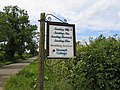 Stonepit Cottage sign - geograph.org.uk - 187344.jpg 639 × 479; 96 KB
-
 Towards Yarn Hill Farm - geograph.org.uk - 449000.jpg 640 × 477; 99 KB
-
 View from footpath looking north - geograph.org.uk - 461687.jpg 640 × 477; 99 KB
-
 View of Long Hill - geograph.org.uk - 187350.jpg 640 × 480; 65 KB
-
 View towards Shennington - geograph.org.uk - 197425.jpg 640 × 480; 44 KB
-
 View towards Tythe Farm - geograph.org.uk - 236896.jpg 640 × 480; 46 KB


