Category:Shepperton
Jump to navigation
Jump to search
town in south-east England, United Kingdom  | |||||
| Upload media | |||||
| Instance of | |||||
|---|---|---|---|---|---|
| Location | Spelthorne, Surrey, South East England, England | ||||
| Located in or next to body of water | |||||
| Area |
| ||||
 | |||||
Deutsch: Shepperton ist eine Stadt im Verwaltungsbezirk Spelthorne der Grafschaft Surrey im Süden Englands, knapp außerhalb Londons. Sie hatte 2001 10.796 Einwohner. Im Süden grenzt sie an die Themse und wird von dem Motorway M3 geteilt.
English: Shepperton is a town in the borough of Spelthorne, Surrey, England. To the South it is bounded by the river Thames at Desborough Island and is bisected by the M3 motorway. It became part of the former Sunbury on Thames Urban District in 1930.
Esperanto: Shepperton estas urbeto en provinco Surrey en suda Anglio. Ĝi situas laŭ la norda flanko de la rivero Tamizo. Ĝi enhavas proksime 10.796 loĝantojn.
Norsk bokmål: Shepperton er en liten by i distriktet Spelthorne, som ligger i Surrey, England. Den ligger ved Themsen, og deles i to av motorveien M3.
Русский: Шеппертон — город в Великобритании.
Subcategories
This category has the following 4 subcategories, out of 4 total.
Media in category "Shepperton"
The following 132 files are in this category, out of 132 total.
-
 'Old' Shepperton. - panoramio.jpg 3,202 × 4,334; 4.11 MB
-
 42-44 High Street, Shepperton - geograph.org.uk - 4688010.jpg 640 × 480; 129 KB
-
 A loop of the Thames - geograph.org.uk - 2658761.jpg 640 × 480; 65 KB
-
 A riverside garden nr. Shepperton Lock. - panoramio.jpg 3,276 × 2,207; 2.67 MB
-
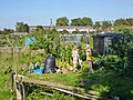 Allotments, Shepperton - geograph.org.uk - 4682095.jpg 640 × 480; 142 KB
-
 Arrived at Shepperton - geograph.org.uk - 3399771.jpg 480 × 640; 150 KB
-
 Battlecrease Hall - geograph.org.uk - 2658759.jpg 640 × 480; 54 KB
-
 Bishop Duppas Recreation Ground - geograph.org.uk - 2587374.jpg 1,024 × 680; 167 KB
-
 Bishop Duppas Recreation Ground - geograph.org.uk - 2779232.jpg 1,024 × 622; 512 KB
-
 Bishop Duppas Recreation Ground - geograph.org.uk - 853816.jpg 640 × 480; 56 KB
-
 Bungalows - Gaston Way - geograph.org.uk - 4543785.jpg 1,632 × 918; 378 KB
-
 Chertsey Road (geograph 2778754).jpg 1,024 × 741; 504 KB
-
 Chertsey Road, Old Shepperton (geograph 5360219).jpg 5,202 × 3,465; 3.02 MB
-
 Church Road, Shepperton - geograph.org.uk - 3550928.jpg 2,048 × 1,536; 1.6 MB
-
 Dunboe Place at the junction of Russell Road - geograph.org.uk - 4115398.jpg 2,560 × 1,920; 1.9 MB
-
 Dunboe Place, Shepperton - geograph.org.uk - 4115359.jpg 2,560 × 1,920; 1.79 MB
-
 Dunboe Place, Shepperton - geograph.org.uk - 4115375.jpg 2,560 × 1,920; 2.12 MB
-
 Duppas Close - geograph.org.uk - 3847280.jpg 640 × 480; 65 KB
-

-
 Felix Lane junction - geograph.org.uk - 4689885.jpg 2,000 × 1,333; 2.77 MB
-
 Felix Lane Junction with Fordbridge Road - geograph.org.uk - 4543813.jpg 1,632 × 918; 387 KB
-
 Felix Lane, Shepperton - geograph.org.uk - 4689892.jpg 889 × 1,333; 1.1 MB
-
 Ferry Lane - geograph.org.uk - 4555786.jpg 1,632 × 918; 442 KB
-
 Ferry Lane Shepperton - geograph.org.uk - 2503242.jpg 640 × 480; 82 KB
-
 Ferry Lane, Old Shepperton - geograph.org.uk - 2658868.jpg 640 × 480; 90 KB
-
 Ferry Lane, Shepperton - geograph.org.uk - 3569433.jpg 1,953 × 1,530; 888 KB
-
 Fiat and Nissan dealership on Russell Road - geograph.org.uk - 4116012.jpg 2,560 × 1,920; 2.1 MB
-
 Flood at The Three Horseshoes - geograph.org.uk - 3847282.jpg 640 × 480; 84 KB
-
 Flood, Shepperton - geograph.org.uk - 3847288.jpg 640 × 480; 93 KB
-
 Flower filled boat - geograph.org.uk - 5360205.jpg 4,507 × 3,011; 3.8 MB
-
 Footpath crossing point - geograph.org.uk - 4646326.jpg 2,000 × 1,333; 2.63 MB
-
 Footpath to River Thames - geograph.org.uk - 3049801.jpg 640 × 480; 160 KB
-
 Footpath, Shepperton - geograph.org.uk - 4644287.jpg 2,000 × 1,333; 3.46 MB
-
 Fordbridge Road, Shepperton - geograph.org.uk - 2884929.jpg 4,320 × 3,240; 4.27 MB
-
 Gaston Bridge Road (A244) - geograph.org.uk - 5870796.jpg 1,024 × 768; 333 KB
-
 Gaston Bridge Road, A244, Shepperton - geograph.org.uk - 5609881.jpg 640 × 428; 111 KB
-
 Gaston Bridge, Shepperton - geograph.org.uk - 4689898.jpg 2,000 × 1,333; 2.98 MB
-
 Gaston Way - geograph.org.uk - 4543797.jpg 1,632 × 918; 546 KB
-
 Glebeland gardens, Shepperton - geograph.org.uk - 4644929.jpg 2,000 × 1,333; 2.77 MB
-
 Golden Grill, Shepperton High St - geograph.org.uk - 5360153.jpg 5,202 × 3,465; 4.14 MB
-
 Gordon Road - geograph.org.uk - 5870802.jpg 1,024 × 768; 272 KB
-
 Govett Avenue, Shepperton - geograph.org.uk - 4644944.jpg 2,000 × 1,333; 2.75 MB
-
 Govett Avenue, Shepperton - geograph.org.uk - 4645550.jpg 2,000 × 1,333; 2.27 MB
-
 Green by Russell Road, Shepperton - geograph.org.uk - 4115417.jpg 2,560 × 1,920; 2.04 MB
-
 Green Lane, Shepperton - geograph.org.uk - 4646318.jpg 2,000 × 1,333; 2.3 MB
-
 Halliford School - geograph.org.uk - 2658765.jpg 640 × 480; 63 KB
-
 Halliford School - geograph.org.uk - 5360422.jpg 5,202 × 3,465; 3.43 MB
-
 Harrison's, Shepperton - geograph.org.uk - 2739363.jpg 2,560 × 1,920; 1.76 MB
-
 High Street, Shepperton - geograph.org.uk - 5360151.jpg 640 × 426; 77 KB
-
 Homecare and DIY, Shepperton High St - geograph.org.uk - 5360158.jpg 4,814 × 3,082; 2.93 MB
-
 Littleton Lane, Shepperton - geograph.org.uk - 73303.jpg 480 × 640; 116 KB
-
 Littleton Lane, Shepperton - geograph.org.uk - 73304.jpg 640 × 480; 109 KB
-

-
 Lower Halliford - geograph.org.uk - 4564188.jpg 640 × 451; 44 KB
-
 Manor House Court, Old Shepperton (geograph 5360215).jpg 4,781 × 2,956; 2.29 MB
-
 Manor Park club - geograph.org.uk - 5360197.jpg 4,310 × 2,984; 2.53 MB
-
 Manor Park cricket ground - geograph.org.uk - 5360409.jpg 5,202 × 3,465; 3.69 MB
-
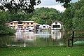
 Moorings near Lower Halliford - geograph.org.uk - 5360427.jpg 5,202 × 3,465; 3.29 MB
-
 Moorings, Shepperton - geograph.org.uk - 2739351.jpg 2,560 × 1,920; 1.69 MB
-
 Motorway footbridge - geograph.org.uk - 3551069.jpg 2,048 × 1,536; 1.49 MB
-
 Nell Gwynne Avenue, Shepperton - geograph.org.uk - 4646305.jpg 2,000 × 1,333; 2.67 MB
-
 Old Charlton Road - geograph.org.uk - 4543749.jpg 1,632 × 918; 507 KB
-
 Old Charlton Road - geograph.org.uk - 4543756.jpg 1,632 × 918; 440 KB
-
 Old Shepperton Square (geograph 4204348).jpg 5,669 × 1,906; 1.34 MB
-
 Outside the Shapla - geograph.org.uk - 5211340.jpg 1,600 × 1,200; 602 KB
-
 Petrol station, Shepperton - geograph.org.uk - 2884924.jpg 4,320 × 3,240; 3.72 MB
-
 Plaque at Shepperton Square (geograph 6465523).jpg 797 × 533; 151 KB
-
 Playing fields, Thamesmead school - geograph.org.uk - 4644285.jpg 2,000 × 1,333; 1.99 MB
-
 Postbox in Chertsey Road (geograph 6123090).jpg 640 × 480; 72 KB
-
 Ragwort in a field east of Walton Bridge Road - geograph.org.uk - 5870815.jpg 1,024 × 768; 290 KB
-
 Recreation area near Gaston Bridge - geograph.org.uk - 4690077.jpg 2,000 × 1,333; 2.48 MB
-
 Recreation ground, Shepperton - geograph.org.uk - 4644277.jpg 2,000 × 1,333; 2.2 MB
-
 River Ash Back Gardens.JPG 2,560 × 1,920; 2.42 MB
-
 River Thames at Shepperton - geograph.org.uk - 3049785.jpg 640 × 480; 71 KB
-
 River Thames by Shepperton - geograph.org.uk - 2739347.jpg 2,560 × 1,920; 1.69 MB
-
-
 River Thames near Lower Halliford - geograph.org.uk - 5360432.jpg 5,202 × 3,465; 3.44 MB
-
 Riverside houses, Shepperton - geograph.org.uk - 4682112.jpg 640 × 480; 121 KB
-
 Riverside, Shepperton - geograph.org.uk - 2739359.jpg 2,560 × 1,920; 1.68 MB
-
 Riverview, Russell Road - geograph.org.uk - 3049777.jpg 640 × 480; 67 KB
-
 Riverview, Russell Road - geograph.org.uk - 3049780.jpg 640 × 480; 82 KB
-
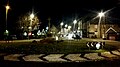
 Roundabout and war memorial, Shepperton - geograph.org.uk - 5360188.jpg 5,202 × 3,465; 3.96 MB
-
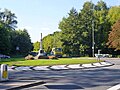
 Roundabout with war memorial - geograph.org.uk - 5211331.jpg 1,600 × 899; 454 KB
-
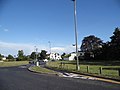
 Roundabout with war memorial, Shepperton - geograph.org.uk - 4682079.jpg 640 × 480; 122 KB
-
 Russell Road at the junction of Walton Lane - geograph.org.uk - 4115404.jpg 2,560 × 1,920; 1.99 MB
-
 Sailing club by the River Thames - geograph.org.uk - 3049771.jpg 640 × 427; 107 KB
-
 Scrub area off Renfree Way - geograph.org.uk - 3550948.jpg 2,048 × 1,536; 1.83 MB
-
 Shepperton Business Park - geograph.org.uk - 4645545.jpg 2,000 × 1,333; 2.51 MB
-
 Shepperton Green - geograph.org.uk - 4564186.jpg 640 × 426; 52 KB
-
 Shepperton High Street - geograph.org.uk - 3550897.jpg 1,942 × 1,535; 883 KB
-
 Shepperton High Street - geograph.org.uk - 5360165.jpg 5,202 × 3,465; 3.7 MB
-
 Shepperton Square in Snow (geograph 6436412).jpg 1,024 × 584; 97 KB
-
 Shepperton town centre - geograph.org.uk - 5469530.jpg 640 × 426; 87 KB
-
 Shepperton Village (28079006677).jpg 3,216 × 2,136; 3.76 MB
-
 Shepperton, Dockett Eddy Lane - geograph.org.uk - 546244.jpg 640 × 480; 125 KB
-
 Shepperton, United Kingdom (Unsplash).jpg 4,682 × 3,121; 8.61 MB
-
 Shepperton.png 1,280 × 800; 495 KB
-
 Small Bridge to School Field - geograph.org.uk - 4558612.jpg 1,632 × 918; 706 KB
-
 Station Approach at Shepperton Station - geograph.org.uk - 4344247.jpg 1,024 × 683; 154 KB
-
 Station Approach, Shepperton - geograph.org.uk - 2884935.jpg 4,320 × 3,240; 4.81 MB
-
 Station Approach, Shepperton - geograph.org.uk - 4645543.jpg 2,000 × 1,333; 2.05 MB
-
 Stream by Gaston Bridge - geograph.org.uk - 853782.jpg 640 × 480; 117 KB
-
 Sunbury Golf Course - geograph.org.uk - 5469245.jpg 800 × 533; 129 KB
-
 Sunbury2.jpg 640 × 425; 80 KB
-
 Thames path boardwalk - geograph.org.uk - 5360415.jpg 5,202 × 3,465; 4.74 MB
-
 The Bell Inn - geograph.org.uk - 4543773.jpg 1,632 × 918; 379 KB
-
 The Red Lion - geograph.org.uk - 2172351.jpg 3,008 × 2,000; 1.64 MB
-
 The Red Lion - geograph.org.uk - 2739356.jpg 2,560 × 1,920; 1.73 MB
-
 The Red Lion at Shepperton - geograph.org.uk - 5360438.jpg 5,202 × 3,465; 3.89 MB
-
 The Red Lion sign - geograph.org.uk - 3049807.jpg 480 × 640; 59 KB
-
 The Red Lion, Lower Halliford - geograph.org.uk - 2779258.jpg 1,024 × 531; 422 KB
-
 The Red Lion, Lower Halliford - geograph.org.uk - 4461665.jpg 2,048 × 1,536; 3.12 MB
-
 The Red Lion, Shepperton - geograph.org.uk - 2658764.jpg 640 × 480; 57 KB
-
 The Red Lion, Shepperton - geograph.org.uk - 4688020.jpg 640 × 428; 85 KB
-
-

-
 The Shepperton Superstore - geograph.org.uk - 4644939.jpg 2,000 × 1,333; 2.32 MB
-
 The Thames at Lower Halliford - geograph.org.uk - 2779251.jpg 1,024 × 640; 618 KB
-
 The Thames at Shepperton, February 7th 2014 (2) (geograph 3844965).jpg 1,024 × 768; 182 KB
-
 The Thames at Shepperton, February 7th 2014 (3) (geograph 3844978).jpg 1,024 × 768; 134 KB
-
 The Three Horseshoes - geograph.org.uk - 3550905.jpg 2,007 × 1,532; 983 KB
-
 The Three Horseshoes, Shepperton - geograph.org.uk - 4687917.jpg 640 × 428; 104 KB
-
 Three Horseshoes, Shepperton - geograph.org.uk - 5360177.jpg 5,202 × 3,465; 3.99 MB
-
 Village Hall, Shepperton - geograph.org.uk - 4687988.jpg 640 × 428; 122 KB
-
 Walkway, Shepperton - geograph.org.uk - 4644933.jpg 2,000 × 1,333; 2.97 MB
-
 Walton Bridge - panoramio.jpg 4,288 × 3,216; 8.04 MB
-
 Warren Lodge Hotel (geograph 3719982).jpg 427 × 640; 77 KB
-
 Western Drive, Shepperton - geograph.org.uk - 4644938.jpg 2,000 × 1,333; 2.65 MB
-
 Western Drive, Shepperton - geograph.org.uk - 4645555.jpg 2,000 × 1,333; 2.85 MB
-
 Western Drive, Shepperton - geograph.org.uk - 4646297.jpg 2,000 × 1,333; 2.47 MB
-
 WLMG Nissan, Shepperton - geograph.org.uk - 2884918.jpg 4,320 × 3,240; 4.28 MB
-
 Halliford Mere - geograph.org.uk - 648560.jpg 640 × 480; 103 KB


.jpg)
.jpg)


_in_Laleham_Road,_Shepperton_-_geograph.org.uk_-_5469522.jpg)


_-_geograph.org.uk_-_5870796.jpg)


.jpg)


.jpg)

.jpg)


.jpg)

.jpg)

.jpg)


_(geograph_3844965).jpg)
_(geograph_3844978).jpg)


.jpg)


.jpg)