Category:Sherston, Wiltshire
Jump to navigation
Jump to search
village and civil parish in Wiltshire, England  | |||||
| Upload media | |||||
| Instance of | |||||
|---|---|---|---|---|---|
| Location | Wiltshire, South West England, England | ||||
| Located in or next to body of water | |||||
| Population |
| ||||
| official website | |||||
 | |||||
English: Sherston is a village in the English county of Wiltshire. The population in 2001 was 1418 (source: Wiltsire County Council).
Nederlands: Sherston is een dorp (village) en civil parish in de unitary authority Wiltshire, in het Engelse graafschap Wiltshire. De civil parish telt
Subcategories
This category has the following 7 subcategories, out of 7 total.
C
- Carpenters Arms, Sherston (1 F)
K
P
- Pinkney Court (2 F)
R
- Rattlebone Inn (5 F)
S
- Holy Cross church, Sherston (6 F)
W
- Willesley, Wiltshire (7 F)
Pages in category "Sherston, Wiltshire"
This category contains only the following page.
Media in category "Sherston, Wiltshire"
The following 200 files are in this category, out of 294 total.
(previous page) (next page)-
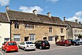
 32 High Street - geograph.org.uk - 5230861.jpg 4,320 × 3,240; 3.27 MB
-
 6 High Street - geograph.org.uk - 5230222.jpg 4,320 × 3,240; 3.12 MB
-
 A barn near Pinchmore - geograph.org.uk - 2488880.jpg 2,592 × 1,944; 1.2 MB
-
 A major barn conversion is practically complete - geograph.org.uk - 4297373.jpg 3,264 × 2,448; 1.72 MB
-
 A major barn conversion nears completion - geograph.org.uk - 2499985.jpg 2,592 × 1,944; 1.6 MB
-
 A minor road junction near Westonbirt - geograph.org.uk - 2488861.jpg 2,592 × 1,944; 2.07 MB
-
 A typical Cotswold dry stone wall - geograph.org.uk - 5449456.jpg 640 × 480; 339 KB
-
 A well concealed phone box - geograph.org.uk - 4297396.jpg 3,264 × 2,448; 1.73 MB
-
 An unusual stile - geograph.org.uk - 5449450.jpg 640 × 480; 367 KB
-
 An upgraded track - geograph.org.uk - 4297387.jpg 3,264 × 2,448; 1.7 MB
-
 B4040 near Ellstree House - geograph.org.uk - 6246945.jpg 800 × 574; 155 KB
-
 B4040 through Sherston, Wiltshire 2015 - geograph.org.uk - 5810068.jpg 2,797 × 1,807; 1.05 MB
-
 B4040 through Sherston, Wiltshire 2015 - geograph.org.uk - 5810083.jpg 2,785 × 1,826; 1.63 MB
-
 B4040 towards Luckington - geograph.org.uk - 6246938.jpg 800 × 574; 182 KB
-
 B4040, Easton Town - geograph.org.uk - 6246836.jpg 800 × 505; 164 KB
-
 B4040, Pinksney - geograph.org.uk - 6246827.jpg 800 × 600; 143 KB
-
 Bransdown Hill - geograph.org.uk - 6246823.jpg 800 × 600; 112 KB
-
 Carrier's Farm, from the Macmillan Way - geograph.org.uk - 5640485.jpg 3,264 × 2,448; 1.94 MB
-
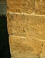
 Carved sheep - geograph.org.uk - 5230840.jpg 4,320 × 3,240; 3.57 MB
-
 Cereal crop near Pinkney Court - geograph.org.uk - 6246820.jpg 800 × 600; 112 KB
-

-
 Church of the Holy Cross, Sherston - geograph.org.uk - 4827581.jpg 640 × 476; 82 KB
-
 Church of the Holy Cross, Sherston - geograph.org.uk - 6246850.jpg 800 × 600; 119 KB
-
-

-

-

-

-

-

-

-

-

-

-

-

-

-

-

-

-

-

-

-
-

-

-

-
-
-

-

-

-
-

-

-

-

-
 Church Street, Sherston, Wiltshire 2015 - geograph.org.uk - 5811636.jpg 2,747 × 1,829; 1.07 MB
-
 Church Street, Sherston, Wiltshire 2015 - geograph.org.uk - 5811638.jpg 2,778 × 1,829; 1,007 KB
-
 Church Street, Sherston, Wiltshire 2015 - geograph.org.uk - 5811799.jpg 2,896 × 1,944; 1.18 MB
-
 Church Street, Sherston, Wiltshire 2015 - geograph.org.uk - 5811801.jpg 2,459 × 1,587; 1.35 MB
-
 Cliff Rd, Sherston, Wiltshire 2015 - geograph.org.uk - 5810027.jpg 2,789 × 1,822; 1,022 KB
-
 Cliff View, Sherston, Wiltshire 2019 - geograph.org.uk - 6211352.jpg 2,896 × 1,944; 1.14 MB
-
 Colourful brick - geograph.org.uk - 5230215.jpg 4,320 × 3,240; 3.03 MB
-
 Commonwood Farm ^ Farmhouse, Sherston, Wiltshire 2014 - geograph.org.uk - 5322162.jpg 3,872 × 2,592; 1.82 MB
-
 Commonwood Farm ^ Farmhouse, Sherston, Wiltshire 2014 - geograph.org.uk - 5322172.jpg 3,872 × 1,457; 1.14 MB
-
 Commonwood Farmhouse, Sherston, Wiltshire 2014 - geograph.org.uk - 5322169.jpg 3,872 × 2,592; 2.35 MB
-
 Commonwood Lane - geograph.org.uk - 326660.jpg 490 × 640; 96 KB
-
 Cottage, Cliff Rd, Sherston, Wiltshire 2015 - geograph.org.uk - 5811644.jpg 2,747 × 1,837; 1.38 MB
-
 Cottage, Cliff Rd, Sherston, Wiltshire 2019 - geograph.org.uk - 6211457.jpg 2,896 × 1,944; 1.07 MB
-
 Cottages, Church Street, Sherston, Wiltshire 2015 - geograph.org.uk - 5811632.jpg 2,584 × 1,611; 1.16 MB
-
 Cottages, Cliff Rd, Sherston, Wiltshire 2019 - geograph.org.uk - 6211353.jpg 2,896 × 1,944; 1.18 MB
-
 Cottages, Cliff Rd, Sherston, Wiltshire 2019 - geograph.org.uk - 6211356.jpg 2,896 × 1,944; 1.04 MB
-
 Cottages, Cliff Rd, Sherston, Wiltshire 2019 - geograph.org.uk - 6211363.jpg 2,896 × 1,944; 1.15 MB
-
 Court Street - geograph.org.uk - 5230828.jpg 4,320 × 3,240; 3.02 MB
-
 Court Street houses - geograph.org.uk - 5230824.jpg 4,320 × 3,240; 3.64 MB
-
 Crops north of Sherston - geograph.org.uk - 2488983.jpg 2,592 × 1,944; 1.31 MB
-
 Cross roads outside Sherston - geograph.org.uk - 1629180.jpg 640 × 480; 106 KB
-

-
 Cut silage field, Easton Town - geograph.org.uk - 6246832.jpg 640 × 480; 61 KB
-
 Cyclist on the A433 - geograph.org.uk - 3075826.jpg 640 × 480; 85 KB
-

-
 Dog Leg House, Sherston - geograph.org.uk - 2500062.jpg 2,592 × 1,944; 1.41 MB
-
 Down to the river - geograph.org.uk - 5230859.jpg 4,320 × 3,240; 2.96 MB
-
 Farmland east of Luckington - geograph.org.uk - 2482276.jpg 2,592 × 1,944; 1.25 MB
-
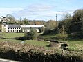
 Farmland north of Sherston - geograph.org.uk - 2500000.jpg 2,592 × 1,944; 1.44 MB
-
 Farmland south of Easton Grey - geograph.org.uk - 2482304.jpg 2,592 × 1,944; 1.59 MB
-
 Farmland south of Knockdown - geograph.org.uk - 2500111.jpg 2,592 × 1,944; 1.35 MB
-
 Field near Angel Farm - geograph.org.uk - 6246933.jpg 800 × 570; 132 KB
-
 Field of wheat - geograph.org.uk - 5448476.jpg 640 × 480; 327 KB
-
 Fields south of Upper Stanbridge Farm - geograph.org.uk - 2500064.jpg 2,592 × 1,944; 1.58 MB
-
 Footbridge over River Avon - geograph.org.uk - 488674.jpg 640 × 477; 124 KB
-

-
-
 Former Shop ^ P.O, High Street, Sherston, Wiltshire 2015 - geograph.org.uk - 5810596.jpg 2,896 × 1,944; 1.33 MB
-
 Former Victorian School, High St, Sherston, Wiltshire 2015 - geograph.org.uk - 5810588.jpg 2,896 × 1,944; 1.31 MB
-
 Fosse Way - geograph.org.uk - 1728083.jpg 3,888 × 2,592; 4.52 MB
-
 Fosse Way Byway - geograph.org.uk - 1607366.jpg 640 × 480; 91 KB
-
 Garage, Church Street, Sherston, Wiltshire 2015 - geograph.org.uk - 5811622.jpg 2,532 × 1,635; 783 KB
-

-
 Gravestone of Titanic survivor, Sherston - geograph.org.uk - 421146.jpg 552 × 640; 412 KB
-

-
 Grazing, Pinkney Park - geograph.org.uk - 6246825.jpg 800 × 600; 107 KB
-
 Hairdresser Sherston - geograph.org.uk - 3109817.jpg 640 × 480; 60 KB
-
 Halfway Bush Farm - geograph.org.uk - 2500007.jpg 2,592 × 1,944; 1.17 MB
-
 Halfway Bush Farm - geograph.org.uk - 488638.jpg 640 × 477; 104 KB
-
 High St, Sherston - geograph.org.uk - 4297319.jpg 2,448 × 3,264; 1.7 MB
-
 High Street, Sherston, Wiltshire 2015 - geograph.org.uk - 5810021.jpg 1,241 × 790; 255 KB
-
 High Street, Sherston, Wiltshire 2015 - geograph.org.uk - 5810046.jpg 2,238 × 856; 443 KB
-
 High Street, Sherston, Wiltshire 2015 - geograph.org.uk - 5810593.jpg 2,888 × 1,375; 733 KB
-
 High Street, Sherston, Wiltshire 2015 - geograph.org.uk - 5810595.jpg 2,301 × 1,471; 687 KB
-
 High Street, Sherston, Wiltshire 2015 - geograph.org.uk - 5811683.jpg 2,020 × 1,301; 559 KB
-
 High Street, Sherston, Wiltshire 2015 - geograph.org.uk - 5811706.jpg 2,133 × 1,398; 523 KB
-
 High Street, Sherston, Wiltshire 2015 - geograph.org.uk - 5811762.jpg 2,356 × 1,565; 831 KB
-
 High Street, Sherston, Wiltshire 2015 - geograph.org.uk - 5811767.jpg 2,896 × 1,944; 1.31 MB
-
 High Street, Sherston, Wiltshire 2015 - geograph.org.uk - 5811770.jpg 2,896 × 1,944; 1.32 MB
-
 High Street, Sherston, Wiltshire 2015 - geograph.org.uk - 5811773.jpg 2,896 × 1,944; 1.35 MB
-
 High Street, Sherston, Wiltshire 2015 - geograph.org.uk - 5811775.jpg 2,823 × 1,829; 1.09 MB
-
 High Street, Sherston, Wiltshire 2015 - geograph.org.uk - 5811785.jpg 2,896 × 1,944; 1.34 MB
-
 Hill Cottage, Sherston, Wiltshire 2019 - geograph.org.uk - 6211323.jpg 2,507 × 1,719; 1.4 MB
-
 Holy Cross Church in Sherston - geograph.org.uk - 5201287.jpg 3,855 × 2,891; 1.55 MB
-
 Holy Cross Church, Sherston, Wiltshire 2015 - geograph.org.uk - 5810054.jpg 2,797 × 1,837; 1.13 MB
-
 Holy Cross Churchyard Tomb, Sherston, Wiltshire 2015 - geograph.org.uk - 5811715.jpg 2,786 × 1,841; 1.39 MB
-
 Holy Cross Churchyard, Sherston, Wiltshire 2015 - geograph.org.uk - 5811642.jpg 2,193 × 1,430; 1.08 MB
-
 Home Farm - geograph.org.uk - 4297411.jpg 3,264 × 2,448; 1.68 MB
-
 Horse jump and stile near Sherston - geograph.org.uk - 1012661.jpg 640 × 480; 71 KB
-
 House and shop - geograph.org.uk - 5230818.jpg 4,320 × 3,240; 2.71 MB
-
 House at Sherston - geograph.org.uk - 3109784.jpg 640 × 480; 74 KB
-
 House in Cliff Rd, Sherston, Wiltshire 2015 - geograph.org.uk - 5811788.jpg 2,555 × 1,703; 1.16 MB
-
 House, High Street, Sherston, Wiltshire 2015 - geograph.org.uk - 5811682.jpg 2,067 × 1,366; 511 KB
-
 House, High Street, Sherston, Wiltshire 2015 - geograph.org.uk - 5811703.jpg 2,482 × 1,590; 1.2 MB
-
 House, Sherston, Wiltshire 2019 - geograph.org.uk - 6211501.jpg 2,896 × 1,944; 1.14 MB
-
 Houses on Easton Town, Sherston - geograph.org.uk - 6246847.jpg 800 × 507; 103 KB
-
 Houses on Silver Street, Sherston - geograph.org.uk - 6246931.jpg 800 × 600; 111 KB
-
 Houses, High Street, Sherston, Wiltshire 2015 - geograph.org.uk - 5810042.jpg 2,403 × 1,108; 497 KB
-
 Houses, High Street, Sherston, Wiltshire 2015 - geograph.org.uk - 5811689.jpg 2,801 × 1,829; 1.15 MB
-
 Houses, High Street, Sherston, Wiltshire 2015 - geograph.org.uk - 5811701.jpg 2,300 × 1,504; 1.99 MB
-
 Houses, High Street, Sherston, Wiltshire 2015 - geograph.org.uk - 5811764.jpg 2,812 × 1,833; 1.1 MB
-

-

-

-
-

-

-
-

-

-

-
 Leech Lane - geograph.org.uk - 2488978.jpg 2,592 × 1,944; 1.59 MB
-
 Listed memorial - geograph.org.uk - 5230812.jpg 4,320 × 3,240; 4.3 MB
-
 Lordswood Farm - geograph.org.uk - 2482546.jpg 2,592 × 1,944; 1.96 MB
-
 Lordswood House - geograph.org.uk - 326658.jpg 640 × 427; 78 KB
-
 Lower Stanbridge Farm - geograph.org.uk - 5640467.jpg 3,264 × 2,448; 1.91 MB
-
 Lychgate and tree - geograph.org.uk - 5230799.jpg 3,240 × 4,320; 4.14 MB
-
 Lychgate, Holy Cross Church, Sherston, Wiltshire 2015 - geograph.org.uk - 5811795.jpg 2,758 × 1,845; 1.29 MB
-
 Methodist Chapel, Sherston, Wiltshire 2015 - geograph.org.uk - 5811725.jpg 2,755 × 1,810; 1.11 MB
-
 Middle Lodge, Pinkney Park - geograph.org.uk - 6246830.jpg 800 × 472; 112 KB
-
 Morris Minor - geograph.org.uk - 326672.jpg 640 × 480; 128 KB
-
 Near Forlorn - geograph.org.uk - 4297399.jpg 3,264 × 2,448; 1.73 MB
-
 New Barn farm - geograph.org.uk - 308211.jpg 640 × 480; 121 KB
-
 New Barn farm yard - geograph.org.uk - 308212.jpg 640 × 480; 67 KB
-
 No's 1-3 Cliff Road, Sherston, Wiltshire 2019 - geograph.org.uk - 6211351.jpg 2,896 × 1,944; 1.24 MB
-

-

-

-

-
 Old House, High Street, Sherston, Wiltshire 2015 - geograph.org.uk - 5810591.jpg 2,262 × 1,512; 859 KB
-
 Old Pump, Willesley - geograph.org.uk - 2128478.jpg 2,272 × 1,704; 1.98 MB
-
 Once the Swan Inn (geograph 5230221).jpg 4,320 × 3,240; 3.58 MB
-
 Ordnance Survey Cut Mark - geograph.org.uk - 5116575.jpg 497 × 640; 106 KB
-
 Ordnance Survey Cut Mark - geograph.org.uk - 5201292.jpg 4,000 × 3,000; 3.93 MB
-
 Ordnance Survey Flush Bracket 10000 - geograph.org.uk - 5201280.jpg 4,000 × 3,000; 4.69 MB
-
 Parish church (1) - geograph.org.uk - 5230802.jpg 3,298 × 3,239; 2.13 MB
-
 Parish church (2) - geograph.org.uk - 5230804.jpg 4,320 × 3,240; 2.94 MB
-
 Parish church (3) - geograph.org.uk - 5230806.jpg 3,115 × 4,153; 2.27 MB
-
 Parish church (4) - geograph.org.uk - 5230810.jpg 4,320 × 3,239; 4.03 MB
-

-
 Pinkney Wood - geograph.org.uk - 2482288.jpg 2,592 × 1,944; 1.2 MB
-
 Post Office on High Street, Sherston - geograph.org.uk - 6246913.jpg 640 × 373; 49 KB
-
 Postbox, Sherston - geograph.org.uk - 1382354.jpg 480 × 640; 145 KB
-
 Primary School, Sherston, Wiltshire 2015 - geograph.org.uk - 5811797.jpg 2,827 × 1,845; 1.18 MB
-
 Rattlebone Inn Sign, Sherston, Wiltshire 2015 - geograph.org.uk - 5810078.jpg 2,797 × 1,826; 1.18 MB
-
 Rattlebone Inn, Sherston, Wiltshire 2015 - geograph.org.uk - 5810051.jpg 2,785 × 1,810; 1.05 MB
-
 Rattlebone Inn, Sherston, Wiltshire 2015 - geograph.org.uk - 5810085.jpg 2,782 × 1,822; 891 KB
-

-
 River Avon by Sherston - geograph.org.uk - 1745947.jpg 640 × 480; 84 KB
-
 Road junction in Pinkney - geograph.org.uk - 2499323.jpg 2,592 × 1,944; 1.61 MB
-
 Road junction in Sherston - geograph.org.uk - 3408389.jpg 4,000 × 3,000; 3.28 MB
-
 Self-catering cottage at Byam's Farm - geograph.org.uk - 5449458.jpg 640 × 480; 329 KB
-
 Shallowbrook Lane - geograph.org.uk - 3109608.jpg 640 × 480; 90 KB
-
 Shallowbrooks Lane - geograph.org.uk - 2500089.jpg 2,592 × 1,944; 1.9 MB
-
 Sherston - geograph.org.uk - 1745966.jpg 640 × 480; 95 KB
-
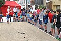
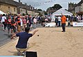
 Sherston Boules Festival Day, Wiltshire 2019 - geograph.org.uk - 6211224.jpg 2,423 × 1,577; 1.22 MB
-
 Sherston Boules Festival Day, Wiltshire 2019 - geograph.org.uk - 6211233.jpg 1,024 × 680; 253 KB
-
 Sherston Boules Festival Day, Wiltshire 2019 - geograph.org.uk - 6211237.jpg 1,024 × 472; 169 KB
-
 Sherston Boules Festival Day, Wiltshire 2019 - geograph.org.uk - 6211241.jpg 2,709 × 1,807; 2.85 MB
-
 Sherston Boules Festival Day, Wiltshire 2019 - geograph.org.uk - 6211246.jpg 1,024 × 697; 194 KB
-
 Sherston Boules Festival Day, Wiltshire 2019 - geograph.org.uk - 6211252.jpg 1,024 × 696; 199 KB
-
 Sherston Boules Festival Day, Wiltshire 2019 - geograph.org.uk - 6211254.jpg 2,896 × 1,314; 1.34 MB
-
 Sherston Boules Festival Day, Wiltshire 2019 - geograph.org.uk - 6211260.jpg 1,980 × 1,367; 715 KB


_-_geograph.org.uk_-_4584089.jpg)
_-_geograph.org.uk_-_4584090.jpg)
_-_geograph.org.uk_-_4584098.jpg)
_-_geograph.org.uk_-_4584045.jpg)
_-_geograph.org.uk_-_4584046.jpg)
_-_geograph.org.uk_-_4584047.jpg)
_-_geograph.org.uk_-_4584048.jpg)
_-_geograph.org.uk_-_4584053.jpg)
_-_geograph.org.uk_-_4584056.jpg)
_-_geograph.org.uk_-_4584057.jpg)


_-_geograph.org.uk_-_4584058.jpg)
_-_geograph.org.uk_-_4584060.jpg)
_-_geograph.org.uk_-_4584061.jpg)
_-_geograph.org.uk_-_4584067.jpg)
_-_geograph.org.uk_-_4584115.jpg)
_-_geograph.org.uk_-_4584064.jpg)
_-_geograph.org.uk_-_4584081.jpg)
_-_geograph.org.uk_-_4584083.jpg)
_-_geograph.org.uk_-_4584084.jpg)
_-_geograph.org.uk_-_4584080.jpg)
_-_geograph.org.uk_-_4584110.jpg)
_-_geograph.org.uk_-_4584117.jpg)


_-_geograph.org.uk_-_4584070.jpg)
_-_geograph.org.uk_-_4584071.jpg)
_-_geograph.org.uk_-_4584074.jpg)
_-_geograph.org.uk_-_4584076.jpg)
_-_geograph.org.uk_-_4584105.jpg)
_-_geograph.org.uk_-_4584079.jpg)
_-_geograph.org.uk_-_4584072.jpg)
_-_geograph.org.uk_-_4584101.jpg)
_-_geograph.org.uk_-_4584102.jpg)
_-_geograph.org.uk_-_4584107.jpg)


.jpg)


_-_geograph.org.uk_-_5230802.jpg)
_-_geograph.org.uk_-_5230804.jpg)
_-_geograph.org.uk_-_5230806.jpg)
_-_geograph.org.uk_-_5230810.jpg)


