Category:Shiogama, Miyagi
Jump to navigation
Jump to search

العربية: شيوغاما، مياغي
한국어: 시오가마 시
Русский: Сиогама
city in Miyagi Prefecture, Japan    | |||||
| Upload media | |||||
| Instance of | |||||
|---|---|---|---|---|---|
| Location |
| ||||
| Located in or next to body of water | |||||
| Anthem |
| ||||
| Legal form |
| ||||
| Inception |
| ||||
| Population |
| ||||
| Area |
| ||||
| Replaces |
| ||||
| official website | |||||
 | |||||
Subcategories
This category has the following 17 subcategories, out of 17 total.
A
- AEON TOWN Shiogama (2 F)
F
- Former Kamei House (14 F)
H
- Hourenji (1 F)
I
- Ichibankan (Shiogama) (2 F)
M
N
O
- Okama-jinja (10 F)
P
S
- Shiogama Machikado Museum (6 F)
- Shiogama Minato Festival (10 F)
T
- Teizan Canal (31 F)
- Trains in Shiogama, Miyagi (5 F)
Media in category "Shiogama, Miyagi"
The following 81 files are in this category, out of 81 total.
-
 Flag of Shiogama, Miyagi.svg 900 × 600; 340 bytes
-
 Shiogama in Miyagi Prefecture Ja.svg 484 × 538; 8 KB
-
 20091011松島.jpg 1,480 × 790; 294 KB
-
 211030 Fureai-esup Shiogama in Shiogama Miyagi pref Japan01s3.jpg 6,000 × 4,000; 13.67 MB
-
 211030 Shiogama Miyagi pref Japan01s3.jpg 4,000 × 6,000; 16.54 MB
-
 211030 Shiogama Miyagi pref Japan02s3.jpg 4,000 × 6,000; 16.52 MB
-
 211030 Shiogama Miyagi pref Japan03s3.jpg 4,000 × 6,000; 18.59 MB
-
 211030 Shiogama Miyagi pref Japan04s3.jpg 6,000 × 4,000; 16.92 MB
-
 211030 Shiogama Miyagi pref Japan05s3.jpg 6,000 × 4,000; 12.68 MB
-
 211030 Shiogama Miyagi pref Japan06s3.jpg 6,000 × 4,000; 14.1 MB
-
 211030 Shiogama Miyagi pref Japan07s3.jpg 6,000 × 4,000; 14.44 MB
-
 211030 Shiogama Miyagi pref Japan08s3.jpg 6,000 × 4,000; 14.23 MB
-
 211030 Shiogama Municipal Daiichi Elementary School Shiogama Miyagi pref Japan01s3.jpg 6,000 × 4,000; 14.84 MB
-
 211030 Tsukushi Shiogama Miyagi pref Japan01s3.jpg 6,000 × 4,000; 16.5 MB
-
 211030 Tsukushi Shiogama Miyagi pref Japan02s3.jpg 6,000 × 4,000; 9.59 MB
-
 211030 Tsukushi Shiogama Miyagi pref Japan03s3.jpg 6,000 × 4,000; 11.35 MB
-
 81016shiogama-postoffice.jpg 2,048 × 1,360; 1.12 MB
-
 81087urato-postoffice.jpg 2,048 × 1,360; 1.12 MB
-
 Big Tree - panoramio (4).jpg 2,736 × 3,648; 4.58 MB
-
 Boat on the Road.JPG 2,352 × 1,568; 1.8 MB
-
 Cedars(ヒマラヤ杉) - panoramio.jpg 2,736 × 3,648; 4.74 MB
-
 Census Sen-En 1950-2010.jpg 703 × 913; 52 KB
-
 Damage of Tsunami at Shiogama.JPG 2,352 × 1,568; 1.71 MB
-
 Emblem of Shiogama, Miyagi.svg 504 × 494; 277 bytes
-
-
 Fire.hydrant.cover.in.shiogama.city.jpg 1,255 × 941; 409 KB
-
 Flag of Shiogama Miyagi.JPG 373 × 263; 12 KB
-
 Flooded with high-tide in Shiogama.JPG 2,352 × 1,568; 1.95 MB
-
 FM BAY AREA CO., LTD1.JPG 2,816 × 2,112; 2.89 MB
-
 Great Chilean Earthquake damage at Shiogama.jpg 620 × 400; 156 KB
-
 Hojima Island, Shiogama Miyagi Aerial photograph.2019.jpg 1,601 × 1,201; 441 KB
-
 Japan-kotsu-65.jpg 1,024 × 767; 259 KB
-
 Katsurajima Island, Shiogama Miyagi Aerial photograph.2019.jpg 4,254 × 3,190; 4.48 MB
-
 Miyagi Cable TV co.,Ltd.1.JPG 2,816 × 2,112; 2.79 MB
-
 Miyagi Kendo 3 Go in Shiogama 2008-04.jpg 2,592 × 1,944; 966 KB
-
 Miyagi prefecture Shiogama health center.JPG 2,816 × 2,112; 2.49 MB
-
 Miyakobus-Shiogama.jpg 1,024 × 506; 148 KB
-
 Miyakobus-Shiogama02.jpg 1,024 × 768; 158 KB
-
 MorinoMiyakoShinkinBank Shiogama-022.jpg 1,536 × 2,048; 605 KB
-
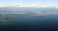
 Natori, shiogama and sendai from an aeroplane.jpg 4,288 × 1,581; 835 KB
-
 Nonoshima Island, Shiogama Miyagi Aerial photograph.2019.jpg 3,949 × 2,962; 3.42 MB
-
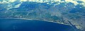
 Panoramic view of Shiogama and Matsushima, Mutsu Province (14802990295).jpg 2,500 × 1,809; 1.97 MB
-
 Population distribution of Shiogama, Miyagi, Japan.svg 512 × 256; 22 KB
-
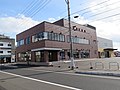
 Royal Home Center.JPG 1,587 × 892; 165 KB
-
 Sabusawajima Island, Shiogama Miyagi Aerial photograph.2019.jpg 2,752 × 4,551; 3.92 MB
-
 Saka General Hospital1.JPG 2,816 × 2,112; 2.64 MB
-
 Saka General Hospital2.JPG 2,112 × 2,816; 2.68 MB
-
 Sen-en Golf Club Urakasumi Course, Shiogama Miyagi Aerial photograph.2019.jpg 2,829 × 2,122; 2.49 MB
-
 Shadow picture of Shiogama city.svg 577 × 277; 433 KB
-
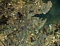
 Shiogama and sendai from an aeroplane.jpg 3,763 × 2,822; 1.28 MB
-
 Shiogama and sendai from an aeroplane2.jpg 4,288 × 3,216; 1.21 MB
-
 Shiogama city center area Aerial photograph.1984.jpg 6,638 × 5,144; 31.5 MB
-
 Shiogama city hall Government building.JPG 2,560 × 1,920; 1.12 MB
-
 Shiogama district fire fighting union affairs Shiogama fire station 1.JPG 2,816 × 2,112; 1.6 MB
-
 Shiogama Gas.JPG 2,816 × 2,112; 2.45 MB
-
 Shiogama Gas2.jpg 5,184 × 3,888; 4.52 MB
-
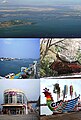 Shiogama montage.JPG 515 × 763; 194 KB
-
 Shiogama Police Station 1.JPG 2,816 × 2,112; 2.2 MB
-
 Shiogama-city.png 253 × 222; 4 KB
-
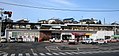 Shiogama-stn-02.JPG 1,856 × 871; 429 KB
-
 Shiogamadai2sho.JPG 2,592 × 1,944; 936 KB
-
 Tamagawachu.JPG 2,592 × 1,944; 996 KB
-
 The Sea From The Garden(庭園から海) - panoramio.jpg 3,648 × 2,736; 4.11 MB
-
 Tsukimigaokasho.JPG 2,592 × 1,944; 904 KB
-
 Umenomiya-jinja shrine,Shiogama city.JPG 3,648 × 2,736; 2.65 MB
-
 View from bus in Shiogama.jpg 1,920 × 1,080; 837 KB
-
 Yamaya Shiogama shop.jpg 5,184 × 3,888; 4.36 MB
-
 塩釜港 貞山運河沿い Shiogama Port, along a Teizan Canal - panoramio.jpg 4,608 × 3,456; 3.93 MB
-
 塩釜港緑地(みなと公園) Shiogama Port Park - panoramio.jpg 4,608 × 3,456; 3.35 MB
-
 尾島ヶ崎護防稲荷神社 Ojimagasaki Gobō Inari Shrine - panoramio.jpg 4,608 × 3,456; 3.48 MB
-
 板ヶ崎稲荷神社 Itagasaki Inari Shrine - panoramio.jpg 4,608 × 3,456; 3.51 MB
-
 桂島 - panoramio.jpg 2,816 × 2,112; 1.4 MB
-
 石田・須賀 入口 Entrance to Ishida - Suka - panoramio.jpg 4,608 × 3,456; 3.43 MB
-
 祓ヶ崎稲荷神社 入口 Haraigasaki Inari Shrine - panoramio.jpg 4,608 × 3,456; 3.43 MB
-
 稲荷神社 Inari Shrine - panoramio.jpg 4,608 × 3,456; 3.48 MB
-
 稲荷神社参道 Path to Inari Shrine - panoramio.jpg 4,608 × 3,456; 3.45 MB
-
 越の浦付近 踏切 Crossing near Koshinoura - panoramio.jpg 4,608 × 3,456; 3.45 MB
-
 青葉ヶ丘公園 Aobagaoka Park - panoramio (1).jpg 4,608 × 3,456; 3.28 MB
-
 青葉ヶ丘公園 Aobagaoka Park - panoramio.jpg 4,608 × 3,456; 3.43 MB
-
 青葉ヶ丘公園から見下ろした須賀方面 Suka, looking down from Aobagaoka Park - panoramio.jpg 4,608 × 3,456; 3.56 MB
-
 須賀神社 Suka Shrine - panoramio.jpg 4,608 × 3,456; 3.36 MB


.jpg)


_-_panoramio.jpg)


.jpg)


.jpg)