Category:Shipley, Derbyshire
Jump to navigation
Jump to search
village and civil parish in Amber Valley district, Derbyshire, England  | |||||
| Upload media | |||||
| Instance of | |||||
|---|---|---|---|---|---|
| Location | Amber Valley, Derbyshire, East Midlands, England | ||||
 | |||||
Subcategories
This category has the following 9 subcategories, out of 9 total.
A
- American Adventure Theme Park (15 F)
D
- Derby Lodge, Derbyshire (10 F)
H
- Home Farm, Shipley (2 F)
O
- Osborne's Pond (6 F)
S
- Shipley Gate railway station (3 F)
- Shipley Hall, Derbyshire (11 F)
- Shipley Lock (Erewash Canal) (15 F)
Media in category "Shipley, Derbyshire"
The following 190 files are in this category, out of 190 total.
-
 18th century tramways - geograph.org.uk - 5876.jpg 640 × 427; 92 KB
-
 A beech wood - geograph.org.uk - 5361279.jpg 2,000 × 1,333; 3.11 MB
-
 A bridge over the canal - geograph.org.uk - 6269805.jpg 2,000 × 1,330; 2.8 MB
-
 A commemorative bench - geograph.org.uk - 5742714.jpg 2,000 × 1,333; 3.5 MB
-
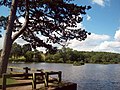
 A pleasant pond - geograph.org.uk - 5742692.jpg 2,000 × 1,333; 2.23 MB
-
 A woodland walk - geograph.org.uk - 5742675.jpg 2,000 × 1,333; 3.94 MB
-
 Above the lake - geograph.org.uk - 5742711.jpg 2,000 × 1,333; 2.79 MB
-
 Algrave Hall Farm - geograph.org.uk - 1987274.jpg 640 × 466; 88 KB
-
 At the bottom of Long Lane - geograph.org.uk - 6067508.jpg 4,783 × 3,607; 4.01 MB
-
 At the southern end of Shipley Lake - geograph.org.uk - 6067436.jpg 5,184 × 3,888; 4.99 MB
-
 Barns at Boat Inn Farm - geograph.org.uk - 5038172.jpg 1,200 × 799; 255 KB
-
 Beetle Drive at Shipley Gate - geograph.org.uk - 3557336.jpg 1,280 × 960; 233 KB
-
 Bell Lane - geograph.org.uk - 1995572.jpg 640 × 480; 119 KB
-
 Bell Lane - geograph.org.uk - 5742668.jpg 2,000 × 1,333; 3.21 MB
-
 Bell Lane, Smalley - geograph.org.uk - 5472578.jpg 1,280 × 960; 530 KB
-
 Below Shipley Lock - geograph.org.uk - 834227.jpg 640 × 427; 102 KB
-

-
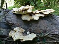 Bracket fungus, Shipley Country Park - geograph.org.uk - 5469085.jpg 1,280 × 960; 500 KB
-
 Bridge 25 from Shipley Lock (no 72) - geograph.org.uk - 6185259.jpg 1,600 × 1,200; 475 KB
-
 Bridleway in Shipley Country Park - geograph.org.uk - 6239120.jpg 640 × 480; 170 KB
-
 Britannia Park car park - geograph.org.uk - 1987086.jpg 640 × 480; 83 KB
-
 Broken gate with farm buildings on the hill - geograph.org.uk - 6067441.jpg 5,184 × 3,888; 6.79 MB
-
 Bus depot, Heanor Gate Industrial Estate - geograph.org.uk - 5469028.jpg 1,280 × 848; 172 KB
-

-
 Bus shelter at Shipley - geograph.org.uk - 6067444.jpg 4,916 × 3,758; 3.9 MB
-
 Bus shelter on Hassock Lane South - geograph.org.uk - 4858500.jpg 800 × 608; 120 KB
-
 Business unit on Heanor Gate Road - geograph.org.uk - 4725119.jpg 640 × 480; 54 KB
-
 Canal boat near Shipley Lock - geograph.org.uk - 5038174.jpg 1,200 × 799; 329 KB
-
 Canal side meadow - geograph.org.uk - 834254.jpg 640 × 480; 88 KB
-
 Canal, barges and chimneys, Shipley (2217316212).jpg 1,612 × 1,540; 1 MB
-
 Coal heads down the Erewash - geograph.org.uk - 947651.jpg 640 × 392; 69 KB
-

-
 Colliery Road Bridge, Shipley Park.jpg 1,280 × 960; 623 KB
-
 Corner of the car park - geograph.org.uk - 2007456.jpg 800 × 600; 225 KB
-
 Cotmanhay Wood - geograph.org.uk - 3557413.jpg 1,280 × 960; 418 KB
-
 Counter Solutions Car Park from Nutbrook Trail - panoramio.jpg 1,600 × 1,200; 662 KB
-
 Counter Solutions front - panoramio.jpg 1,600 × 1,200; 527 KB
-
 Couple with dog - walking up Long Lane - geograph.org.uk - 6067446.jpg 4,967 × 3,616; 4.4 MB
-
 Cycle track in Shipley Park - geograph.org.uk - 5469163.jpg 1,280 × 960; 475 KB
-
 Cycleway near Marlpool - geograph.org.uk - 1985379.jpg 640 × 480; 173 KB
-
 Derbyshire UK parish map highlighting Shipley.svg 888 × 1,308; 2.34 MB
-
 Display of memorabilia at Dubdays Summerfest - geograph.org.uk - 3557445.jpg 1,280 × 960; 328 KB
-

-
 Erewash Valley near Eastwood - geograph.org.uk - 3557331.jpg 1,280 × 960; 544 KB
-
 Farm outbuildings - geograph.org.uk - 5742688.jpg 2,000 × 1,333; 2.39 MB
-
 Farmland in the Erewash Valley - geograph.org.uk - 4290684.jpg 640 × 339; 36 KB
-
 Farmland near Eastwood - geograph.org.uk - 3608349.jpg 640 × 467; 33 KB
-
 Fishing at Mapperley Reservoir - geograph.org.uk - 1999117.jpg 800 × 600; 194 KB
-
 Flatmeadow Farm - geograph.org.uk - 5742671.jpg 2,000 × 1,333; 1.48 MB
-
 Flower meadow, Shipley Country Park - geograph.org.uk - 5469053.jpg 1,280 × 960; 480 KB
-
 Flying The Nest - geograph.org.uk - 5813444.jpg 1,280 × 853; 365 KB
-
 Flying The Nest - geograph.org.uk - 5813448.jpg 1,280 × 853; 358 KB
-

-

-
 Footpath and cycle track - geograph.org.uk - 5742700.jpg 2,000 × 1,333; 4.01 MB
-
 Footpath at Shipley - geograph.org.uk - 1987021.jpg 640 × 480; 119 KB
-
-

-

-
 Footpath in Shipley Wood - geograph.org.uk - 3820278.jpg 4,000 × 3,000; 2.7 MB
-
 Footpath to Shipley - geograph.org.uk - 3557349.jpg 1,280 × 960; 582 KB
-
 Former pit winding wheel - geograph.org.uk - 6239114.jpg 640 × 480; 111 KB
-
 Gate across the road at Shipley Gate - geograph.org.uk - 3557405.jpg 1,280 × 960; 486 KB
-
 Gate at Shipley Gate - geograph.org.uk - 3557446.jpg 1,280 × 960; 241 KB
-
 Half headstock wheel and information board - geograph.org.uk - 5247877.jpg 1,280 × 853; 448 KB
-
 Hassock Lane North - geograph.org.uk - 1987318.jpg 640 × 480; 104 KB
-
 Head of a Hare - geograph.org.uk - 6067443.jpg 3,363 × 4,608; 3.53 MB
-
 Heanor Gate Road - geograph.org.uk - 4725122.jpg 640 × 480; 58 KB
-
 Heanor Gate Road - geograph.org.uk - 4725306.jpg 640 × 480; 58 KB
-
 Lakeside Business Centre - 1 - geograph.org.uk - 1986669.jpg 640 × 480; 115 KB
-
 Lakeside Business Centre - 2 - geograph.org.uk - 1986678.jpg 640 × 480; 117 KB
-
 Leafy path - geograph.org.uk - 832787.jpg 427 × 640; 153 KB
-
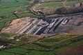
 Lodge House Opencast Mine, aerial 2014 (2) - geograph.org.uk - 3925971.jpg 1,024 × 597; 90 KB
-

-

-

-
-
 Lodge House surface coal mine - geograph.org.uk - 1999023.jpg 800 × 600; 181 KB
-
 Long Lane - geograph.org.uk - 3557409.jpg 1,280 × 960; 399 KB
-
 Long Lane railway bridge - geograph.org.uk - 3557341.jpg 1,280 × 960; 529 KB
-
 Long Lane, Shipley - geograph.org.uk - 3864404.jpg 1,280 × 851; 267 KB
-
 Long Lane, Shipley Gate - geograph.org.uk - 834176.jpg 640 × 427; 77 KB
-
 Looking back up the hill - geograph.org.uk - 5742709.jpg 2,000 × 1,333; 2.58 MB
-
 Looking north to Heanor - geograph.org.uk - 3249645.jpg 3,648 × 2,736; 4.7 MB
-
 Mapperley Dam - geograph.org.uk - 5742681.jpg 2,000 × 1,333; 3.61 MB
-
 Mapperley reservoir - geograph.org.uk - 5742679.jpg 2,000 × 1,333; 2.89 MB
-
 Mapperley Reservoir - geograph.org.uk - 6239135.jpg 640 × 480; 118 KB
-
 Mapperley Reservoir dam - 2 - geograph.org.uk - 1998831.jpg 800 × 600; 199 KB
-
 Mapperley Reservoir dam wall - geograph.org.uk - 6239136.jpg 640 × 480; 122 KB
-

-
 Marlpool Station access road geograph-2672458-by-Alan-Murray-Rust.jpg 1,280 × 848; 263 KB
-
 Marshland in the Erewash Valley - geograph.org.uk - 4290687.jpg 640 × 430; 45 KB
-
 Meadow by the Nottingham Canal - geograph.org.uk - 832782.jpg 640 × 427; 114 KB
-
 Meadow near Algrave Hall Farm - geograph.org.uk - 1987299.jpg 640 × 480; 111 KB
-
 MFN, Shipley Gate - geograph.org.uk - 3557434.jpg 1,280 × 960; 319 KB
-
 Michael House School - Maypole Dancing - geograph.org.uk - 173895.jpg 480 × 640; 125 KB
-
 Multi-user track, Heanor Gate - geograph.org.uk - 5469044.jpg 1,280 × 960; 596 KB
-

-
 Newmanleys Mill House - geograph.org.uk - 3557453.jpg 1,280 × 960; 274 KB
-
 No access to Shipley Lake - geograph.org.uk - 5469150.jpg 1,280 × 960; 592 KB
-
 Not on speaking terms - geograph.org.uk - 5469050.jpg 1,280 × 1,280; 270 KB
-
 Nottingham Lodge - geograph.org.uk - 5742704.jpg 2,000 × 1,333; 3.09 MB
-
 Old tramway through Bentley's Plantation - geograph.org.uk - 1987171.jpg 640 × 480; 181 KB
-
 On Long Lane near Shipley - geograph.org.uk - 6067445.jpg 4,769 × 3,745; 4.73 MB
-
 On the Nutbrook Trail - geograph.org.uk - 5482857.jpg 1,280 × 960; 336 KB
-
 Osborne's Pond - geograph.org.uk - 1985358.jpg 640 × 480; 132 KB
-
 Osborne's Pond Shipley Country Park - geograph.org.uk - 2815536.jpg 2,592 × 3,462; 2.29 MB
-
 Part of the Dubdays Summerfest at Shipley Gate - geograph.org.uk - 3557436.jpg 1,280 × 960; 365 KB
-
 Part of the footpath - geograph.org.uk - 5742697.jpg 2,000 × 1,333; 4.28 MB
-
 Path by John Wood - geograph.org.uk - 1999080.jpg 800 × 600; 175 KB
-
 Paths converging in Shipley Country Park - geograph.org.uk - 6067433.jpg 5,184 × 3,888; 7.62 MB
-
 Paul's Arm Bridge.jpg 1,280 × 960; 548 KB
-
 Pit Lane, Shipley - geograph.org.uk - 2672465.jpg 1,280 × 809; 176 KB
-
 Pit Lane, Shipley - geograph.org.uk - 3865120.jpg 1,280 × 851; 311 KB
-
 Playing field at Shipley - geograph.org.uk - 1987332.jpg 640 × 480; 114 KB
-

-

-
 Purdy House Farm - geograph.org.uk - 1987261.jpg 640 × 480; 80 KB
-
 Purdy House Farm - geograph.org.uk - 3557347.jpg 1,280 × 960; 254 KB
-
 Railway bridge abutment - geograph.org.uk - 3557197.jpg 1,280 × 960; 488 KB
-
 Railway towards Alfreton - geograph.org.uk - 3608371.jpg 640 × 433; 119 KB
-
 Restored landscape - geograph.org.uk - 5472580.jpg 1,280 × 878; 386 KB
-
 River Erewash - geograph.org.uk - 3557202.jpg 1,280 × 960; 389 KB
-
 River Erewash, upstream (west) from the Erewash Canal - geograph.org.uk - 6186207.jpg 1,753 × 1,315; 942 KB
-
 Rooks or crows^ - geograph.org.uk - 1302072.jpg 640 × 480; 185 KB
-
 Scots Pine in Shipley Country Park - geograph.org.uk - 3058819.jpg 3,296 × 2,472; 1.53 MB
-
 Scots Pine Tree near Shipley Wood - geograph.org.uk - 3820273.jpg 4,000 × 3,000; 2.78 MB
-
 Settling ponds outlet, Shipley Common - geograph.org.uk - 5482861.jpg 1,280 × 960; 444 KB
-
 Settling ponds, Shipley Common - geograph.org.uk - 5482858.jpg 1,280 × 960; 391 KB
-
 Shipley Country Park - 1 - geograph.org.uk - 1982840.jpg 640 × 480; 105 KB
-
 Shipley Country Park - 2 - geograph.org.uk - 1982845.jpg 640 × 480; 100 KB
-
 Shipley Country Park - 3 - geograph.org.uk - 1982863.jpg 640 × 480; 131 KB
-
 Shipley Country Park - 4 - geograph.org.uk - 1982904.jpg 640 × 480; 113 KB
-
 Shipley Country Park - 5 - geograph.org.uk - 1982911.jpg 640 × 480; 77 KB
-
 Shipley Country Park - 6 - geograph.org.uk - 1999187.jpg 800 × 600; 192 KB
-
 Shipley Country Park - geograph.org.uk - 3058857.jpg 3,296 × 2,472; 1,022 KB
-
 Shipley derbyshire 017615 dbfa299a.jpg 640 × 480; 61 KB
-
 Shipley Gate Station House - geograph.org.uk - 3557425.jpg 1,280 × 960; 253 KB
-
 Shipley Hall - 1 - geograph.org.uk - 1995431.jpg 640 × 480; 96 KB
-
 Shipley Hall - 2 - geograph.org.uk - 1995457.jpg 640 × 480; 102 KB
-
 Shipley Hall Cricket Club - geograph.org.uk - 5469165.jpg 1,280 × 870; 323 KB
-
 Shipley Hill - geograph.org.uk - 15880.jpg 640 × 480; 68 KB
-
 Shipley Lake - geograph.org.uk - 1995145.jpg 640 × 480; 219 KB
-
 Shipley Lake - geograph.org.uk - 5742694.jpg 2,000 × 1,333; 2.13 MB
-
 Shipley Lake - geograph.org.uk - 6239117.jpg 640 × 480; 130 KB
-
 Shipley Lake, aerial 2014 - geograph.org.uk - 3925930.jpg 1,024 × 683; 149 KB
-
 Shipley Lock - geograph.org.uk - 6269798.jpg 2,000 × 1,330; 2.3 MB
-
 Shipley Meadows - geograph.org.uk - 1998912.jpg 800 × 600; 205 KB
-
 Shipley Park - geograph.org.uk - 5742662.jpg 2,000 × 1,333; 2.24 MB
-
 Shipley Park Visitor Centre - geograph.org.uk - 5742718.jpg 1,921 × 1,255; 614 KB
-
 Shipley Woodside Colliery "headgear" - geograph.org.uk - 2672470.jpg 1,280 × 853; 318 KB
-
 Shipley Woodside Colliery - 1 - geograph.org.uk - 1987050.jpg 640 × 480; 143 KB
-
 Shipley Woodside Colliery - 2 - geograph.org.uk - 1987058.jpg 640 × 475; 116 KB
-
 Shipley Woodside Colliery - 3 - geograph.org.uk - 1994933.jpg 640 × 480; 96 KB
-
 Shipley Woodside Colliery - geograph.org.uk - 2672471.jpg 1,280 × 853; 181 KB
-
 Signals near Shipley Gate - geograph.org.uk - 3557401.jpg 1,280 × 960; 569 KB
-
 Silver haired couple at Derby Lodge - geograph.org.uk - 6067430.jpg 4,918 × 3,776; 6.63 MB
-
 Site of old railway - geograph.org.uk - 3557399.jpg 1,280 × 960; 429 KB
-
 Slack Lane, Heanor Gate - geograph.org.uk - 5469042.jpg 1,280 × 944; 362 KB
-
 Spanish Chestnut tree, Shipley Hill - geograph.org.uk - 5469097.jpg 960 × 1,280; 584 KB
-
 Swans at Shipley Lock on the Erewash Canal - geograph.org.uk - 6067510.jpg 4,806 × 3,503; 2.73 MB
-
 The American Adventure - 1 - geograph.org.uk - 1995235.jpg 640 × 480; 136 KB
-
 The American Adventure - 2 - geograph.org.uk - 1995280.jpg 640 × 480; 96 KB
-
 The American Adventure car park - 1 - geograph.org.uk - 1995161.jpg 640 × 480; 95 KB
-
 The American Adventure car park - 2 - geograph.org.uk - 1995180.jpg 640 × 480; 91 KB
-
 The Country Park Tavern at Marlpool - geograph.org.uk - 1982826.jpg 640 × 480; 113 KB
-
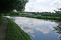 The Erewash Canal - geograph.org.uk - 834165.jpg 640 × 427; 90 KB
-
 The Erewash Valley - geograph.org.uk - 4290692.jpg 640 × 430; 41 KB
-
 The Missile roller coaster (1990) - geograph.org.uk - 2913126.jpg 1,024 × 730; 185 KB
-
 The River Erewash flows under the Erewash Canal - geograph.org.uk - 5038116.jpg 1,200 × 799; 609 KB
-

-
 The site of Shipley Hall - geograph.org.uk - 5469096.jpg 1,280 × 960; 485 KB
-
 The Stables - geograph.org.uk - 3557448.jpg 1,280 × 960; 432 KB
-
 Towards Mapperley Reservoir - geograph.org.uk - 5742673.jpg 2,000 × 1,333; 3.37 MB
-
 Track and woodland near Poplar Farm - geograph.org.uk - 3608357.jpg 640 × 429; 67 KB
-
 Track leading to Flatmeadow Farm - geograph.org.uk - 6239128.jpg 640 × 480; 87 KB
-
 Tree with autumn leaves - geograph.org.uk - 3249651.jpg 3,648 × 2,736; 4.77 MB
-
 Trees lining the drain - geograph.org.uk - 5742664.jpg 2,000 × 1,333; 3.64 MB
-

-
 View to Flatmeadow Farm from Bell Lane - geograph.org.uk - 6067426.jpg 5,184 × 3,888; 6.19 MB
-
 Wasteland in Shipley Country Park - geograph.org.uk - 2007464.jpg 800 × 600; 229 KB
-
 Weir tail pond, Shipley Gate - geograph.org.uk - 3557451.jpg 1,280 × 960; 480 KB
-

-
 Wind turbine, Erewash Valley - geograph.org.uk - 4303195.jpg 640 × 393; 29 KB
-
 Woodside festival - geograph.org.uk - 5810396.jpg 1,280 × 960; 368 KB
-
 Heanor Gate Industrial Estate - geograph.org.uk - 37659.jpg 640 × 427; 34 KB
-
 Heanor Gate Industrial Estate - geograph.org.uk - 37661.jpg 640 × 427; 38 KB
-

-
 Shipley Country Park - geograph.org.uk - 681794.jpg 640 × 480; 109 KB
-
 Shipley Gate - geograph.org.uk - 551733.jpg 640 × 428; 102 KB


_-_geograph.org.uk_-_6185259.jpg)


.jpg)


_-_geograph.org.uk_-_3925971.jpg)


_from_the_Erewash_Canal_-_geograph.org.uk_-_6186207.jpg)


_-_geograph.org.uk_-_2913126.jpg)


