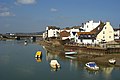
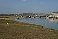
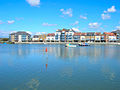
Category:Shoreham-by-Sea
Jump to navigation
Jump to search
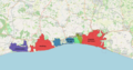
seaside town and port in West Sussex, England  | |||||
| Upload media | |||||
| Instance of | |||||
|---|---|---|---|---|---|
| Location | Adur, West Sussex, South East England, England | ||||
| Located in or next to body of water | |||||
| Area |
| ||||
| official website | |||||
 | |||||
Deutsch: Shoreham-by-Sea, ehemals New Shoreham, ist eine Stadt im Distrikt Adur in West Sussex, England. Der Ort hat eine Fläche von 984.88 ha und 19175 Einwohner (2001).
English: Shoreham-by-Sea (shortened to Shoreham) is a small town, port and seaside resort, also being the major settlement in the Adur District of West Sussex in South East England. Shoreham-by-Sea railway station is located less than a mile from the town centre and London Gatwick Airport is 23 miles away. Shoreham has a population of 17,537 according to the 2001 census, and is historically part of Sussex.
Italiano: Shoreham-by-Sea è una cittadina di 17.537 abitanti della contea del West Sussex, in Inghilterra.
Nederlands: Shoreham-by-Sea is een plaats in het bestuurlijke gebied Adur, in het Engelse graafschap West Sussex.
Norsk bokmål: Shoreham-by-Sea, i dagligtale bare Shoreham, er en by i West Sussex, England. Den ligger i, og er administrasjonssenter for, distriktet Adur.
Polski: Shoreham-by-Sea – miasto portowe w hrabstwie West Sussex, dystrykt Adur w południowej Anglii (Wielka Brytania). Zamieszkuje je 19 175 mieszkańców (2001).
Română: Shoreham-by-Sea este un oraş şi o staţiune litorală în comitatul West Sussex, regiunea South East England, Anglia. Oraşul se află în districtul Adur a cărui reşedinţă este.

Subcategories
This category has the following 15 subcategories, out of 15 total.
A
- Adur Railway Bridge (28 F)
B
H
K
O
- Old Shoreham Toll Bridge (8 F)
P
R
- Shoreham Redoubt (24 F)
- Riverside Moorings, Shoreham (82 F)
S
- Shoreham-by-Sea in art (4 F)
- Shoreham-by-Sea War Memorial (4 F)
Media in category "Shoreham-by-Sea"
The following 200 files are in this category, out of 309 total.
(previous page) (next page)-
 A27 through Mill Hill - geograph.org.uk - 48458.jpg 640 × 479; 91 KB
-
 Admiralty Chart No 11 New Shoreham to Selsey Bill, Surveyed 1807.jpg 15,458 × 10,416; 36.17 MB
-
 Adur Civic Centre - geograph.org.uk - 1148001.jpg 640 × 480; 70 KB
-
 Adur Railway Bridge - geograph.org.uk - 641563.jpg 640 × 426; 53 KB
-

-
 Beach Road - geograph.org.uk - 1233770.jpg 640 × 480; 72 KB
-
 Bike shadow (5639033358).jpg 612 × 612; 81 KB
-
 Boat in locks - geograph.org.uk - 1484703.jpg 640 × 480; 81 KB
-
 Boats and pools, River Adur - geograph.org.uk - 1767470.jpg 640 × 428; 111 KB
-
 Boats at Shoreham-by-sea, Sussex - geograph.org.uk - 1811466.jpg 3,872 × 2,592; 2.23 MB
-
 Boats on the river Adur.jpg 4,032 × 3,024; 2.99 MB
-
 Boats on the Shoreham-by-Sea Mudflats, Sussex - geograph.org.uk - 1811212.jpg 3,872 × 2,592; 3.55 MB
-
 Bridget at Sunrise - geograph.org.uk - 1011238.jpg 640 × 479; 73 KB
-
 Brighton - panoramio (2).jpg 2,395 × 852; 1.23 MB
-
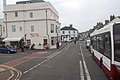
 Brighton Road - geograph.org.uk - 1148030.jpg 640 × 485; 64 KB
-
 Brighton Road, Shoreham - geograph.org.uk - 2740635.jpg 4,320 × 3,240; 3.31 MB
-
 Brighton Road, Shoreham, Sussex - geograph.org.uk - 1813715.jpg 3,872 × 2,592; 2.21 MB
-
 Brighton Road, Shoreham-by-Sea - geograph.org.uk - 2746771.jpg 4,320 × 3,240; 3.58 MB
-
 BrightonAndHoveBUA.png 1,618 × 850; 1.15 MB
-
 Brunswick Road - geograph.org.uk - 1148482.jpg 640 × 480; 75 KB
-
 Brunswick Road, Shoreham by Sea - geograph.org.uk - 3193074.jpg 2,088 × 1,396; 1.36 MB
-
 Brunswick Road, Shoreham-by-Sea - geograph.org.uk - 2746792.jpg 4,320 × 3,240; 3.23 MB
-
 Brunswick Road, Shoreham-by-Sea, - geograph.org.uk - 2610197.jpg 4,000 × 3,000; 2.22 MB
-
 Brunswick Road, Shoreham-by-Sea, Sussex - geograph.org.uk - 1810807.jpg 3,872 × 2,592; 3.59 MB
-
 Buckingham Road - geograph.org.uk - 1148493.jpg 640 × 480; 101 KB
-
 Church of St Mary De Haura - Vicarage - geograph.org.uk - 1763712.jpg 1,600 × 1,200; 391 KB
-
 Compass Bus bus (SN56 AXC), 27 August 2011.jpg 768 × 1,024; 209 KB
-
 Corralls Petroleum, Brighton Road - geograph.org.uk - 1147952.jpg 640 × 480; 71 KB
-

-
 Creek at low tide, Shoreham-by-Sea - geograph.org.uk - 2305811.jpg 640 × 480; 46 KB
-

-
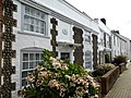 Dolphin Cottage, Church Street, Shoreham - geograph.org.uk - 3647682.jpg 640 × 480; 100 KB
-
 Dolphin Cottage, Church Street, Shoreham by Sea - geograph.org.uk - 2610187.jpg 3,753 × 2,792; 1.91 MB
-
 Downland near Mill Hill - geograph.org.uk - 1073399.jpg 640 × 479; 68 KB
-
 Dunelm Mill, Eastern Avenue - geograph.org.uk - 1147995.jpg 640 × 480; 64 KB
-
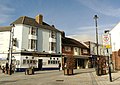 East Street, Shoreham by Sea - geograph.org.uk - 3822254.jpg 800 × 565; 106 KB
-
 East Street, Shoreham-by-sea, Sussex - geograph.org.uk - 1810857.jpg 3,872 × 2,592; 2.2 MB
-

-

-
 Egypt Wharf - geograph.org.uk - 1233425.jpg 480 × 640; 58 KB
-
 Emerald Quay - geograph.org.uk - 1233325.jpg 480 × 640; 77 KB
-

-
 Fire in the Sky - geograph.org.uk - 1011228.jpg 640 × 479; 70 KB
-
 Fisherman's hut - geograph.org.uk - 678966.jpg 640 × 480; 99 KB
-
 Fishermans Wharf - geograph.org.uk - 1233394.jpg 480 × 640; 54 KB
-

-
 Footpath, Mill Hill Nature Reserve - geograph.org.uk - 1072869.jpg 479 × 640; 103 KB
-
 Former Railway Bridge - geograph.org.uk - 1073590.jpg 640 × 479; 117 KB
-
 Former Shoreham-Horsham Railway - geograph.org.uk - 1073595.jpg 640 × 479; 113 KB
-
 Garden Close - geograph.org.uk - 1767740.jpg 640 × 428; 84 KB
-
 German prisoners debark in an English port after capture at Normandy.jpg 2,844 × 2,480; 3.77 MB
-
 Grazing land on South Downs - geograph.org.uk - 712685.jpg 640 × 480; 70 KB
-
 Harbour shots-3-2 (51082214916).png 3,558 × 4,604; 81.08 MB
-
 High Street - geograph.org.uk - 1074992.jpg 479 × 640; 67 KB
-
 High Street, (A259) - geograph.org.uk - 711862.jpg 640 × 480; 68 KB
-
 Holmbush Centre - geograph.org.uk - 497185.jpg 640 × 479; 121 KB
-

-
 Its a bus. Its a boat. Its a er er . . . . - Flickr - Elsie esq..jpg 1,600 × 1,200; 262 KB
-
 K6 Telephone Kiosk, East Street, Shoreham-by-Sea (IoE Code 297426).jpg 1,800 × 2,400; 1,018 KB
-
 Le Poissonnerie, Brighton Road - geograph.org.uk - 1147977.jpg 480 × 640; 81 KB
-
 Lennards Wharf - geograph.org.uk - 1233410.jpg 480 × 640; 49 KB
-
 Level Crossing, Eastern Avenue, Shoreham-by-Sea (June 2023) (1).jpg 2,400 × 1,600; 1.18 MB
-
 Level Crossing, Eastern Avenue, Shoreham-by-Sea (June 2023) (2).jpg 2,600 × 1,800; 1.4 MB
-
 Little High Street Hard - geograph.org.uk - 1074979.jpg 479 × 640; 137 KB
-
 Little High Street Hard - geograph.org.uk - 1074984.jpg 479 × 640; 49 KB
-
 Low Railway Bridge at West Street, Shoreham-by-Sea (May 2018).jpg 1,400 × 1,400; 440 KB
-
 Low Tide Footpath, River Adur - geograph.org.uk - 1073585.jpg 640 × 479; 100 KB
-
 Marina, Emerald Quay - geograph.org.uk - 1233369.jpg 640 × 480; 91 KB
-
 Max Miller Commemorative plaque.JPG 3,296 × 2,472; 1.19 MB
-
 Max Miller house in Shoreham.JPG 2,967 × 2,393; 3.61 MB
-
 Memorial to PC Jeffrey Tooley, Shoreham, Sussex - geograph.org.uk - 1813695.jpg 3,872 × 2,592; 6.19 MB
-
 Middle Street - geograph.org.uk - 1148450.jpg 480 × 640; 87 KB
-
 Mile Oak v Lancing (8126192281).jpg 3,296 × 2,472; 2.1 MB
-
 Mile Oak v Lancing (8126193053).jpg 2,940 × 2,138; 1.48 MB
-
 Mile Oak v Lancing (8126194011).jpg 3,296 × 2,472; 1.91 MB
-
 Mile Oak v Pagham (8146373921).jpg 3,648 × 2,736; 2.14 MB
-
 Mile Oak v Pagham (8146375481).jpg 3,648 × 2,736; 2.5 MB
-
 Mile Oak v Pagham (8146376619).jpg 3,648 × 2,736; 1.67 MB
-
 Mile Oak v Pagham (8146378573).jpg 3,648 × 2,736; 1.16 MB
-
 Mile Oak v Pagham (8146411914).jpg 3,648 × 2,736; 2.15 MB
-
 Mile Oak v Pagham (8146413814).jpg 3,648 × 2,736; 2.02 MB
-
 Mill Hill - geograph.org.uk - 1073388.jpg 479 × 640; 71 KB
-
 Mill Hill grazing land - geograph.org.uk - 1039830.jpg 640 × 480; 81 KB
-
 Mill Hill Nature Reserve - geograph.org.uk - 1073370.jpg 640 × 479; 81 KB
-
 Mill Lane - geograph.org.uk - 1148494.jpg 640 × 487; 75 KB
-
 Minelco Wharf - geograph.org.uk - 1233350.jpg 640 × 480; 49 KB
-
 Muddy Causeway - geograph.org.uk - 1231807.jpg 480 × 640; 94 KB
-
 Mudflats at Shoreham-by-Sea, Sussex - geograph.org.uk - 1811190.jpg 3,872 × 2,592; 4.85 MB
-
 Mudflats at Shoreham-by-Sea, Sussex - geograph.org.uk - 1811201.jpg 3,872 × 2,592; 4.74 MB
-
 Mudflats, Shoreham-by-Sea - geograph.org.uk - 2305712.jpg 640 × 480; 87 KB
-
 New build on West Beach Road - geograph.org.uk - 678948.jpg 640 × 480; 67 KB
-

-
 New Road - geograph.org.uk - 1148429.jpg 472 × 640; 69 KB
-
 New Shoreham - geograph.org.uk - 1231779.jpg 640 × 480; 69 KB
-
 New Tamar Lifeboat Station, Shoreham-on-Sea - geograph.org.uk - 2158904.jpg 4,000 × 3,000; 2.87 MB
-
 Newly built on West Beach Road - geograph.org.uk - 1034114.jpg 640 × 480; 104 KB
-
 No through route - geograph.org.uk - 1767651.jpg 640 × 428; 104 KB
-
 Norfolk Bridge - geograph.org.uk - 756182.jpg 640 × 479; 62 KB
-

-
 Norfolk Bridge at Dawn - geograph.org.uk - 1011211.jpg 640 × 484; 65 KB
-
 Northwestward view of River Adur at Shoreham-by-Sea (June 2023).jpg 2,800 × 1,600; 1.4 MB
-
 Old cottages, Church Street - geograph.org.uk - 641418.jpg 640 × 480; 90 KB
-

-
 Old Fort Road - geograph.org.uk - 1233551.jpg 640 × 480; 64 KB
-
 Old Level Crossing - geograph.org.uk - 1073556.jpg 436 × 640; 90 KB
-

-
 Old School House, St Nicolas' Lane, Old Shoreham (IoE Code 297363).jpg 2,400 × 1,800; 1.01 MB
-

-

-
 Old Shoreham from footbridge.JPG 2,048 × 1,536; 679 KB
-
 Old Shoreham Road - geograph.org.uk - 1075065.jpg 479 × 640; 60 KB
-
 Old Toll Bridge - geograph.org.uk - 1011450.jpg 640 × 479; 55 KB
-
 Old Toll Bridge - geograph.org.uk - 1073564.jpg 640 × 479; 100 KB
-
 Old Toll Bridge - geograph.org.uk - 733283.jpg 640 × 479; 81 KB
-
 Ordnance Survey One-Inch Sheet 133 Chichester & Worthing, Published 1920.jpg 11,878 × 8,925; 9.74 MB
-
 Outfall, Shoreham Power Station Beach - geograph.org.uk - 488883.jpg 640 × 479; 141 KB
-
 Outfall, Shoreham Power Station Beach - geograph.org.uk - 488889.jpg 479 × 640; 148 KB
-
 Parade of shops, High Street, Shoreham-by-Sea - geograph.org.uk - 2990571.jpg 1,600 × 1,130; 355 KB
-
 Park keeper's cottage, Buckingham Park, Shoreham - geograph.org.uk - 1804295.jpg 1,600 × 1,200; 531 KB
-
 PC Tooley memorial closeup.JPG 3,296 × 2,472; 1.19 MB
-
 PC Tooley memorial.JPG 3,296 × 2,472; 1.2 MB
-
 People pay tribute to those who lost their lives in the Shoreham Airshow Crash.jpg 3,264 × 2,448; 2.58 MB
-
 Petrol Pump Graveyard - geograph.org.uk - 1073624.jpg 640 × 479; 109 KB
-
 Picturesque Susses Angmering Church (NBY 439648).jpg 3,600 × 2,335; 706 KB
-
 Picturesque Susses Old Shoreham. (NBY 439894).jpg 3,600 × 2,334; 739 KB
-
 Picturesque Sussex Old Shoreham. (NBY 439893).jpg 3,600 × 2,333; 1.9 MB
-
 Pillbox near Shoreham Airport - geograph.org.uk - 1011354.jpg 479 × 640; 60 KB
-
 Pillbox near Shoreham Airport - geograph.org.uk - 1075046.jpg 479 × 640; 98 KB
-
 Public Slipway, Emerald Quay - geograph.org.uk - 1233310.jpg 468 × 640; 75 KB
-
 Queens Place - geograph.org.uk - 1148496.jpg 640 × 456; 76 KB
-
 Railway bridge arches (5636268770).jpg 612 × 612; 79 KB
-
 Railway Buffers, Downs Link - geograph.org.uk - 1073630.jpg 479 × 640; 122 KB
-
 Ravens Road, Shoreham-by-Sea - geograph.org.uk - 641407.jpg 640 × 480; 77 KB
-
 Ready for Development - geograph.org.uk - 1073597.jpg 640 × 479; 80 KB
-
 Regional Cycle Route 79 - geograph.org.uk - 1039241.jpg 640 × 480; 98 KB
-
 Regional Cycle Route 79 - geograph.org.uk - 1039247.jpg 640 × 480; 100 KB
-
 River Adur - geograph.org.uk - 1011202.jpg 479 × 640; 77 KB
-
 River Adur - geograph.org.uk - 1012521.jpg 640 × 479; 109 KB
-
 River Adur - geograph.org.uk - 1074989.jpg 640 × 479; 86 KB
-
 River Adur - geograph.org.uk - 113059.jpg 640 × 445; 100 KB
-
 River Adur - geograph.org.uk - 1148435.jpg 480 × 640; 54 KB
-
 River Adur - geograph.org.uk - 1148464.jpg 480 × 640; 66 KB
-
 River Adur - geograph.org.uk - 1148472.jpg 480 × 640; 61 KB
-
 River Adur - geograph.org.uk - 1231782.jpg 640 × 480; 69 KB
-
 River Adur - geograph.org.uk - 706391.jpg 640 × 479; 91 KB
-
 River Adur - geograph.org.uk - 706417.jpg 640 × 479; 63 KB
-
 River Adur - Riverfront - geograph.org.uk - 1763775.jpg 1,600 × 1,200; 316 KB
-
 River Adur 01.jpg 3,888 × 5,184; 5.1 MB
-
 River Adur 02.jpg 5,184 × 3,888; 7.16 MB
-
 River Adur 03.jpg 3,888 × 5,184; 7.37 MB
-
 River Adur 04.jpg 3,888 × 5,184; 6.62 MB
-
 River Adur 05.jpg 5,184 × 3,888; 7.58 MB
-
 River Adur 06.jpg 5,184 × 3,888; 6.97 MB
-
 River Adur 07.jpg 5,184 × 3,888; 6.73 MB
-
 River Adur 08.jpg 3,888 × 5,184; 6.3 MB
-
 River Adur at Low Tide - geograph.org.uk - 1011242.jpg 640 × 479; 73 KB
-
 River Adur at Old Shoreham.JPG 1,971 × 1,479; 498 KB
-
 River Adur at Shoreham.JPG 2,028 × 1,508; 1.44 MB
-
 River Adur at Sunrise - geograph.org.uk - 1011230.jpg 640 × 479; 72 KB
-
 River Adur from the Norfolk Bridge - geograph.org.uk - 1763736.jpg 1,600 × 1,200; 292 KB
-
 River Adur, Shoreham-by-Sea - geograph.org.uk - 1189832.jpg 640 × 358; 47 KB
-
 River Adur, Shoreham-By-Sea - geograph.org.uk - 2493313.jpg 640 × 430; 66 KB
-
 River Adur, Shoreham-by-sea, Sussex - geograph.org.uk - 1810875.jpg 3,872 × 2,592; 1.92 MB
-
 River Adur, Shoreham-by-sea, Sussex - geograph.org.uk - 1810884.jpg 3,872 × 2,592; 1.57 MB
-
 River Adur, Shoreham-by-sea, Sussex - geograph.org.uk - 1810916.jpg 3,872 × 2,592; 2.27 MB
-
 Ropetackle - geograph.org.uk - 1074954.jpg 640 × 479; 119 KB
-
 Ropetackle - geograph.org.uk - 1074965.jpg 640 × 479; 125 KB
-
 Ropetackle - geograph.org.uk - 690996.jpg 479 × 640; 79 KB
-
 Ropetackle - geograph.org.uk - 756167.jpg 640 × 479; 80 KB
-
 Ropetackle development - geograph.org.uk - 641547.jpg 640 × 426; 62 KB
-
 Ropetackle, Shoreham-by-Sea - geograph.org.uk - 641422.jpg 640 × 480; 63 KB
-
 Saltmarsh near Norfolk Bridge - geograph.org.uk - 1011250.jpg 479 × 640; 75 KB
-
 Scrap heap, Shoreham-by-Sea - geograph.org.uk - 3079308.jpg 1,024 × 797; 152 KB
-
 Scrapyard, Railway Wharf - geograph.org.uk - 1147920.jpg 468 × 640; 68 KB
-
 Seat along the seafront - geograph.org.uk - 1189917.jpg 640 × 425; 73 KB
-
 Seats, Coronation Green - geograph.org.uk - 690813.jpg 479 × 640; 57 KB
-
 Ship Street Hard - geograph.org.uk - 1148444.jpg 480 × 640; 67 KB
-
 Ship Street Hard - geograph.org.uk - 1148446.jpg 480 × 640; 120 KB
-
 Shops, Brunswick Road - geograph.org.uk - 1148483.jpg 640 × 502; 73 KB
-
 Shops, Buckingham Road - geograph.org.uk - 1148492.jpg 640 × 504; 81 KB
-
 Shoreham Airshow 2015 - geograph.org.uk - 4627534.jpg 4,000 × 2,666; 6.95 MB
-
 Shoreham Airshow 2015 - geograph.org.uk - 4627542.jpg 4,000 × 2,250; 7.05 MB
-
 Shoreham at low tide - geograph.org.uk - 582286.jpg 640 × 480; 87 KB
-
 Shoreham by sea 2001.jpg 3,417 × 1,176; 401 KB
-
 Shoreham by sea coronation green.jpg 350 × 263; 43 KB
-
 Shoreham By-Pass - geograph.org.uk - 1012454.jpg 640 × 479; 92 KB
-
 Shoreham By-Pass - geograph.org.uk - 1073406.jpg 640 × 479; 66 KB
-
 Shoreham By-Pass - geograph.org.uk - 1073411.jpg 479 × 640; 75 KB
-
 Shoreham By-Pass Bridge - geograph.org.uk - 1073473.jpg 460 × 640; 74 KB
-
 Shoreham By-Pass Bridge - geograph.org.uk - 733276.jpg 479 × 640; 111 KB
-
 Shoreham By-Pass, A27(T) - geograph.org.uk - 712443.jpg 640 × 480; 77 KB
-
 Shoreham By-Pass, A27(T) - geograph.org.uk - 712655.jpg 640 × 480; 73 KB
-
 Shoreham Coastguard Lookout - geograph.org.uk - 1013348.jpg 640 × 480; 158 KB
-
 Shoreham fire station - geograph.org.uk - 471937.jpg 640 × 427; 172 KB
-
 Shoreham Flyover - geograph.org.uk - 575870.jpg 640 × 410; 70 KB
-
 Shoreham Footbridge - geograph.org.uk - 1231773.jpg 640 × 480; 85 KB
-
 Shoreham Footbridge - geograph.org.uk - 1231798.jpg 640 × 480; 86 KB
-
 Shoreham from footbridge.JPG 2,042 × 1,528; 1.08 MB
-

-
 Shoreham Tooley Memorial 23 July 2021.jpg 1,402 × 1,052; 1.06 MB


.jpg)


,_27_August_2011.jpg)


.png)

_-_geograph.org.uk_-_711862.jpg)


.jpg)


_(1).jpg)
_(2).jpg)


.jpg)


.jpg)
.jpg)
.jpg)
.jpg)
.jpg)
.jpg)
.jpg)
.jpg)
.jpg)


.jpg)


.jpg)


.jpg)
.jpg)
.jpg)


.jpg)


_-_geograph.org.uk_-_712443.jpg)
_-_geograph.org.uk_-_712655.jpg)


_-_geograph.org.uk_-_1146634.jpg)

.jpg)