Category:Shropshire photographs taken on 2007-06-03
Jump to navigation
Jump to search
Media in category "Shropshire photographs taken on 2007-06-03"
The following 60 files are in this category, out of 60 total.
-
 Abandoned. Old ploughing Equipment - geograph.org.uk - 456610.jpg 640 × 458; 163 KB
-

-

-
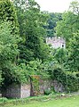 Boundary Wall and Church Tower, Willey - geograph.org.uk - 457480.jpg 476 × 640; 163 KB
-
-

-
 Bridleway to Willey, Shropshire - geograph.org.uk - 457639.jpg 480 × 640; 157 KB
-
 Bridleway towards Willey, Shropshire - geograph.org.uk - 457317.jpg 640 × 478; 187 KB
-
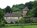 Buildings, Willey Old Hall, Shropshire - geograph.org.uk - 457476.jpg 640 × 483; 180 KB
-
 By the Lake, near Willey, Shropshire - geograph.org.uk - 457323.jpg 480 × 640; 177 KB
-
 Cattle at Willey, Shropshire - geograph.org.uk - 457465.jpg 640 × 436; 152 KB
-
 Ent^ Near Willey, Shropshire - geograph.org.uk - 457633.jpg 484 × 640; 146 KB
-

-
 Farmers' Road through Fields, Shropshire - geograph.org.uk - 456303.jpg 640 × 480; 183 KB
-

-

-

-
 Horses Grazing, Haughton, Shropshire - geograph.org.uk - 455851.jpg 640 × 448; 146 KB
-
 Inside the Courtyard, Willey, Shropshire - geograph.org.uk - 457474.jpg 640 × 446; 121 KB
-
 Lane and Crop Fields, Shropshire - geograph.org.uk - 454471.jpg 640 × 415; 131 KB
-
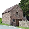 Old Barn, Linleygreen, Shropshire - geograph.org.uk - 457664.jpg 640 × 640; 181 KB
-
 Old Buildings, Willey, Shropshire - geograph.org.uk - 457468.jpg 640 × 400; 162 KB
-

-
 Rural Shropshire, near Morville - geograph.org.uk - 456325.jpg 640 × 480; 149 KB
-

-
 Sheep Grazing near Morville, Shropshire - geograph.org.uk - 456605.jpg 640 × 480; 142 KB
-
 Village Hall, Willey, Shropshire - geograph.org.uk - 457803.jpg 640 × 407; 166 KB
-
 Wheat Field, near Willey, Shropshire - geograph.org.uk - 454952.jpg 640 × 480; 172 KB
-
 Wheatfield near Willey, Shropshire - geograph.org.uk - 457656.jpg 640 × 480; 141 KB
-

-
 Cattle Grazing, The Smithies, Shropshire - geograph.org.uk - 456670.jpg 640 × 441; 163 KB
-
 Crop Fields near Linleygreen, Shropshire - geograph.org.uk - 457659.jpg 640 × 480; 138 KB
-
 Crop Fields near Shirlett, Shropshire - geograph.org.uk - 454484.jpg 640 × 433; 146 KB
-
 Damson Cottage, The Smithies, Shropshire - geograph.org.uk - 456667.jpg 640 × 498; 169 KB
-
 Dead Oak Tree, Linleygreen, Shropshire - geograph.org.uk - 455268.jpg 640 × 640; 167 KB
-
 Dead Oak Tree, Linleygreen, Shropshire - geograph.org.uk - 455278.jpg 495 × 640; 133 KB
-
 Farm Land, Shirlett, Shropshire - geograph.org.uk - 456947.jpg 640 × 435; 172 KB
-
 Farmers' Road through Fields, Shropshire - geograph.org.uk - 456379.jpg 640 × 497; 191 KB
-
 Farmland near Linleygreen, Shropshire - geograph.org.uk - 457822.jpg 640 × 428; 148 KB
-

-
 Footpath through Oak Trees, Shropshire - geograph.org.uk - 454499.jpg 640 × 480; 159 KB
-

-

-
 Footpath through Trees, Shropshire - geograph.org.uk - 456328.jpg 480 × 640; 148 KB
-
-
 Forest Track, Shirlett, Shropshire - geograph.org.uk - 456930.jpg 640 × 455; 170 KB
-

-

-
 Out of the Woods, Shropshire - geograph.org.uk - 456330.jpg 640 × 444; 170 KB
-
 Path through the Oak Trees, Shropshire - geograph.org.uk - 456595.jpg 480 × 640; 157 KB
-

-

-

-

-

-

-
 The Pines of Shirlett, Shropshire - geograph.org.uk - 456921.jpg 480 × 640; 183 KB
-
 View from near Linleygreen, Shropshire - geograph.org.uk - 457850.jpg 640 × 640; 160 KB
-

-
 View to The Long Mynd, Shropshire - geograph.org.uk - 456388.jpg 640 × 400; 143 KB


,_Linleygreen,_Shropshire_-_geograph.org.uk_-_457672.jpg)


.jpg)