Category:Sibbertoft
Jump to navigation
Jump to search

village and civil parish in Northamptonshire, United Kingdom  | |||||
| Upload media | |||||
| Instance of | |||||
|---|---|---|---|---|---|
| Location | West Northamptonshire, Northamptonshire, East Midlands, England | ||||
| Population |
| ||||
| Area |
| ||||
| Said to be the same as | Sibbertoft (Wikimedia duplicated page, civil parish) | ||||
 | |||||
Subcategories
This category has the following 2 subcategories, out of 2 total.
Media in category "Sibbertoft"
The following 137 files are in this category, out of 137 total.
-
 A gate little used^ - geograph.org.uk - 2007640.jpg 4,000 × 3,000; 2.91 MB
-
 Auster AOP.6 at Husbands Bosworth Gliding Club.jpg 1,024 × 506; 170 KB
-
 Battlefield Trail - geograph.org.uk - 5223321.jpg 480 × 640; 45 KB
-
 Battlefield Trail - geograph.org.uk - 5223324.jpg 480 × 640; 49 KB
-
 Battlefield Trail - geograph.org.uk - 5223326.jpg 640 × 480; 56 KB
-
 Battlefield Trail - geograph.org.uk - 5223327.jpg 640 × 480; 59 KB
-
 Bridleway to Sibbertoft - geograph.org.uk - 5323318.jpg 640 × 640; 96 KB
-
 Brook Meadow Campsite - geograph.org.uk - 5373023.jpg 4,608 × 2,824; 2.58 MB
-
 Cereal field near Prince Rupert's Farm - geograph.org.uk - 3537977.jpg 1,024 × 680; 243 KB
-
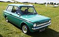
 Chevrolet Aveo LT - Flickr - mick - Lumix.jpg 2,999 × 2,073; 1.39 MB
-
 Chipmunk Aircraft ex Royal Navy - Flickr - mick - Lumix.jpg 3,717 × 1,706; 2.45 MB
-
 Crop field north of Sibbertoft - geograph.org.uk - 4337004.jpg 640 × 480; 91 KB
-
 Crop field west of Sibbertoft - geograph.org.uk - 4335980.jpg 640 × 480; 109 KB
-
 Crossing the main watershed - geograph.org.uk - 2007722.jpg 4,000 × 3,000; 2.83 MB
-
 Daihatsu Move - Flickr - mick - Lumix.jpg 3,052 × 2,038; 1.09 MB
-
 Dax Boss 302 - AC Cobra Replica - Flickr - mick - Lumix.jpg 3,051 × 2,038; 1.54 MB
-
 Drive to Prince Rupert's Farm - geograph.org.uk - 3537962.jpg 1,024 × 680; 224 KB
-
 Entering Sibbertoft from the north - geograph.org.uk - 5029084.jpg 640 × 452; 44 KB
-
 Field track near Sibbertoft Wood - geograph.org.uk - 1810862.jpg 3,648 × 2,736; 2.21 MB
-
 Fire Hydrant Sign - geograph.org.uk - 296420.jpg 507 × 640; 68 KB
-
 Flight Design CTSW at Sibbertoft Gliding Club.jpg 3,734 × 2,201; 3.2 MB
-
 Ford Model T - Flickr - mick - Lumix.jpg 3,193 × 1,947; 1.21 MB
-
 Franklin Special - Lotus 7 Clone - Flickr - mick - Lumix.jpg 3,052 × 2,038; 1.72 MB
-
 Gateway - geograph.org.uk - 296421.jpg 640 × 480; 74 KB
-
 Giant mushrooms - geograph.org.uk - 547266.jpg 640 × 460; 132 KB
-
 Gravestones to the daughters of John and Susanna Ore - geograph.org.uk - 2002641.jpg 4,000 × 3,000; 2.9 MB
-

-
 Green in Sibbertoft - geograph.org.uk - 6839885.jpg 1,886 × 1,228; 1.85 MB
-
 Hillman Imp 1969 at Sibbertoft Gliding Club - Flickr - mick - Lumix.jpg 3,799 × 2,376; 2.1 MB
-
 Houses along Sulby Hall Old Drive - geograph.org.uk - 547209.jpg 640 × 408; 91 KB
-
 How Now Brown Cow^ - geograph.org.uk - 5373079.jpg 1,920 × 1,440; 749 KB
-
 Hyundai Accent 1997 - Flickr - mick - Lumix.jpg 3,089 × 2,013; 1.35 MB
-
 Jurassic Way - geograph.org.uk - 5223383.jpg 480 × 640; 52 KB
-
 Jurassic Way - geograph.org.uk - 5223385.jpg 640 × 480; 52 KB
-
 Jurassic Way - geograph.org.uk - 5223386.jpg 640 × 480; 59 KB
-

-
 Jurassic Way stile - geograph.org.uk - 296417.jpg 480 × 640; 128 KB
-
 Leaving Sibbertoft - geograph.org.uk - 4337003.jpg 640 × 480; 101 KB
-
 Lodges at Brook Meadow - geograph.org.uk - 5030393.jpg 640 × 480; 36 KB
-
 Mazda MX5 - Flickr - mick - Lumix.jpg 3,108 × 2,001; 1.35 MB
-
 MG 1930 - Flickr - mick - Lumix.jpg 2,995 × 2,076; 1.89 MB
-
 Microlight at Sibbertoft Airfield - Flickr - mick - Lumix.jpg 3,324 × 1,871; 1.21 MB
-
 Minor road towards Marston Trussell - geograph.org.uk - 4337006.jpg 640 × 480; 89 KB
-
 Misty evening at Sibbertoft - geograph.org.uk - 296419.jpg 640 × 480; 28 KB
-
 Muck shifters at the Wrongs - geograph.org.uk - 3529006.jpg 3,648 × 2,736; 2.62 MB
-
 Naseby Battle Field. - geograph.org.uk - 517483.jpg 640 × 480; 114 KB
-
 Naseby junction - geograph.org.uk - 5260386.jpg 480 × 640; 72 KB
-
 Naseby Road, Sibbertoft - geograph.org.uk - 6843891.jpg 1,920 × 1,280; 1.31 MB
-
 Off-Road Driving Experience Centre - geograph.org.uk - 5373046.jpg 3,264 × 1,836; 2.78 MB
-
 Path near Sibbertoft - geograph.org.uk - 5223319.jpg 640 × 480; 47 KB
-
 Permissive Path near Sibbertoft - geograph.org.uk - 5223329.jpg 640 × 480; 63 KB
-
 Permissive Path near Sibbertoft - geograph.org.uk - 5223331.jpg 640 × 480; 52 KB
-
 Permissive Path near Sibbertoft - geograph.org.uk - 5223334.jpg 640 × 480; 60 KB
-
 Quad Bike Driving Course - geograph.org.uk - 5373052.jpg 2,820 × 1,372; 1.27 MB
-
 Quarry near the Wrongs - geograph.org.uk - 3529956.jpg 640 × 480; 94 KB
-
 Reception at Brook Meadow campsite - geograph.org.uk - 5030181.jpg 640 × 480; 37 KB
-
 Riley 1930 - Flickr - mick - Lumix.jpg 2,823 × 1,852; 1.28 MB
-

-
 Road from Sibbertoft - geograph.org.uk - 5223315.jpg 640 × 480; 57 KB
-
 Road junction - geograph.org.uk - 4874655.jpg 1,024 × 576; 144 KB
-
 Road to Sibbertoft - geograph.org.uk - 6799782.jpg 768 × 1,024; 199 KB
-
 Sibberftoft houses.JPG 3,072 × 2,304; 2.33 MB
-
 Sibbertoft - St Helen's Church - geograph.org.uk - 5243554.jpg 5,184 × 2,920; 1.36 MB
-
 Sibbertoft Classic Car Meeting - Flickr - mick - Lumix(1).jpg 1,024 × 471; 121 KB
-
 Sibbertoft Classic Car Meeting - Flickr - mick - Lumix.jpg 3,132 × 1,985; 1.18 MB
-
 Sibbertoft Cottages - geograph.org.uk - 2995581.jpg 640 × 480; 68 KB
-
 Sibbertoft Parish Church - geograph.org.uk - 5173342.jpg 640 × 480; 66 KB
-
 Sibbertoft Road - eastbound - geograph.org.uk - 6799784.jpg 768 × 1,024; 161 KB
-
 Sibbertoft Road - geograph.org.uk - 5260381.jpg 480 × 640; 87 KB
-
 Sibbertoft Road to Clipston - geograph.org.uk - 2002649.jpg 4,000 × 3,000; 2.87 MB
-
 Sibbertoft Road, Northamptonshire - geograph.org.uk - 547295.jpg 640 × 480; 128 KB
-
 Sibbertoft Village - geograph.org.uk - 5373069.jpg 3,818 × 2,338; 2.1 MB
-
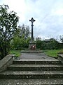 Sibbertoft War Memorial - geograph.org.uk - 5373068.jpg 3,456 × 4,608; 4.05 MB
-
 Sibbertoft west.JPG 3,072 × 2,304; 2.38 MB
-
 Sibbertoft-The Red Lion - geograph.org.uk - 2995618.jpg 640 × 480; 56 KB
-
 Sibbertoft-Welland Rise - geograph.org.uk - 2995604.jpg 640 × 480; 68 KB
-
 Stile near Sibbertoft - geograph.org.uk - 1810839.jpg 3,648 × 2,736; 2.16 MB
-
 Stubble field south of Welford Road - geograph.org.uk - 4335961.jpg 640 × 480; 85 KB
-
 The entrance to Avalanche Adventure, Sibbertoft - geograph.org.uk - 6839886.jpg 1,920 × 1,280; 1.59 MB
-
 The entrance to Avalanche Adventure, Sibbertoft - geograph.org.uk - 6847495.jpg 1,920 × 1,280; 1.75 MB
-
 The Fishing Lake at Brook Meadow - geograph.org.uk - 5373057.jpg 3,209 × 1,661; 2.06 MB
-
 The Jurassic Way at Sibbertoft - geograph.org.uk - 5373078.jpg 2,935 × 4,608; 3.64 MB
-

-
 The Red Lion Public House - Sibbertoft - geograph.org.uk - 5373076.jpg 4,119 × 2,982; 2.93 MB
-
 The Red Lion, Sibbertoft - geograph.org.uk - 4336999.jpg 640 × 480; 68 KB
-
 The Red Lion. - geograph.org.uk - 393218.jpg 640 × 480; 83 KB
-
 Track to Avalanche Adventure - geograph.org.uk - 4335976.jpg 640 × 480; 74 KB
-
 TVR Griffith - Flickr - mick - Lumix.jpg 3,187 × 1,952; 1.36 MB
-
 Welford Road - geograph.org.uk - 4335965.jpg 640 × 480; 79 KB
-
 Welford Road - geograph.org.uk - 4336996.jpg 640 × 480; 116 KB
-
 Welford Road Derelict Building - geograph.org.uk - 2999276.jpg 640 × 480; 91 KB
-
 Welland Rise, Sibbertoft - geograph.org.uk - 4337000.jpg 640 × 480; 62 KB
-
 Welland Rise, Sibbertoft - geograph.org.uk - 5029119.jpg 640 × 480; 63 KB
-
 Westhorpe House - Sibbertoft - geograph.org.uk - 5373074.jpg 3,292 × 2,201; 2.18 MB
-
 Wheat stubble - geograph.org.uk - 2007737.jpg 4,000 × 3,000; 3.02 MB
-
 A Warning. - geograph.org.uk - 452689.jpg 640 × 480; 142 KB
-
 Approaching Sibbertoft - geograph.org.uk - 547271.jpg 640 × 463; 144 KB
-
 Avalanche Adventure Site - geograph.org.uk - 547261.jpg 640 × 461; 110 KB
-
 Beeches Close, Sibbertoft - geograph.org.uk - 547274.jpg 640 × 427; 119 KB
-
 Bridge over flooded stream - geograph.org.uk - 302972.jpg 640 × 480; 149 KB
-
 Brook running west to Sulby reservoir. - geograph.org.uk - 294590.jpg 640 × 480; 192 KB
-
 Carp Lake. - geograph.org.uk - 393199.jpg 640 × 480; 116 KB
-

-
 Church Street towards Sibbertoft - geograph.org.uk - 547282.jpg 640 × 470; 128 KB
-
 Church Street, Sibbertoft Road junction - geograph.org.uk - 547287.jpg 640 × 463; 151 KB
-
 Farmland between Clipston and Naseby - geograph.org.uk - 183173.jpg 640 × 480; 88 KB
-
 Farmland between Welford and Naseby - geograph.org.uk - 175031.jpg 640 × 480; 104 KB
-
 Footpath to Berberis Spinney. - geograph.org.uk - 452685.jpg 640 × 480; 99 KB
-
 Gate Field and Horse Box - geograph.org.uk - 296412.jpg 640 × 480; 103 KB
-
 Hothorpe Hills this way - geograph.org.uk - 296403.jpg 640 × 480; 43 KB
-
 Icy Hedgerow - geograph.org.uk - 296406.jpg 640 × 480; 96 KB
-
 Laetioporus sulphureus. - geograph.org.uk - 452707.jpg 640 × 480; 124 KB
-
 Lane close to Hothorpe Hills - geograph.org.uk - 547302.jpg 640 × 541; 125 KB
-
 Lonely tree - geograph.org.uk - 294593.jpg 640 × 480; 110 KB
-
 Long Hold Spinney - geograph.org.uk - 517494.jpg 640 × 480; 84 KB
-
 Meeting of the ways. - geograph.org.uk - 302968.jpg 640 × 480; 138 KB
-
 Misty Field - geograph.org.uk - 296413.jpg 640 × 480; 72 KB
-
 Misty Road - geograph.org.uk - 296415.jpg 640 × 480; 94 KB
-
 Mud Coloured Lake. - geograph.org.uk - 452721.jpg 640 × 480; 93 KB
-
 Muddy footpath - geograph.org.uk - 302974.jpg 640 × 480; 127 KB
-
 Reservoir - geograph.org.uk - 180323.jpg 640 × 480; 96 KB
-
 Road Junction - geograph.org.uk - 296422.jpg 640 × 463; 95 KB
-
 ROC Post, Clipston, Northants - geograph.org.uk - 53145.jpg 640 × 251; 35 KB
-
 Rural Road Junction - geograph.org.uk - 296423.jpg 640 × 480; 42 KB
-
 Sibbertoft Reading Rooms - geograph.org.uk - 175956.jpg 640 × 480; 76 KB
-
 Starr's Lodge drive - geograph.org.uk - 180313.jpg 640 × 480; 67 KB
-
 Starr's Lodge. - geograph.org.uk - 452687.jpg 640 × 480; 115 KB
-
 The Road into Sibbertoft. - geograph.org.uk - 393209.jpg 640 × 480; 97 KB
-
 The Tip of the Wood. - geograph.org.uk - 452699.jpg 640 × 480; 115 KB
-
 Very misty field^ - geograph.org.uk - 296414.jpg 640 × 480; 66 KB
-

-
 View by Rough-hill Spinney. - geograph.org.uk - 452695.jpg 640 × 480; 84 KB
-
 View to Barn Conversion. - geograph.org.uk - 328635.jpg 640 × 480; 102 KB
-
 View to Distant House. - geograph.org.uk - 328609.jpg 640 × 480; 85 KB
-
 View to Hill Top Farm. - geograph.org.uk - 359984.jpg 640 × 480; 79 KB
-
 View towards Broadmoor Farm. - geograph.org.uk - 328605.jpg 640 × 480; 82 KB
-
 View towards Prince Rupert's farm - geograph.org.uk - 328601.jpg 640 × 480; 84 KB


.jpg)


