Category:Signs of trails to summits and view points in the Czech Republic
Jump to navigation
Jump to search
Čeština: Tvarové turistické značení odbočky k vrcholu nebo vyhlídce v České republice
Subcategories
This category has only the following subcategory.
Media in category "Signs of trails to summits and view points in the Czech Republic"
The following 27 files are in this category, out of 27 total.
-
 Cesta z Plešivce na Vysoký vrch, značkařský kolík.jpg 2,048 × 1,536; 613 KB
-
 Dubá, Plešivec, rozcestník (2013).jpg 2,448 × 3,264; 651 KB
-
 Dubá, Plešivec, směrovky na Vysoký vrch.jpg 3,264 × 2,448; 842 KB
-
 Hlavatice, rozcestník.jpg 3,264 × 2,448; 2.23 MB
-
 Husa, kresba u odbočky, detail.jpg 3,264 × 2,448; 2.4 MB
-
 Husa, skalní útvary u stezky k vrcholu.jpg 3,264 × 2,448; 2.7 MB
-
 INFO Turisti.jpg 4,000 × 3,000; 3.7 MB
-
 Ještěd, turistické značky na podjezdu.jpg 2,048 × 1,536; 655 KB
-
 Klecany, Klecanský háj, rozcestník a odbočky.JPG 2,136 × 2,848; 3.03 MB
-
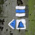 Modrá značka s odbočkou.jpg 198 × 198; 43 KB
-
 Odbočka k vyhlídce, šipka.jpg 3,264 × 2,448; 1.29 MB
-
 Odbočka k vyhlídce.jpg 2,048 × 1,536; 294 KB
-
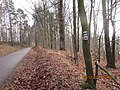 Odbočka z cyklostezky.JPG 4,608 × 3,456; 6.2 MB
-
 Provodín R3.jpg 3,648 × 2,432; 3.47 MB
-
 Svatý Jan pod Skalou, turistické značky na zdi kláštera (01).jpg 3,264 × 2,448; 2.47 MB
-
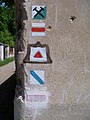 Svatý Jan pod Skalou, turistické značky na zdi kláštera.jpg 2,448 × 3,264; 2.99 MB
-
 Svojkovské skály 061.jpg 3,888 × 2,592; 5.64 MB
-
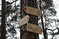
 Turistická značka k vyhlídce U Lvíčka.jpg 3,042 × 2,407; 3.49 MB
-
 Turistická značka označující vyhlídku v Hornopožárském lese.JPG 4,416 × 3,312; 6.69 MB
-
 Vraní skála, vrcholová kniha.jpg 2,448 × 3,264; 3.03 MB
-
 Značka odbočky na borovici.jpg 2,048 × 1,536; 694 KB
-
 Značka odbočky na buku.jpg 2,048 × 1,536; 709 KB
-
 Značka odbočky se šipkou.jpg 2,048 × 1,536; 703 KB
-
 Značkařské šablony, odbočka k vrcholu a šipka.jpg 1,906 × 3,103; 472 KB
-
 Značkařský kolík.jpg 931 × 1,309; 292 KB
-
 Žlutá odbočka k Mexiku-detail.jpg 2,048 × 1,536; 736 KB
-
 Žlutá odbočka k Mexiku.jpg 1,536 × 2,048; 797 KB

.jpg)


.jpg)


