Category:Silian
Jump to navigation
Jump to search
village in United Kingdom  | |||||
| Upload media | |||||
| Instance of | |||||
|---|---|---|---|---|---|
| Location | Ceredigion, Wales | ||||
 | |||||
Cymraeg: Pentref yn Nyffryn Aeron, Ceredigion yw Silian, neu Sulien yn hanesyddol. Lleolir tua dwy filltir i'r gogledd-ddwyrain o Lanbedr Pont Steffan, ar lôn gefn hanner ffordd rhwng Pont Creuddun ar yr A482, a Glan Denys ar yr A485.
English: Silian, or originally Sulien, is a village in the valley of the River Aeron, Ceredigion, Wales. It is located approximatley two miles north-west of Lampeter, on a back road connecting Pont Creuddun on the A482, and Glan Denys on the A485.
Media in category "Silian"
The following 12 files are in this category, out of 12 total.
-
 Crossroads - geograph.org.uk - 655951.jpg 640 × 480; 75 KB
-
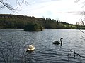 Falcondale Lake - geograph.org.uk - 311853.jpg 640 × 479; 52 KB
-
 Old trackbed near Olwen - geograph.org.uk - 676203.jpg 640 × 480; 51 KB
-
 Ty'n-y-fford Farm - geograph.org.uk - 779952.jpg 640 × 480; 45 KB
-
 Wood with bluebells - geograph.org.uk - 701019.jpg 640 × 480; 131 KB
-
 Beudiau Farmhouse - geograph.org.uk - 735634.jpg 640 × 462; 58 KB
-
 Disused trailer near Silian - geograph.org.uk - 633127.jpg 640 × 480; 89 KB
-
 Glandenys - geograph.org.uk - 655903.jpg 640 × 480; 92 KB
-
 Heol y Wig-Forest Road - geograph.org.uk - 655974.jpg 640 × 480; 121 KB
-
 Moorland pastures - geograph.org.uk - 358436.jpg 640 × 480; 133 KB
-
 St Mary's Church, Maestir - geograph.org.uk - 503022.jpg 640 × 428; 113 KB
-
 Track through Olwen Wood - geograph.org.uk - 566302.jpg 640 × 480; 151 KB


