Category:Silverstone
Jump to navigation
Jump to search
English: Silverstone is a village and civil parish in Northamptonshire, England. It is about from the M40 motorway junction 10, Northampton, Milton Keynes and Banbury. The A43 now bypasses to the south-east of the village, between the village and the race circuit.
village and civil parish in Northamptonshire, United Kingdom  | |||||
| Upload media | |||||
| Instance of | |||||
|---|---|---|---|---|---|
| Location |
| ||||
| Population |
| ||||
| Area |
| ||||
| Said to be the same as | Silverstone (Wikimedia duplicated page, civil parish) | ||||
| official website | |||||
 | |||||
Subcategories
This category has the following 4 subcategories, out of 4 total.
Media in category "Silverstone"
The following 200 files are in this category, out of 233 total.
(previous page) (next page)-
 "Suicide drop" on Silverstone 4x4 course - geograph.org.uk - 478771.jpg 640 × 480; 179 KB
-

-
 A Lot of Nissans - geograph.org.uk - 4633373.jpg 1,024 × 683; 160 KB
-
 A row of Caterhams - geograph.org.uk - 4631907.jpg 1,024 × 683; 182 KB
-
 A row of Morgans - geograph.org.uk - 4633141.jpg 1,024 × 683; 185 KB
-
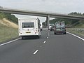
 A43 bridge carrying A413 - geograph.org.uk - 2538125.jpg 3,648 × 2,736; 855 KB
-
 A43 bridge carrying Whittlebury Road - geograph.org.uk - 2538118.jpg 3,648 × 2,736; 1.53 MB
-
 A43 foot-bridge serving Silverstone - geograph.org.uk - 2538116.jpg 3,648 × 2,736; 1.81 MB
-
 A43 from a Silverstone access road - geograph.org.uk - 3543341.jpg 1,600 × 1,071; 482 KB
-
 A43 from the Whittlebury Road - geograph.org.uk - 3543333.jpg 1,600 × 1,067; 515 KB
-
 A43 heading north east - geograph.org.uk - 4315332.jpg 640 × 415; 41 KB
-
 A43 heading north east - geograph.org.uk - 4316446.jpg 640 × 418; 64 KB
-
 A43 southeast of Pits Farm - geograph.org.uk - 3343163.jpg 3,648 × 2,736; 789 KB
-
 A43 towards Northampton - geograph.org.uk - 4316447.jpg 640 × 469; 55 KB
-
 A43 towards Northampton - geograph.org.uk - 6192149.jpg 1,024 × 684; 249 KB
-
 A43 towards Northampton - geograph.org.uk - 6192153.jpg 1,024 × 684; 279 KB
-
 A43 towards Northampton - geograph.org.uk - 6192155.jpg 1,024 × 684; 228 KB
-
 A43 towards Northampton - geograph.org.uk - 6192170.jpg 1,024 × 684; 209 KB
-
 A43 towards Towcester - geograph.org.uk - 6242018.jpg 800 × 600; 114 KB
-
 Animal shelter on the edge of the paddock - geograph.org.uk - 3223651.jpg 1,600 × 1,067; 394 KB
-
 Artist at Work - geograph.org.uk - 4633374.jpg 1,024 × 683; 199 KB
-
 Austin Healeys in a line - geograph.org.uk - 4634230.jpg 1,024 × 683; 153 KB
-
 Avenue from Silverstone to Stowe - geograph.org.uk - 478669.jpg 640 × 480; 106 KB
-
 Ayrton Senna outlet at Silverstone - geograph.org.uk - 4592042.jpg 1,200 × 799; 312 KB
-
 Back road - geograph.org.uk - 3300980.jpg 1,024 × 768; 593 KB
-

-
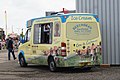 Beechdean Ice Cream Van at Silverstone - geograph.org.uk - 4586391.jpg 1,200 × 799; 337 KB
-
 Beechdean Ice Cream Van at Silverstone - geograph.org.uk - 4586504.jpg 1,200 × 799; 415 KB
-
 Big Wheel at Silverstone - geograph.org.uk - 4595953.jpg 1,200 × 799; 323 KB
-
 Brackley Road - geograph.org.uk - 6232967.jpg 640 × 480; 46 KB
-
 BRDC Clubhouse, Silverstone - geograph.org.uk - 4595921.jpg 1,200 × 799; 364 KB
-
 Bridge for bridleway across A43 - geograph.org.uk - 6371402.jpg 1,024 × 768; 113 KB
-
 Bridge over the A43 near Silverstone - geograph.org.uk - 4315329.jpg 640 × 475; 48 KB
-
 Brown Ford Prefect - geograph.org.uk - 4631775.jpg 1,024 × 683; 191 KB
-
 Bucknell Wood - geograph.org.uk - 443631.jpg 640 × 640; 191 KB
-
 Bucknell Woods - Snow.jpg 2,546 × 2,794; 5.68 MB
-
 C5 going By - geograph.org.uk - 4633143.jpg 1,024 × 683; 145 KB
-
 Church Street, Silverstone - geograph.org.uk - 6241879.jpg 800 × 600; 160 KB
-
 Classic Mustangs - geograph.org.uk - 4631910.jpg 1,024 × 683; 190 KB
-
 Club Silverstone Stand, Silverstone - geograph.org.uk - 4588274.jpg 1,200 × 799; 296 KB
-

-
 Copse A Stand, Silverstone - geograph.org.uk - 4586478.jpg 1,200 × 799; 306 KB
-
 Copse A Stand, Silverstone - geograph.org.uk - 4586496.jpg 1,200 × 799; 344 KB
-
 Copse B Stand, Silverstone - geograph.org.uk - 4586500.jpg 1,200 × 799; 333 KB
-
 Copse C Stand, Silverstone - geograph.org.uk - 4586509.jpg 1,200 × 799; 375 KB
-
 Copse C Stand, Silverstone - geograph.org.uk - 4586510.jpg 1,200 × 799; 328 KB
-
 Copse Corner, Silverstone - geograph.org.uk - 4586571.jpg 1,200 × 799; 349 KB
-
 Croft Stores - geograph.org.uk - 5075404.jpg 4,000 × 3,000; 2.21 MB
-

-
 Digging a large hole in the road - geograph.org.uk - 4605797.jpg 4,320 × 3,240; 4.65 MB
-
 Double decker bar bus at Silverstone - geograph.org.uk - 4591972.jpg 1,200 × 799; 381 KB
-

-
 Elizabeth II postbox on Stocks Hill Silverstone - geograph.org.uk - 6242706.jpg 2,776 × 4,803; 3.26 MB
-
 End Wall, cement over stone - geograph.org.uk - 3571222.jpg 800 × 600; 186 KB
-
 Entrance to Parkfields - geograph.org.uk - 469527.jpg 640 × 425; 65 KB
-
 Entrance to the field - geograph.org.uk - 3223648.jpg 1,600 × 1,066; 675 KB
-
 Farmhouse by the Whittlebury Road - geograph.org.uk - 3543331.jpg 1,600 × 1,067; 428 KB
-
 Fast food outlet at Silverstone - geograph.org.uk - 4586375.jpg 1,200 × 799; 274 KB
-
 Fast food outlets at Luffield, Silverstone - geograph.org.uk - 4592004.jpg 1,200 × 799; 355 KB
-
 Fast food outlets at Silverstone - geograph.org.uk - 4586397.jpg 1,200 × 799; 270 KB
-
 Fast food outlets at Silverstone - geograph.org.uk - 4586483.jpg 1,200 × 799; 400 KB
-

-
 Flybrid Systems, Silverstone - geograph.org.uk - 4611723.jpg 1,200 × 799; 256 KB
-
 Flying over - geograph.org.uk - 4633372.jpg 1,024 × 683; 19 KB
-
 Footbridge over Dadford Road, Silverstone - geograph.org.uk - 4611729.jpg 1,200 × 799; 355 KB
-
 Ford RS2000 - geograph.org.uk - 4634227.jpg 1,024 × 683; 146 KB
-
 Former Telephone Exchange, Silverstone - geograph.org.uk - 1313739.jpg 640 × 480; 116 KB
-
 Four way junction in Lodge Copse - geograph.org.uk - 442502.jpg 640 × 480; 158 KB
-
 General Admission Viewing at Silerstone - geograph.org.uk - 4586592.jpg 1,200 × 799; 356 KB
-
 General Admission Viewing at Silerstone - geograph.org.uk - 4586612.jpg 1,200 × 799; 354 KB
-
 General Admission Viewing at Silerstone - geograph.org.uk - 4586623.jpg 1,200 × 799; 337 KB
-
 General Admission Viewing near Copse - geograph.org.uk - 4592081.jpg 1,200 × 799; 398 KB
-
 General Admission Viewing near Copse C - geograph.org.uk - 4586584.jpg 1,200 × 799; 351 KB
-
 General Admission Viewing near Copse Corner - geograph.org.uk - 4592070.jpg 1,200 × 799; 442 KB
-
 General Admission Viewing near Luffield - geograph.org.uk - 4591989.jpg 1,200 × 799; 417 KB
-
 Getting ready to Fire - geograph.org.uk - 4633148.jpg 533 × 800; 82 KB
-
 Grassland and power lines, Silverstone - geograph.org.uk - 6241878.jpg 800 × 600; 125 KB
-
 Greatrex of Stafford (10722879633).jpg 1,038 × 702; 77 KB
-
 Hanging in the Air - geograph.org.uk - 4633369.jpg 1,024 × 683; 93 KB
-
 Hay field by Whittlebury Road - geograph.org.uk - 3543330.jpg 1,600 × 1,068; 503 KB
-
 High Street, Silverstone - geograph.org.uk - 5075390.jpg 4,000 × 3,000; 3.32 MB
-
 Home of the Navigator - geograph.org.uk - 3301000.jpg 1,699 × 586; 108 KB
-
 Horses between Stowe and Silverstone - geograph.org.uk - 478748.jpg 640 × 480; 254 KB
-
 Hot Dog stall at Luffield - geograph.org.uk - 4592001.jpg 1,200 × 799; 364 KB
-
 Houses on Stocks Hill, Silverstone - geograph.org.uk - 6242001.jpg 800 × 550; 104 KB
-
 Hovercraft racing at Whittlebury Park - geograph.org.uk - 2832175.jpg 3,456 × 2,304; 3.88 MB
-

-
 Ice cream van at Luffield, Silverstone - geograph.org.uk - 4591983.jpg 1,200 × 799; 352 KB
-
 Ice cream van at Luffield, Silverstone - geograph.org.uk - 4592000.jpg 1,200 × 799; 383 KB
-
 Ice cream van at Silverstone - geograph.org.uk - 4586597.jpg 1,200 × 799; 504 KB
-
 Ice cream van at Woodcote, Silverstone - geograph.org.uk - 4592045.jpg 1,200 × 799; 291 KB
-
 Information board at Copse, Silverstone - geograph.org.uk - 4586560.jpg 1,200 × 799; 302 KB
-
-
 Inside Silverstone - geograph.org.uk - 5282287.jpg 480 × 640; 59 KB
-
 Jag in Front - geograph.org.uk - 4632070.jpg 1,024 × 683; 156 KB
-
 JAGUARMK1BUY1.jpg 750 × 1,334; 292 KB
-
 Joseph Loake GB3 2023.jpg 4,453 × 2,969; 9.6 MB
-
 Lay-by on the A43 near Silverstone - geograph.org.uk - 4366373.jpg 1,024 × 682; 142 KB
-
 Lay-by on the A43 near Siverstone - geograph.org.uk - 4316442.jpg 640 × 459; 65 KB
-
 Licensed Bar at Silverstone - geograph.org.uk - 4586381.jpg 1,200 × 799; 329 KB
-
 Lime Kiln Close - geograph.org.uk - 3749610.jpg 640 × 480; 106 KB
-
 Lines of Sevens - geograph.org.uk - 4631905.jpg 1,024 × 683; 180 KB
-
 Looking towards Woodcote's Silverstone - geograph.org.uk - 4586461.jpg 1,200 × 799; 342 KB
-
 Lotus in a Row - geograph.org.uk - 4631770.jpg 1,024 × 683; 143 KB
-
 Luffield Stand, Silverstone - geograph.org.uk - 4591992.jpg 1,200 × 799; 391 KB
-
 Motorcyclist on Wellington Straight, Silverstone - geograph.org.uk - 4597103.jpg 1,200 × 799; 237 KB
-
 Moulton College with Solar farm beyond - geograph.org.uk - 4982602.jpg 1,600 × 1,066; 510 KB
-
 New College - geograph.org.uk - 4632291.jpg 1,024 × 683; 116 KB
-
 Official F1 Team Merchandise at Silverstone - geograph.org.uk - 4586488.jpg 1,200 × 799; 332 KB
-
 Old Drum Patio Set - geograph.org.uk - 4633377.jpg 1,024 × 683; 159 KB
-
 One way traffic on Dadford Road - geograph.org.uk - 4611734.jpg 1,200 × 799; 347 KB
-
 One way traffic on Dadford Road - geograph.org.uk - 4611842.jpg 1,200 × 799; 451 KB
-
 Ordnance Survey One-Inch Sheet 146 Buckingham, Published 1947.jpg 10,967 × 12,804; 15.89 MB
-
 Ordnance Survey One-Inch Sheet 146 Buckingham, Published 1954.jpg 8,324 × 9,956; 10 MB
-
 Ordnance Survey One-Inch Sheet 146 Buckingham, Published 1968.jpg 8,385 × 9,940; 10.2 MB
-
 Petronas outlet at Luffield, Silverstone - geograph.org.uk - 4591991.jpg 1,200 × 799; 371 KB
-
 Pick ^ Mix Sweet Stall at Luffield, Silverstone - geograph.org.uk - 4591980.jpg 1,200 × 799; 403 KB
-
 Picnic area at Luffield, Silverstone - geograph.org.uk - 4592034.jpg 1,200 × 799; 383 KB
-
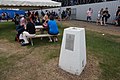
 Picnic tables at Silverstone - geograph.org.uk - 4586384.jpg 1,200 × 799; 218 KB
-
 Porsche 919 Race Car - geograph.org.uk - 4633392.jpg 1,024 × 683; 155 KB
-
 Porsche 935 Racer - geograph.org.uk - 4633387.jpg 1,024 × 683; 142 KB
-
 Porsche 944 Racer - geograph.org.uk - 4633381.jpg 1,024 × 683; 117 KB
-
 Porsche 959 Rally Car - geograph.org.uk - 4633389.jpg 1,024 × 683; 176 KB
-
 Porsche Spyder - geograph.org.uk - 4633395.jpg 1,024 × 683; 104 KB
-
 Porsche911atSilverstone2016.jpg 3,264 × 2,448; 1.98 MB
-
 Post Office and shop, Silverstone - geograph.org.uk - 6242010.jpg 800 × 600; 118 KB
-
 Public footpath towards Pits Farm - geograph.org.uk - 4982610.jpg 1,600 × 1,066; 485 KB
-
 Queuing to get into Silverstone - geograph.org.uk - 4586362.jpg 1,200 × 799; 344 KB
-
 Queuing to get into Silverstone - geograph.org.uk - 4586365.jpg 1,200 × 799; 426 KB
-
 Racing car outside the Silverstone UTE building - geograph.org.uk - 4586455.jpg 1,200 × 799; 404 KB
-
 Racing round Luffield - geograph.org.uk - 4632062.jpg 1,024 × 683; 167 KB
-
 Road Angel at Silverstone Park, Silverstone - geograph.org.uk - 4611929.jpg 1,200 × 799; 350 KB
-
 Roundabout leading to A413 - geograph.org.uk - 3196446.jpg 1,024 × 768; 544 KB
-
 Rounding the Bend - geograph.org.uk - 4632072.jpg 1,024 × 683; 159 KB
-
 Sheep grazing by the bridleway - geograph.org.uk - 3543338.jpg 1,600 × 1,069; 709 KB
-
 Sheep near Stowe Corner, Silverstone - geograph.org.uk - 478660.jpg 640 × 480; 234 KB
-
 Sideways Seven - geograph.org.uk - 4631896.jpg 1,024 × 683; 210 KB
-
 Sign for the White Horse, Silverstone - geograph.org.uk - 6242006.jpg 602 × 800; 102 KB
-
 Silverstone Circuit at Silverstone Six - geograph.org.uk - 4586607.jpg 1,200 × 799; 465 KB
-
 Silverstone Methodist Church - geograph.org.uk - 5620998.jpg 2,592 × 1,944; 1.41 MB
-
 Silverstone Telephone Exchange - geograph.org.uk - 1313743.jpg 640 × 480; 84 KB
-
 Silverstone towards Becketts Corner - geograph.org.uk - 4586670.jpg 1,200 × 799; 369 KB
-
 Silverstone towards Copse A Stand - geograph.org.uk - 4586469.jpg 1,200 × 799; 342 KB
-
 Silverstone UTE building at Silverstone - geograph.org.uk - 4586439.jpg 1,200 × 799; 259 KB
-
 Silverstone UTE building at Silverstone - geograph.org.uk - 4586447.jpg 1,200 × 799; 272 KB
-
 Silverstone Village - geograph.org.uk - 4762940.jpg 1,600 × 1,001; 202 KB
-
 Silverstone Visitor Car Park charges - geograph.org.uk - 4611949.jpg 799 × 1,200; 373 KB
-
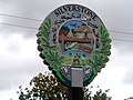
 Silverstone, village sign - geograph.org.uk - 4633113.jpg 2,163 × 2,883; 2.35 MB
-
 Smoking Round - geograph.org.uk - 4631899.jpg 1,024 × 683; 151 KB
-
 Snoozebox bedrooms at Silverstone F1 event - geograph.org.uk - 4611846.jpg 1,200 × 799; 371 KB
-
 Speed camera on the A43 - geograph.org.uk - 430843.jpg 640 × 480; 100 KB
-
 Spitfire on Display - geograph.org.uk - 4632295.jpg 1,024 × 683; 120 KB
-
 St Michael's Church, Silverstone - geograph.org.uk - 6242709.jpg 5,184 × 3,888; 5.46 MB
-
 St Michael's, Silverstone - geograph.org.uk - 143165.jpg 640 × 427; 105 KB
-
 St Michael's, Silverstone - geograph.org.uk - 4633421.jpg 4,320 × 3,240; 5.14 MB
-
 Stands at National Pits Straight, Silverstone - geograph.org.uk - 4595907.jpg 1,200 × 799; 504 KB
-
 Stands at Woodcote, Silverstone - geograph.org.uk - 4595910.jpg 1,200 × 799; 341 KB
-
 Start - finish straight at Silverstone - geograph.org.uk - 4575376.jpg 4,256 × 2,832; 5.11 MB
-
 Stream by Pits Farm - geograph.org.uk - 4982607.jpg 1,066 × 1,600; 693 KB
-
 Sturdy Stile, Silverstone - geograph.org.uk - 3571211.jpg 800 × 600; 181 KB
-

-
 The A413 goes over the A43 near Silverstone - geograph.org.uk - 4611650.jpg 1,200 × 787; 277 KB
-
 The Coach Park at Silverstone Circuit - geograph.org.uk - 4611699.jpg 1,200 × 799; 338 KB
-
 The Coach Park at Silverstone Circuit - geograph.org.uk - 4611938.jpg 1,200 × 799; 387 KB
-
 The E Zone area, Silverstone - geograph.org.uk - 4591971.jpg 1,200 × 799; 374 KB
-
 The E Zone area, Silverstone - geograph.org.uk - 4591976.jpg 1,200 × 799; 323 KB
-
 The Green Man - geograph.org.uk - 449024.jpg 640 × 480; 82 KB
-
 The Hobgoblin Bar at Silverstone - geograph.org.uk - 4613185.jpg 1,200 × 799; 399 KB
-
 The Medical Centre - geograph.org.uk - 4633145.jpg 1,024 × 683; 126 KB
-
 The Royal Oak (A413) - geograph.org.uk - 250088.jpg 600 × 450; 83 KB
-
 The Village Stands at Silverstone - geograph.org.uk - 4597109.jpg 1,200 × 799; 318 KB
-
 The White Horse, Silverstone - geograph.org.uk - 4633131.jpg 4,320 × 3,240; 2.97 MB
-
 The White Horse, Silverstone - geograph.org.uk - 6242005.jpg 800 × 600; 123 KB
-
 Toilet block near Copse C Stand, Silverstone - geograph.org.uk - 4586567.jpg 1,200 × 799; 366 KB
-
 Towcester Road - geograph.org.uk - 6232970.jpg 640 × 480; 57 KB
-
 Track on Car Park - geograph.org.uk - 2918392.jpg 4,608 × 3,456; 3.82 MB
-
 Track to Silverstone car park - geograph.org.uk - 3543339.jpg 1,600 × 1,067; 508 KB
-
-
 Triumphs lined up - geograph.org.uk - 4631768.jpg 1,024 × 683; 168 KB
-
 Two Chasing - geograph.org.uk - 4632068.jpg 1,024 × 683; 162 KB
-
 Two on the Bend - geograph.org.uk - 4632066.jpg 1,024 × 683; 149 KB
-
 Village sign, Silverstone (detail) - geograph.org.uk - 4633120.jpg 4,320 × 3,240; 4.43 MB
-

-
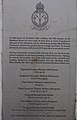 War Memorial Plaque at Silverstone Circuit - geograph.org.uk - 4592253.jpg 770 × 1,200; 317 KB
-
 Wellington Straight towards Village - geograph.org.uk - 4595961.jpg 1,200 × 799; 322 KB
-
 Wellington Straight, Silverstone - geograph.org.uk - 4595928.jpg 1,200 × 799; 278 KB
-
 Wellington Straight, Silverstone - geograph.org.uk - 4595942.jpg 1,200 × 799; 328 KB
-
 Wellington Straight, Silverstone - geograph.org.uk - 4595947.jpg 1,200 × 799; 316 KB
-
 What goes up must come Down - geograph.org.uk - 4633150.jpg 1,024 × 683; 61 KB
-
 White Horse sign - geograph.org.uk - 5075395.jpg 3,000 × 4,000; 1.72 MB
-
 Whittlebury Road - geograph.org.uk - 6232977.jpg 640 × 480; 70 KB
-

-
 Woodcote A Stand at Silverstone - geograph.org.uk - 4592040.jpg 1,200 × 799; 338 KB
-
 Woodcote B Stand at Silverstone - geograph.org.uk - 4586370.jpg 1,200 × 799; 375 KB
-
 Woodcote B Stand at Silverstone - geograph.org.uk - 4592046.jpg 1,200 × 799; 362 KB
-
 Autumn colours near Silverstone - geograph.org.uk - 599129.jpg 640 × 413; 145 KB
-
 Barn - geograph.org.uk - 461124.jpg 640 × 346; 66 KB
-

-
 Bridleway between woods - geograph.org.uk - 442497.jpg 640 × 480; 121 KB
-
 Bridleway gate - geograph.org.uk - 442512.jpg 640 × 489; 133 KB


.jpg)


_-_geograph.org.uk_-_250088.jpg)


_-_geograph.org.uk_-_4633120.jpg)


