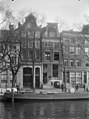
Category:Singel 269, Amsterdam
Jump to navigation
Jump to search
| Object location | | View all coordinates using: OpenStreetMap |
|---|
 | |||||
| Upload media | |||||
| Instance of |
| ||||
|---|---|---|---|---|---|
| Location | Amsterdam, North Holland, Netherlands | ||||
| Street address |
| ||||
| Located on street | |||||
| Heritage designation |
| ||||
 | |||||
|
This is a category about rijksmonument number 5203
|
| Address |
|
Media in category "Singel 269, Amsterdam"
The following 5 files are in this category, out of 5 total.
-
 Amsterdam - Singel 269.JPG 3,056 × 4,592; 4.88 MB
-
 Amsterdam, straatzicht de Singel rond 277 met RM's foto2 2014-01-12 14.30.jpg 4,416 × 3,312; 11.3 MB
-
 Overzicht voorgevels, straatbeeld - Amsterdam - 20020903 - RCE.jpg 894 × 1,200; 232 KB
-
 Stadsarchief Amsterdam, Afb 012000004194.jpg 2,082 × 2,302; 678 KB
-
 Stadsarchief Amsterdam, Afb 012000004195.jpg 2,190 × 2,870; 934 KB


