Category:Singel 484, Amsterdam
Jump to navigation
Jump to search
| Object location | | View all coordinates using: OpenStreetMap |
|---|
 | |||||
| Upload media | |||||
| Instance of |
| ||||
|---|---|---|---|---|---|
| Location | Amsterdam, North Holland, Netherlands | ||||
| Street address |
| ||||
| Located on street | |||||
| Heritage designation |
| ||||
 | |||||
|
This is a category about rijksmonument number 5410
|
| Address |
|
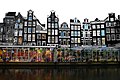
Media in category "Singel 484, Amsterdam"
The following 4 files are in this category, out of 4 total.
-
 Amsterdam - Singel 484.JPG 3,056 × 4,592; 4.25 MB
-
 Bloemenmarkt 2008 (3).jpg 1,024 × 681; 657 KB
-
 Grachtengordel-Zuid, 1017 Amsterdam, Netherlands - panoramio (40).jpg 4,896 × 3,264; 5.56 MB
-
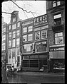 Paul Guermonprez, Afb 010016000274.jpg 3,280 × 4,163; 2.24 MB
.jpg)
.jpg)
