Category:Sint Pietersberg kunstbunker
Jump to navigation
Jump to search
 | |||||
| Upload media | |||||
| Instance of | |||||
|---|---|---|---|---|---|
| Location | |||||
| Located on street | |||||
| Connects with | |||||
| Owned by | |||||
| Inception |
| ||||
 | |||||
Media in category "Sint Pietersberg kunstbunker"
The following 49 files are in this category, out of 49 total.
-

-
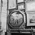
 De schilderijen zijn bevestigd aan beweegbare schotten, Bestanddeelnr 900-2435.jpg 2,867 × 2,905; 1.54 MB
-
 Depot met draadhekken, Bestanddeelnr 900-2431.jpg 2,885 × 2,900; 1.41 MB
-

-
 Diverse schilderijen aan een hekwerk, Bestanddeelnr 900-2438.jpg 2,872 × 2,873; 1.38 MB
-
 Diverse schilderijen, Bestanddeelnr 900-2441.jpg 2,876 × 2,903; 1.63 MB
-
 Diverse schilderijen, Bestanddeelnr 900-2442.jpg 2,866 × 2,831; 1.56 MB
-
 Diverse schilderijen, Bestanddeelnr 900-2444.jpg 2,873 × 2,887; 1.21 MB
-
 Diverse schilderijen, Bestanddeelnr 900-2446.jpg 2,875 × 2,888; 1.46 MB
-
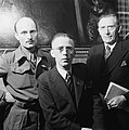 Drietal mannen - waarvan 1 geuniformeerd, Bestanddeelnr 900-2450.jpg 2,875 × 2,891; 1.07 MB
-
 Drietal mannen -waarvan één geuniformeerd in een kantoor, Bestanddeelnr 900-2452.jpg 2,861 × 2,900; 1.1 MB
-
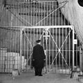
 Een sterk ijzeren hekwerk beschermt de kluis, Bestanddeelnr 900-2422.jpg 2,873 × 2,909; 1.48 MB
-
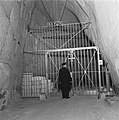
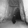
 Een suppoost in de mergelgrot, Bestanddeelnr 900-2414.jpg 2,854 × 2,855; 1.23 MB
-

-

-

-

-
 Kunstschatten Rijksmuseum in de Sint Pietersberg (2948184301).jpg 5,290 × 5,300; 6.79 MB
-
 Kunstschatten Rijksmuseum in St. Pietersberg (2949038782).jpg 5,252 × 5,300; 5.22 MB
-
 Kunstschatten Rijksmuseum in St. Pietersberg (2949040560).jpg 5,264 × 5,300; 6.16 MB
-
 Kunstschatten Rijksmuseum in St. Pietersberg (2949042050).jpg 5,213 × 5,300; 4.95 MB
-
 Maastricht, Statensingel, Van Gend & Loos, kunsttransport 1942.jpg 674 × 464; 96 KB
-
 Militaire bewaker en een suppoost in de mergelgrot, Bestanddeelnr 900-2413.jpg 2,890 × 2,897; 1.14 MB
-
 Militaire bewaker en een suppoost in de mergelgrot, Bestanddeelnr 900-2415.jpg 2,854 × 2,852; 1.24 MB
-

-
 Nachtwaker of suppoost met draaglamp, Bestanddeelnr 900-2416.jpg 2,879 × 2,909; 1.27 MB
-
-
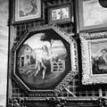
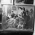
 Schilderij De Emmausgangers, Bestanddeelnr 900-2437.jpg 2,881 × 2,891; 1.5 MB
-
 Schilderijen hangen aan beweegbare hekwerken, Bestanddeelnr 900-2436.jpg 2,866 × 2,882; 1.18 MB
-

-
-

-
 Suppoost met aktetas en uniformpet in een van de mijngangen, Bestanddeelnr 900-2421.jpg 2,882 × 2,900; 1.5 MB
-
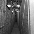
 Suppoost met pijp opent het hekwerk, Bestanddeelnr 900-2423.jpg 2,851 × 2,882; 1 MB
-

-
 Suppoost met uniformpet en aktetas loopt over een pad, Bestanddeelnr 900-2417.jpg 2,872 × 2,891; 1.14 MB
-
 Suppoost met uniformpet en aktetas loopt over een pad, Bestanddeelnr 900-2418.jpg 2,876 × 2,906; 1.46 MB
-
 Suppoost opent deur Rechts op de muren graffiti, Bestanddeelnr 900-2424.jpg 2,869 × 2,891; 1.4 MB
-
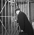
 Suppoost opent kluisdeur, Bestanddeelnr 900-2430.jpg 2,869 × 2,897; 1.14 MB
-
 Suppoost opent met sleutel een kluisdeur, Bestanddeelnr 900-2451.jpg 2,873 × 2,887; 1.07 MB
-
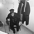
 Suppoost speelt een partij patience in zijn kantoor, Bestanddeelnr 900-2429.jpg 2,840 × 2,911; 1.08 MB
-
 Suppoost steekt een startsleutel in een apparaat, Bestanddeelnr 900-2427.jpg 2,824 × 2,819; 1.22 MB
-
 Suppoost trekt andere schoenen aan, Bestanddeelnr 900-2425.jpg 2,860 × 2,900; 1.2 MB
-
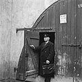 Suppoost verlaat de grot, Bestanddeelnr 900-2420.jpg 2,864 × 2,896; 1.4 MB
-

-

-

-
-


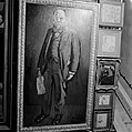
_van_Frans_Hals,,_Bestanddeelnr_900-2448.jpg)


.jpg)
.jpg)
.jpg)
.jpg)


