Category:Sint-Laurentiuskerk, Bocholt, BE
Jump to navigation
Jump to search
| Object location | | View all coordinates using: OpenStreetMap |
|---|
|
This is a category about Beschermd erfgoed number 2278
|
|
This is a category about onroerend erfgoed number 86025
|
church building in Bocholt, Belgium  | |||||
| Upload media | |||||
| Instance of | |||||
|---|---|---|---|---|---|
| Dedicated to | |||||
| Location | Bocholt, Arrondissement of Maaseik, Limburg, Flemish Region, Belgium | ||||
| Diocese | |||||
 | |||||
Media in category "Sint-Laurentiuskerk, Bocholt, BE"
The following 31 files are in this category, out of 31 total.
-
-
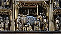
 Antwerps Mariaretabel (ca. 1525) Sint-Laurentiuskerk (Bocholt) 8-09-2019.jpg 5,319 × 4,157; 20.92 MB
-
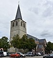
 Bocholt - Sint-Laurentiuskerk.jpg 2,048 × 1,536; 611 KB
-
 Jan van Steffeswert (1510-1520) Christoffel Sint-Laurentiuskerk (Bocholt) 8-09-2019.jpg 3,367 × 5,987; 6.7 MB
-
 Mariaretabel Sint-Laurentiuskerk (Bocholt) 27 september 2019.jpg 5,961 × 4,158; 17.28 MB
-
 Mariaretabel Sint-Laurentiuskerk (Bocholt) gesloten 27-09-2019 16-04-07.jpg 3,623 × 4,806; 11.18 MB
-

-
-
 Piëta Sint-Laurentiuskerk (Bocholt) 8-09-2019.jpg 3,652 × 5,695; 6.12 MB
-
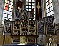
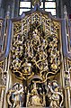
 Retabel Sint-Laurentiuskerk Bocholt 27-09-2019 15-28-06.jpg 6,221 × 4,209; 23.5 MB
-
 Romaanse biechtstoel Sint-Laurentiuskerk (Bocholt) 8-09-2019.jpg 6,000 × 4,000; 6.01 MB
-
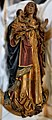
 Sint-Laurentius (onbekend 16e eeuw) Sint-Laurentiuskerk (Bocholt) 8-09-2019.jpg 4,000 × 6,000; 5.77 MB
-
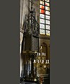
 Sint-Laurentiuskerk (Bocholt) 27-09-2019 14-18-33.jpg 3,635 × 5,510; 4.07 MB
-
 Sint-Laurentiuskerk (Bocholt) 27-09-2019 14-39-31.jpg 2,559 × 4,550; 11.11 MB
-
 Sint-Laurentiuskerk (Bocholt) 27-09-2019 15-06-55.jpg 3,445 × 3,448; 8.96 MB
-
 Sint-Laurentiuskerk (Bocholt) 27-09-2019 15-27-04.jpg 2,603 × 1,464; 2.64 MB
-
 Sint-Laurentiuskerk (Bocholt) 27-09-2019 16-33-46.jpg 3,069 × 5,111; 15.64 MB
-
 Sint-Laurentiuskerk (Bocholt) 8-09-2019 13-18-54.jpg 6,000 × 4,000; 6.83 MB
-
 Sint-Laurentiuskerk (Bocholt) 8-09-2019 13-22-25.jpg 6,000 × 3,380; 7.14 MB
-
 Sint-Laurentiuskerk (Bocholt) 8-09-2019 13-36-42.jpg 6,000 × 3,397; 6.69 MB
-
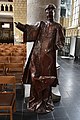
 Sint-Laurentiuskerk (Bocholt) 8-09-2019 13-47-09.jpg 4,578 × 4,983; 6.6 MB
-
 Sint-Laurentiuskerk (Bocholt) Ambrosius 27-09-2019.jpg 2,941 × 4,955; 14.72 MB
-
 Sint-Laurentiuskerk (Bocholt) Antonius van Egypte 27-09-2019.jpg 2,664 × 4,960; 11.43 MB
-
 Sint-Laurentiuskerk (Bocholt) godslamp 27-09-2019.jpg 3,848 × 4,962; 11.79 MB
-
 Sint-Laurentiuskerk (Bocholt) linkerpaneel Colijn de Coter 27-09-2019.jpg 4,000 × 6,000; 20.16 MB
-
 Sint-Laurentiuskerk (Bocholt) rechterpanelen Colijn de Coter 27-09-2019.jpg 4,125 × 3,294; 8.65 MB
-
 Sint-Laurentiuskerk (Bocholt) retabel gesloten toestand 27-09-2019.jpg 5,985 × 3,367; 23.25 MB
-
 Sint-Laurentiuskerk (Bocholt) retabel met stamboom van Jesse 27-09-2019.jpg 2,285 × 3,472; 9.16 MB
-
 Sint-Laurentiuskerk (Bocholt) Rochus 27-09-2019.jpg 3,161 × 4,973; 11.86 MB
-
 Sint-Laurentiuskerk (Bocholt) Sebastiaan 27-09-2019.jpg 2,138 × 4,457; 7.31 MB
-
 Sint-Laurentiuskerk (Bocholt) Twee musicerende engelen.jpg 3,996 × 4,669; 14.27 MB
_Sacramentstoren_(messing_ca.1500)_Sint-Laurentiuskerk_(Bocholt)_8-09-2019.jpg)
_Sint-Laurentiuskerk_(Bocholt)_8-09-2019.jpg)
_Christoffel_Sint-Laurentiuskerk_(Bocholt)_8-09-2019.jpg)
_27_september_2019.jpg)
_gesloten_27-09-2019_16-04-07.jpg)
_Sint-Laurentius_Sint-Laurentiuskerk_(Bocholt)_8-09-2019.jpg)
_Sint-Laurentiuskerk_(Bocholt)_8-09-2019_13-34-40.jpg)
_8-09-2019.jpg)

_8-09-2019.jpg)
_Sint-Laurentiuskerk_(Bocholt)_8-09-2019.jpg)
_27-09-2019_14-18-33.jpg)
_27-09-2019_14-39-31.jpg)
_27-09-2019_15-06-55.jpg)
_27-09-2019_15-27-04.jpg)
_27-09-2019_16-33-46.jpg)
_8-09-2019_13-18-54.jpg)
_8-09-2019_13-22-25.jpg)
_8-09-2019_13-36-42.jpg)
_8-09-2019_13-47-09.jpg)
_Ambrosius_27-09-2019.jpg)
_Antonius_van_Egypte_27-09-2019.jpg)
_godslamp_27-09-2019.jpg)
_linkerpaneel_Colijn_de_Coter_27-09-2019.jpg)
_rechterpanelen_Colijn_de_Coter_27-09-2019.jpg)
_retabel_gesloten_toestand_27-09-2019.jpg)
_retabel_met_stamboom_van_Jesse_27-09-2019.jpg)
_Rochus_27-09-2019.jpg)
_Sebastiaan_27-09-2019.jpg)
_Twee_musicerende_engelen.jpg)