Category:Sint-Servaaskerk (Ravels)
Jump to navigation
Jump to search
| Object location | | View all coordinates using: OpenStreetMap |
|---|
Nederlands: Afbeeldingen van de Sint-Valentinuskerk Poppel, Kerkstraat, 2381, Ravels, België. Gelegen in de gemeente Ravels in de provincie Antwerpen in het noorden van België.
(bron [1];[2])
|
This is a category about onroerend erfgoed number 75602
|
church in Ravels, Belgium .jpg) | |||||
| Upload media | |||||
| Instance of | |||||
|---|---|---|---|---|---|
| Dedicated to | |||||
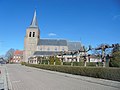
| Location | Ravels, Arrondissement of Turnhout, Province of Antwerp, Flemish Region, Belgium | ||||
| Architectural style | |||||
| Diocese | |||||
| Heritage designation | |||||
| Inception |
| ||||
 | |||||
Subcategories
This category has only the following subcategory.
D
Media in category "Sint-Servaaskerk (Ravels)"
The following 9 files are in this category, out of 9 total.
-
 75602 Ravels - Parochiekerk Sint-Servatius 2.jpg 3,000 × 2,000; 4.83 MB
-
 75602 Ravels - Parochiekerk Sint-Servatius.jpg 3,351 × 4,468; 10.16 MB
-
 Ravels (B) 75602 - Sint Servaasstraat 2 - Sint Servaaskerk.JPG 3,888 × 2,592; 3.21 MB
-
 Ravels - Sint-Servaaskerk (portrait).jpg 2,664 × 4,000; 2.92 MB
-
 Ravels - Sint-Servaaskerk.jpg 2,664 × 4,000; 2.93 MB
-
 Sint-Servaaskerk - Ravels (01).jpg 3,648 × 2,736; 3.96 MB
-
 Sint-Servaaskerk - Ravels (02).jpg 2,736 × 3,648; 3.38 MB
-
 Sint-Servaaskerk - Ravels (03).jpg 2,736 × 3,648; 3.31 MB
-
 Sint-Servaaskerk - Ravels (04).jpg 2,736 × 3,648; 3.29 MB


_75602_-_Sint_Servaasstraat_2_-_Sint_Servaaskerk.JPG)

.jpg)
.jpg)
.jpg)
.jpg)
Categories:
- Kerkstraat, Ravels
- Churches in Ravels
- Churches in Belgium by name
- Saint Servatius churches in Belgium
- Onroerend erfgoed in Ravels
- 16th-century churches in Antwerp (province)
- 19th-century churches in Antwerp (province)
- Brick Gothic churches in Antwerp (province)
- Gothic Revival brick churches in Antwerp (province)
- Architectural basilicas in Antwerp (province)