Category:Sint Aegidius (Abbenbroek)
Jump to navigation
Jump to search
| Object location | | View all coordinates using: OpenStreetMap |
|---|
1.JPG) | |||||
| Upload media | |||||
| Instance of | |||||
|---|---|---|---|---|---|
| Location |
| ||||
| Street address |
| ||||
| Located on street |
| ||||
| Heritage designation |
| ||||
| Inception |
| ||||
| Significant event |
| ||||
 | |||||
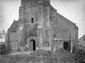
The church:
|
This is a category about rijksmonument number 9356
|
The tower:
|
This is a category about rijksmonument number 9357
|
| Address |
|
Subcategories
This category has only the following subcategory.
Media in category "Sint Aegidius (Abbenbroek)"
The following 50 files are in this category, out of 50 total.
-
 Buitenzijde, vanuit het oosten gezien - Abbenbroek - 20146540 - RCE.jpg 881 × 1,200; 236 KB
-
 Choir Ned. Herv. Kerk Abbenbroek.jpg 1,536 × 2,048; 798 KB
-
 Exterieur - Abbenbroek - 20004128 - RCE.jpg 1,200 × 896; 221 KB
-
 Exterieur naar het noord-westen - Abbenbroek - 20004125 - RCE.jpg 1,200 × 902; 203 KB
-
 Exterieur noordgevel - Abbenbroek - 20268804 - RCE.jpg 1,200 × 883; 235 KB
-
 Exterieur NOORDGEVEL - Abbenbroek - 20293310 - RCE.jpg 953 × 1,200; 362 KB
-
 Exterieur OVERZICHT TOREN - Abbenbroek - 20307211 - RCE.jpg 950 × 1,200; 258 KB
-
 Exterieur SMEEDIJZEREN TOEGANGSHEK (XVIII) - Abbenbroek - 20293757 - RCE.jpg 1,200 × 1,197; 463 KB
-
 Exterieur TOEGANGSHEK BEGRAAFPLAATS - Abbenbroek - 20293755 - RCE.jpg 1,195 × 1,200; 453 KB
-
 Exterieur TOEGANGSHEK BEGRAAFPLAATS - Abbenbroek - 20293756 - RCE.jpg 1,200 × 1,195; 206 KB
-
 Exterieur WESTGEVEL - Abbenbroek - 20293308 - RCE.jpg 958 × 1,200; 340 KB
-
 Exterieur WESTGEVEL TOREN - Abbenbroek - 20293307 - RCE.jpg 954 × 1,200; 292 KB
-
 Exterieur ZUIDGEVEL - Abbenbroek - 20293309 - RCE.jpg 953 × 1,200; 273 KB
-
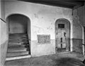 Interieur hal - Abbenbroek - 20004142 - RCE.jpg 1,200 × 941; 199 KB
-
 Kerk - Unknown - 20474655 - RCE.jpg 1,200 × 900; 200 KB
-
 Kerk - Unknown - 20474656 - RCE.jpg 1,200 × 900; 238 KB
-
 Kerk - Unknown - 20474657 - RCE.jpg 1,200 × 900; 131 KB
-
 Kerk en Ambachtsherenhuis te Abbenbroek.jpg 4,435 × 3,403; 4.03 MB
-
 Kerk van Abbenbroek.jpg 4,000 × 2,667; 9.5 MB
-
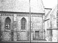
 Koor, detail daklijst - Abbenbroek - 20377323 - RCE.jpg 1,200 × 1,200; 465 KB
-
 Naar het noorden gezien, na de restauratie - Abbenbroek - 20004127 - RCE.jpg 1,200 × 883; 192 KB
-
 Naar het westen gezien, na de restauratie - Abbenbroek - 20004138 - RCE.jpg 886 × 1,200; 197 KB
-
 Naar het zuiden gezien, na de restauratie - Abbenbroek - 20004126 - RCE.jpg 1,200 × 887; 256 KB
-
 Naar het zuidwesten gezien, na de restauratie - Abbenbroek - 20004129 - RCE.jpg 1,200 × 887; 222 KB
-
 Ned. Herv. Kerk Abbenbroek.jpg 2,048 × 1,536; 1.46 MB
-
 Oostgevel - Abbenbroek - 20004139 - RCE.jpg 953 × 1,200; 267 KB
-
 Overzicht kerk en kerktoren vanuit het zuiden - Abbenbroek - 20004115 - RCE.jpg 1,200 × 886; 216 KB
-
 Overzicht kerk met kerktoren vanuit het zuiden - Abbenbroek - 20004114 - RCE.jpg 1,200 × 883; 188 KB
-
 Overzicht koor - Abbenbroek - 20377317 - RCE.jpg 935 × 1,200; 289 KB
-
 Overzicht koor - Abbenbroek minder hoog.jpg 855 × 880; 639 KB
-

-

-
 Overzicht vanaf het zuid-westen - Abbenbroek - 20373307 - RCE.jpg 1,200 × 901; 263 KB
-
 Overzicht vanuit het noorden - Abbenbroek - 20004118 - RCE.jpg 1,200 × 879; 277 KB
-
 Overzicht vanuit het noorden gezien - Abbenbroek - 20004119 - RCE.jpg 1,200 × 891; 292 KB
-
 Overzicht vanuit het noordwesten - Abbenbroek - 20004121 - RCE.jpg 882 × 1,200; 280 KB
-
 Overzicht vanuit het oosten - Abbenbroek - 20004122 - RCE.jpg 891 × 1,200; 247 KB
-
 Overzicht vanuit het oosten gezien - Abbenbroek - 20004123 - RCE.jpg 884 × 1,200; 219 KB
-
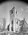
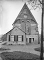
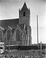
 Sint Aegidius (Abbenbroek)1.JPG 2,048 × 1,536; 1.48 MB
-
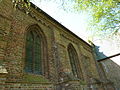
 Sint Aegidius (Abbenbroek)2.JPG 2,048 × 1,536; 1.62 MB
-
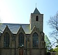
 Sint Aegidius (Abbenbroek)3.JPG 2,048 × 1,536; 1.55 MB
-
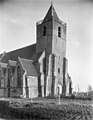
 Sint Aegidius (Abbenbroek)4.JPG 1,559 × 1,475; 1.74 MB
-
 Toren - Abbenbroek - 20004109 - RCE.jpg 954 × 1,200; 369 KB
-
 Toren - Abbenbroek - 20004110 - RCE.jpg 920 × 1,200; 410 KB
-
 Toren naar het zuid-oosten - Abbenbroek - 20004111 - RCE.jpg 931 × 1,200; 224 KB
-
 Toren naar het zuid-oosten - Abbenbroek - 20004113 - RCE.jpg 955 × 1,200; 263 KB
-
 Toren naar het zuiden - Abbenbroek - 20004112 - RCE.jpg 945 × 1,200; 203 KB
-
 Tower Ned. Herv. Kerk Abbenbroek.jpg 1,536 × 2,048; 1.34 MB
-
 Westzijde met toren en ingang - Abbenbroek - 20004120 - RCE.jpg 1,200 × 893; 260 KB
-
 Zicht op hervormde kerk oostzijde - Abbenbroek - 20318911 - RCE.jpg 895 × 1,200; 182 KB


_-_Abbenbroek_-_20293757_-_RCE.jpg)


2.JPG)
3.JPG)
4.JPG)


