Category:Slachtstraat 2, Utrecht
Jump to navigation
Jump to search
| Object location | | View all coordinates using: OpenStreetMap |
|---|
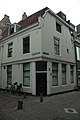
house in Utrecht, Netherlands  | |||||
| Upload media | |||||
| Instance of | |||||
|---|---|---|---|---|---|
| Location | Utrecht, Netherlands | ||||
| Street address |
| ||||
| Located on street | |||||
| Heritage designation |
| ||||
 | |||||
|
This is a category about rijksmonument number 450386
|
| Address |
|
Media in category "Slachtstraat 2, Utrecht"
The following 4 files are in this category, out of 4 total.
-
 Een zeer oud hoekje in de Stad Utrecht.jpg 3,911 × 3,177; 7.94 MB
-
 Exterieur OVERZICHT - Utrecht - 20305987 - RCE.jpg 955 × 1,200; 227 KB
-
 Slachtstraat2.jpg 2,000 × 3,008; 1.4 MB
-
 Voorgevel - Utrecht - 20236978 - RCE.jpg 943 × 1,200; 269 KB


