Category:Slaithwaite
Jump to navigation
Jump to search
village in the United Kingdom .jpg) | |||||
| Upload media | |||||
| Instance of | |||||
|---|---|---|---|---|---|
| Location | Kirklees, West Yorkshire, Yorkshire and the Humber, England | ||||
 | |||||

Subcategories
This category has the following 16 subcategories, out of 16 total.
B
- Bridges in Slaithwaite (17 F)
C
- Crimble Viaduct (8 F)
D
- Drop Clough (21 F)
F
- Foxstone Moss (3 F)
H
- Hill Top, Slaithwaite (15 F)
M
S
- Slaithwaite railway station (19 F)
- Slaithwaite Reservoir (6 F)
- Slaithwaite Viaduct (7 F)
T
Media in category "Slaithwaite"
The following 200 files are in this category, out of 255 total.
(previous page) (next page)-
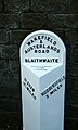 5 Mile Post, A62 road.jpg 308 × 512; 66 KB
-

-
 A path leading to Gosling Green Farm - geograph.org.uk - 2987220.jpg 800 × 600; 123 KB
-
 Across Kitchen Clough to Slaithwaite - geograph.org.uk - 99549.jpg 640 × 480; 72 KB
-
 Across Merry Dale Clough - geograph.org.uk - 2529291.jpg 640 × 480; 148 KB
-
 Ainley Place - geograph.org.uk - 854140.jpg 640 × 480; 86 KB
-

-
 Back o'Dam (4408257661).jpg 2,560 × 1,707; 4.12 MB
-
 Bank Nook, Slaithwaite - geograph.org.uk - 247074.jpg 478 × 640; 135 KB
-
 Bents Lane, Slaithwaite - geograph.org.uk - 6583004.jpg 2,000 × 1,500; 1.54 MB
-
 Black Cop, Slaithwaite - geograph.org.uk - 1658792.jpg 640 × 480; 60 KB
-
 Blakestones, Slaithwaite - geograph.org.uk - 1659561.jpg 640 × 480; 60 KB
-
 Blessed R Meeke (8711221294).jpg 2,249 × 3,455; 6.39 MB
-
 Blue bell alongside the River Colne - geograph.org.uk - 4631398.jpg 1,024 × 768; 270 KB
-
 Bluebells in woodland - geograph.org.uk - 1886050.jpg 1,024 × 768; 229 KB
-
 Bluebells on hillside - geograph.org.uk - 1886064.jpg 768 × 1,024; 521 KB
-
 Boundary stone on Deer Hill, Meltham - geograph.org.uk - 4682141.jpg 2,048 × 1,536; 800 KB
-
 Bradley Brook near Slaithwaite - geograph.org.uk - 2660488.jpg 3,240 × 4,320; 3.01 MB
-
 Bridge, Merry Dale Clough, Slaithwaite (4414453551).jpg 1,707 × 2,560; 4.49 MB
-

-
 Britannia Road - Slaithwaite - geograph.org.uk - 915128.jpg 627 × 640; 304 KB
-
 Brook Mill, Crimble - geograph.org.uk - 880318.jpg 640 × 480; 79 KB
-
 Burnt Plats Lane, Slaithwaite - geograph.org.uk - 1506426.jpg 640 × 480; 118 KB
-
 Burnt Plats Lane, Slaithwaite - geograph.org.uk - 1506441.jpg 640 × 480; 102 KB
-
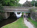 Canal Bridge at Waring Bottom - geograph.org.uk - 556723.jpg 640 × 480; 106 KB
-
 Canal Milestone, Slaithwaite.jpg 600 × 800; 119 KB
-
 Cartgate Foot, Slaithwaite (4421868679).jpg 1,714 × 1,714; 3.04 MB
-

-
 Cattle drinking trough - geograph.org.uk - 3628351.jpg 2,000 × 1,482; 1.5 MB
-
 Causeway, Slaithwaite - geograph.org.uk - 746099.jpg 640 × 480; 88 KB
-
 Causeway, Slaithwaite - geograph.org.uk - 746179.jpg 640 × 480; 66 KB
-
 Chimney, Platt Mill.jpg 480 × 800; 79 KB
-
 Chimneys at Slaithwaite (5082489128).jpg 1,654 × 2,361; 3.22 MB
-

-
 Clock Tower, Crimble, Slaithwaite - geograph.org.uk - 1659500.jpg 480 × 640; 110 KB
-

-

-
 Clough House Millpond under snow and ice - geograph.org.uk - 1658734.jpg 640 × 480; 118 KB
-
 Clough House millpond, Slaithwaite - geograph.org.uk - 1544823.jpg 480 × 640; 176 KB
-
 Clough House, Slaithwaite - geograph.org.uk - 1544784.jpg 640 × 480; 126 KB
-
 Clough House, Slaithwaite - geograph.org.uk - 528478.jpg 640 × 480; 75 KB
-
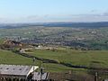
 Colne Valley (6097588350).jpg 4,124 × 2,281; 5.78 MB
-
 Colne Valley Circular Walk towards New House - geograph.org.uk - 5896269.jpg 1,600 × 1,146; 768 KB
-
 Colne Valley, near Slaithwaite (6103450059).jpg 3,958 × 2,509; 6.09 MB
-
-
 Crimea Lane, Slaithwaite - geograph.org.uk - 740726.jpg 640 × 442; 63 KB
-

-

-
-
-
 Disused stile on the Colne Valley Circular Walk - geograph.org.uk - 3628371.jpg 2,000 × 1,475; 1.2 MB
-
 Dri-N-Wash, Slaithwaite (8711217986).jpg 1,915 × 3,148; 3.96 MB
-

-
 Entering Slaithwaite - geograph.org.uk - 3786333.jpg 2,870 × 2,206; 1.23 MB
-

-
 Follingworth Lane, Slaithwaite - geograph.org.uk - 1658674.jpg 640 × 480; 84 KB
-
 Follingworth Lane, Slaithwaite - geograph.org.uk - 1658685.jpg 640 × 480; 48 KB
-

-

-

-
 Footbridge over the River Colne - geograph.org.uk - 29920.jpg 640 × 418; 132 KB
-

-
 Georgian post box on Ned Lane, Slaithwaite - geograph.org.uk - 5896251.jpg 1,064 × 1,600; 625 KB
-
-
 Globe Mill, Slaithwaite - geograph.org.uk - 625109.jpg 640 × 434; 97 KB
-
 Globe Mills (8720483473).jpg 2,374 × 3,432; 4.74 MB
-
 Globe Mills, Slaithwaite (17284683654).jpg 2,688 × 3,360; 6.35 MB
-
 Globe Mills, Slaithwaite - geograph.org.uk - 508253.jpg 640 × 369; 50 KB
-
 Green Lane Top, Slaithwaite - geograph.org.uk - 1658835.jpg 640 × 480; 84 KB
-
 Heavy Metal (7228191490).jpg 2,626 × 3,295; 5.37 MB
-
 Heyroyd Lane, Lingards - geograph.org.uk - 766435.jpg 640 × 502; 90 KB
-
 Heys Lane, Wilberlee - geograph.org.uk - 854134.jpg 640 × 480; 77 KB
-
-
 House - Lewisham Street, Slaithwaite - geograph.org.uk - 915167.jpg 640 × 480; 272 KB
-
 In Need Of Some Attention (4374071738).jpg 2,196 × 1,596; 3.71 MB
-
-

-
 Lane on Worts Hill, Slaithwaite - geograph.org.uk - 741824.jpg 640 × 480; 72 KB
-

-
 Lewisham Road, Slaithwaite - geograph.org.uk - 880393.jpg 640 × 480; 98 KB
-
 Linfit Fold, Slaithwaite - geograph.org.uk - 883619.jpg 640 × 480; 98 KB
-
 Linfit Fold, Slaithwaite - geograph.org.uk - 883622.jpg 640 × 480; 103 KB
-
 Linfit Hall, Slaithwaite - geograph.org.uk - 883638.jpg 640 × 480; 92 KB
-
 Lock, Huddersfield Narrow Canal - geograph.org.uk - 1455685.jpg 640 × 480; 84 KB
-
 Longlands Road,Slaithwaite - geograph.org.uk - 854149.jpg 640 × 480; 93 KB
-
 Lower Holme, Slaithwaite - geograph.org.uk - 1544655.jpg 640 × 480; 56 KB
-
 Lower Holme, Slaithwaite - geograph.org.uk - 1658747.jpg 640 × 480; 58 KB
-
 Lower Holme, Slaithwaite - geograph.org.uk - 1658754.jpg 640 × 480; 62 KB
-
 Lynn G and Geisha at Slaithwaite (28682406305).jpg 3,715 × 2,229; 5.87 MB
-
 Meal Hill Lane, Slaithwaite - geograph.org.uk - 740733.jpg 640 × 475; 71 KB
-
 Meal Hill Lane, Slaithwaite - geograph.org.uk - 740743.jpg 565 × 640; 86 KB
-

-
 Merry Dale Bridge, Slaithwaite - geograph.org.uk - 1418873.jpg 640 × 480; 172 KB
-
 Merrydale Clough - geograph.org.uk - 528520.jpg 640 × 480; 119 KB
-
 Mill, Bridge Street, Slaithwaite (4382785476).jpg 2,103 × 3,096; 4.78 MB
-
 Mill, Slaithwaite (4382785912).jpg 2,357 × 1,679; 3.74 MB
-
 Mills, Slaithwaite - geograph.org.uk - 753382.jpg 640 × 508; 117 KB
-

-

-

-
 Narrow canal.jpg 2,438 × 1,834; 4.37 MB
-
 Near Slaithwaite (10089755626).jpg 3,000 × 3,489; 10.45 MB
-
 New Gate, Slaithwaite - geograph.org.uk - 883596.jpg 480 × 640; 118 KB
-
 New Gate, Slaithwaite - geograph.org.uk - 883600.jpg 640 × 480; 112 KB
-
 New House, Bunkers Hill, Slaithwaite - geograph.org.uk - 740716.jpg 640 × 480; 79 KB
-
 North Lane, Slaithwaite - geograph.org.uk - 528505.jpg 640 × 480; 79 KB
-
 Old Bank, Slaithwaite - geograph.org.uk - 2198.jpg 480 × 342; 38 KB
-
 Old Lock Gate detail - geograph.org.uk - 512033.jpg 600 × 450; 467 KB
-

-

-

-
 Pighill Top Lane, Slaithwaite - geograph.org.uk - 740423.jpg 640 × 480; 83 KB
-

-
 Play Area - Longlands Avenue - geograph.org.uk - 5051058.jpg 640 × 480; 107 KB
-

-

-

-
 Reflections (4409004154).jpg 1,670 × 2,520; 3.35 MB
-
 Reflections in the River Colne, Slaithwaite (4382025663).jpg 1,532 × 2,298; 3.31 MB
-

-

-
 River Colne, Slaithwaite (3239664464).jpg 2,375 × 1,834; 3.86 MB
-
 Ruin (4373314103).jpg 2,450 × 1,599; 5.42 MB
-
 Sat Nav Wrong Use Brain sign, Tyas Lane, Slaithwaite.jpg 1,381 × 2,071; 2.92 MB
-
 Shred (4419808407).jpg 1,781 × 1,186; 2.64 MB
-
 Shuttle Lock No 24E - geograph.org.uk - 91252.jpg 480 × 640; 99 KB
-
 Sign for Slaithwaite Band Room - geograph.org.uk - 1544684.jpg 640 × 480; 97 KB
-
 Sinking ... (3231577621).jpg 2,560 × 1,920; 4.06 MB
-

-
 Clough Road Mills - geograph.org.uk - 1452203.jpg 375 × 500; 105 KB
-
 Slaithwaite (10025982144).jpg 2,933 × 2,933; 5.14 MB
-
 Slaithwaite (10026073566).jpg 4,000 × 2,667; 9.05 MB
-
 Slaithwaite (10075447405).jpg 2,787 × 1,858; 3.66 MB
-
 Slaithwaite (10075474485).jpg 3,000 × 4,000; 10.92 MB
-
 Slaithwaite (10335341334).jpg 3,117 × 2,603; 8.18 MB
-
 Slaithwaite (14108221585).jpg 2,129 × 2,981; 6.25 MB
-
 Slaithwaite (14950973802).jpg 3,875 × 2,748; 9.72 MB
-
 Slaithwaite (15156912690).jpg 3,440 × 3,595; 8.52 MB
-
 Slaithwaite (17356890314).jpg 2,248 × 3,372; 5.99 MB
-
 Slaithwaite (17719741550).jpg 2,972 × 3,715; 8.54 MB
-
 Slaithwaite (17719769010).jpg 2,248 × 3,372; 5.32 MB
-
 Slaithwaite (18056342351).jpg 2,991 × 3,993; 10.32 MB
-
 Slaithwaite (18180637606).jpg 3,955 × 2,373; 6.46 MB
-
 Slaithwaite (27057307135).jpg 2,104 × 2,104; 4.39 MB
-
 Slaithwaite (28602143911).jpg 3,294 × 2,196; 7.2 MB
-
 Slaithwaite (29618925711).jpg 2,029 × 3,044; 5.01 MB
-
 Slaithwaite (3238811561).jpg 2,350 × 1,880; 3.98 MB
-
 Slaithwaite (4382026041).jpg 1,329 × 1,993; 2.48 MB
-
 Slaithwaite (8721608748).jpg 2,618 × 2,645; 4.43 MB
-
 Slaithwaite (8724377826).jpg 2,806 × 3,041; 6.55 MB
-
 Slaithwaite - geograph.org.uk - 2643213.jpg 640 × 419; 78 KB
-
 Slaithwaite - geograph.org.uk - 4227282.jpg 640 × 430; 62 KB
-
 Slaithwaite - geograph.org.uk - 4302400.jpg 640 × 480; 241 KB
-
 Slaithwaite - geograph.org.uk - 6222875.jpg 4,128 × 2,006; 3.3 MB
-
 Slaithwaite - geograph.org.uk - 6369997.jpg 1,024 × 768; 208 KB
-
 Slaithwaite - geograph.org.uk - 6404154.jpg 2,680 × 1,998; 1.46 MB
-
 Slaithwaite - geograph.org.uk - 6404157.jpg 4,032 × 1,794; 1.81 MB
-
 Slaithwaite - geograph.org.uk - 6404160.jpg 4,031 × 1,875; 1.53 MB
-
 Slaithwaite 1 (3235150254).jpg 2,396 × 1,867; 3.35 MB
-
 Slaithwaite 1.JPG 1,600 × 1,200; 373 KB
-
 Slaithwaite 1.jpg 2,344 × 1,372; 2.43 MB
-
 Slaithwaite 2 (3234295527).jpg 2,560 × 1,920; 3.96 MB
-
 Slaithwaite 2 (4406327746).jpg 2,160 × 1,565; 1.73 MB
-
 Slaithwaite 2.jpg 2,448 × 3,264; 3.05 MB
-
 Slaithwaite 3 (4404309900).jpg 2,005 × 1,697; 3.47 MB
-
 Slaithwaite 4 (4404309556).jpg 2,560 × 1,707; 4.5 MB
-

-

-
 Slaithwaite Civic Hall - New Street - geograph.org.uk - 915176.jpg 640 × 480; 251 KB
-
 Slaithwaite from Radcliffe Road - geograph.org.uk - 4269825.jpg 640 × 439; 44 KB
-
 Slaithwaite Hall - geograph.org.uk - 1658843.jpg 480 × 640; 68 KB
-
 Slaithwaite Hall - summer - geograph.org.uk - 1658851.jpg 480 × 640; 114 KB
-
 Slaithwaite Health Centre - New Street - geograph.org.uk - 915172.jpg 640 × 426; 184 KB
-
 Slaithwaite Library - Britannia Road - geograph.org.uk - 915133.jpg 640 × 490; 267 KB
-
 Slaithwaite Moor - geograph.org.uk - 149281.jpg 640 × 480; 120 KB
-
 Slaithwaite National School - geograph.org.uk - 882867.jpg 640 × 480; 133 KB
-
 Slaithwaite Post Office - Lewisham Street - geograph.org.uk - 915165.jpg 509 × 640; 275 KB
-
 Slaithwaite Reservoir (4408238643).jpg 2,560 × 1,920; 5.4 MB
-

-

-

-
 Slaithwaite War Memorial - Lewisham Road - geograph.org.uk - 915159.jpg 368 × 640; 224 KB
-
 Slaithwaite Youth Centre - Church Street - geograph.org.uk - 915150.jpg 640 × 463; 207 KB
-

-
 Slaithwaite, Bank Gate - geograph.org.uk - 4302377.jpg 480 × 640; 298 KB
-
 Slaithwaite, Hill Top - geograph.org.uk - 4302368.jpg 640 × 427; 232 KB
-
 Slaithwaite, milepost - geograph.org.uk - 1548688.jpg 640 × 480; 93 KB
-
 Slaithwaite, viewed from Laund Road.jpg 3,232 × 1,683; 1.51 MB
-
 Slaithwaite, West Riding of Yorkshire - geograph.org.uk - 849751.jpg 640 × 429; 120 KB
-
 Slaithwaite.jpg 2,682 × 4,023; 9.6 MB
-
 Slathw't (3232441678).jpg 2,560 × 1,920; 3.89 MB
-
 Slawit 2.jpg 640 × 480; 190 KB
-

-
 Spa 1907 (3237608556).jpg 2,123 × 1,856; 2.76 MB
-
 Spa Mill - geograph.org.uk - 623634.jpg 432 × 640; 125 KB
-
 Spa Mill, Slaithwaite - geograph.org.uk - 882611.jpg 640 × 480; 65 KB
-
 Spa Mills, Slaithwaite (17717487936).jpg 2,689 × 3,411; 5.75 MB
-
 Spa Mills, Slaithwaite - geograph.org.uk - 508260.jpg 640 × 404; 42 KB
-
 Spa Mills, Slaithwaite - geograph.org.uk - 625115.jpg 640 × 424; 85 KB
-
 Spa Mills, Slaithwaite - geograph.org.uk - 852304.jpg 640 × 480; 94 KB


.jpg)


.jpg)


.jpg)


.jpg)


.jpg)


.jpg)

.jpg)


.jpg)


.jpg)
.jpg)


.jpg)


.jpg)


.jpg)


.jpg)
.jpg)


.jpg)


_-_geograph.org.uk_-_766451.jpg)


.jpg)
.jpg)


.jpg)
.jpg)

.jpg)


.jpg)


.jpg)
.jpg)
.jpg)
.jpg)
.jpg)
.jpg)
.jpg)
.jpg)
.jpg)
.jpg)
.jpg)
.jpg)
.jpg)
.jpg)
.jpg)
.jpg)
.jpg)
.jpg)
.jpg)
.jpg)


.jpg)


.jpg)
.jpg)

.jpg)
.jpg)


.jpg)


.jpg)


.jpg)


.jpg)


