Category:Smirisary
Jump to navigation
Jump to search
English: Smirisary is a hamlet in the council area of Highland, Scotland.
Media in category "Smirisary"
The following 24 files are in this category, out of 24 total.
-

-
 First Cottage at Smirisary - geograph.org.uk - 2007652.jpg 1,499 × 842; 1.76 MB
-
 Gate and stile near Smirisary - geograph.org.uk - 2033190.jpg 800 × 531; 224 KB
-
 Near the end of the Smirisary road - geograph.org.uk - 5164428.jpg 1,024 × 683; 955 KB
-
 New(ish) and old at Smirisary - geograph.org.uk - 1703081.jpg 985 × 659; 177 KB
-
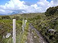
 Path to Smirisary - geograph.org.uk - 1579173.jpg 640 × 429; 153 KB
-
 Road to the first house at Smirisary - geograph.org.uk - 2033173.jpg 800 × 531; 194 KB
-
 Rocky shore at Smirisary - geograph.org.uk - 2458555.jpg 640 × 480; 94 KB
-
 Smirisary - geograph.org.uk - 126441.jpg 470 × 313; 23 KB
-
 Smirisary crofting township - geograph.org.uk - 1579178.jpg 640 × 429; 179 KB
-
 Smirisary looking out to Eigg and Rum - geograph.org.uk - 1579164.jpg 640 × 429; 160 KB
-
 Smirisary path - geograph.org.uk - 4574358.jpg 2,448 × 3,264; 3.91 MB
-
 Smirisary, near Glenuig - geograph.org.uk - 58518.jpg 640 × 418; 52 KB
-
 Smirisary, near Glenuig - geograph.org.uk - 58528.jpg 588 × 394; 105 KB
-
 The coast at Smirisary - geograph.org.uk - 2458523.jpg 640 × 480; 84 KB
-
 The coast at Smirisary - geograph.org.uk - 2458534.jpg 640 × 480; 104 KB
-
 The coast at Smirisary - geograph.org.uk - 2458542.jpg 640 × 480; 97 KB
-
 The Cuillin from Smirisary - geograph.org.uk - 4574407.jpg 2,448 × 3,264; 3.86 MB
-
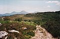
 The path to Smirisary - geograph.org.uk - 2458509.jpg 640 × 480; 106 KB
-
 The path to Smirisary, near Glenuig - geograph.org.uk - 58503.jpg 640 × 418; 66 KB
-

-

-
 Ultimate rocks of Port Aird an Iasgaich near Smirisary, Uig - geograph.org.uk - 5682291.jpg 5,184 × 3,888; 7.08 MB
-
 Smirisary, near Glenuig - geograph.org.uk - 58509.jpg 489 × 640; 60 KB


_and_old_at_Smirisary_-_geograph.org.uk_-_1703081.jpg)


