Category:Snodland
Jump to navigation
Jump to search
town in Kent, England  | |||||
| Upload media | |||||
| Instance of | |||||
|---|---|---|---|---|---|
| Location | Tonbridge and Malling, Kent, South East England, England | ||||
| Population |
| ||||
| Said to be the same as | Snodland (Wikimedia duplicated page, civil parish) | ||||
| official website | |||||
 | |||||
Subcategories
This category has the following 12 subcategories, out of 12 total.
D
- Dode Church, Kent (13 F)
H
- Snodland hoard (6 F)
L
- Snodland Library (5 F)
M
O
- Oasts in Snodland (4 F)
P
S
- All Saints Church, Snodland (10 F)
- Christ Church, Snodland (2 F)
W
- Woodlands Farm, Snodland (2 F)
Media in category "Snodland"
The following 200 files are in this category, out of 546 total.
(previous page) (next page)-
 002osd00000027bu00445000.jpg 4,000 × 2,588; 3.19 MB
-
 A228 - geograph.org.uk - 2512554.jpg 640 × 430; 76 KB
-
 A228 - geograph.org.uk - 3160453.jpg 640 × 430; 58 KB
-

-
 A228 end of dual carriageway - geograph.org.uk - 3222432.jpg 640 × 430; 83 KB
-
 A228 looking south - geograph.org.uk - 3160431.jpg 640 × 430; 55 KB
-
 A228 looking south - geograph.org.uk - 3163276.jpg 640 × 430; 62 KB
-
 A228, dual carriageway - geograph.org.uk - 3493471.jpg 640 × 413; 56 KB
-
 A228, Holborough - geograph.org.uk - 3548572.jpg 640 × 430; 57 KB
-
 A228, northbound - geograph.org.uk - 3222443.jpg 640 × 430; 66 KB
-
 A228, northbound - geograph.org.uk - 3493478.jpg 640 × 430; 76 KB
-
 A228, northbound - geograph.org.uk - 3493483.jpg 640 × 430; 63 KB
-
 A228, northbound - geograph.org.uk - 3493487.jpg 640 × 430; 75 KB
-
 A228, Snodland - geograph.org.uk - 3493472.jpg 640 × 430; 64 KB
-
 A228, Snodland bypass - geograph.org.uk - 3222428.jpg 640 × 430; 61 KB
-
 A228, Snodland bypass - geograph.org.uk - 3222430.jpg 640 × 430; 76 KB
-
 A228, Snodland bypass - geograph.org.uk - 3222439.jpg 640 × 430; 69 KB
-
 A228, Snodland bypass - geograph.org.uk - 3257330.jpg 640 × 430; 57 KB
-
 A228, Snodland bypass - geograph.org.uk - 3257337.jpg 640 × 436; 60 KB
-
 A228, Snodland bypass - geograph.org.uk - 3257349.jpg 640 × 381; 41 KB
-
 A228, Snodland bypass - geograph.org.uk - 3493467.jpg 640 × 370; 42 KB
-
 A228, Snodland bypass - geograph.org.uk - 3493470.jpg 640 × 396; 48 KB
-
 A228, Snodland bypass - geograph.org.uk - 3548580.jpg 640 × 430; 73 KB
-
 A228, Snodland bypass - geograph.org.uk - 3548584.jpg 640 × 430; 58 KB
-
 A228, Snodland turning - geograph.org.uk - 3222433.jpg 640 × 430; 56 KB
-
 A228, Snodland turning - geograph.org.uk - 3548574.jpg 640 × 430; 52 KB
-
 A228, southbound - geograph.org.uk - 3254501.jpg 640 × 395; 43 KB
-
 A228, southbound - geograph.org.uk - 3254502.jpg 640 × 430; 41 KB
-
 A228, southbound - geograph.org.uk - 3548571.jpg 640 × 430; 62 KB
-
 A229, Malling Rd - geograph.org.uk - 2516160.jpg 640 × 430; 74 KB
-
 Abandoned railway - geograph.org.uk - 1084231.jpg 640 × 481; 70 KB
-
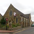
 All Saints' Church, Snodland - geograph.org.uk - 5276190.jpg 1,600 × 1,200; 462 KB
-

-
 All Saints, Snodland - geograph.org.uk - 5360074.jpg 3,264 × 2,448; 1.79 MB
-
 Apple Close, Snodland - geograph.org.uk - 3613108.jpg 3,488 × 2,616; 2.6 MB
-
 Bandstand within Ham Hill Park - geograph.org.uk - 1084286.jpg 640 × 481; 66 KB
-
 Barley off Paddlesworth Road - geograph.org.uk - 2524287.jpg 640 × 480; 153 KB
-
 Barn at Paddlesworth Farm - geograph.org.uk - 5318262.jpg 1,024 × 788; 228 KB
-
 Birling Rd - geograph.org.uk - 2514383.jpg 640 × 430; 54 KB
-
 Birling Rd - geograph.org.uk - 2514385.jpg 640 × 430; 52 KB
-
 Birling Rd - geograph.org.uk - 2514392.jpg 640 × 430; 56 KB
-
 Birling Rd - geograph.org.uk - 3163340.jpg 640 × 430; 74 KB
-
 Birling Rd - geograph.org.uk - 3163355.jpg 640 × 430; 78 KB
-
 Birling Rd - geograph.org.uk - 3633616.jpg 640 × 430; 62 KB
-
 Birling Rd - geograph.org.uk - 3633621.jpg 640 × 430; 65 KB
-
 Birling Road, Snodland - geograph.org.uk - 3610431.jpg 3,488 × 2,616; 2.21 MB
-
 Birling Road, Snodland - geograph.org.uk - 3610439.jpg 3,488 × 2,616; 2.19 MB
-
 BlueBellHill0002.JPG 2,048 × 1,536; 765 KB
-
 BlueBellHill0005.JPG 2,048 × 1,536; 767 KB
-
 BlueBellHill000P.jpg 3,294 × 1,191; 1.69 MB
-
 Bramley Rd - geograph.org.uk - 2514370.jpg 640 × 410; 78 KB
-
 Bramley Road, Snodland - geograph.org.uk - 3610451.jpg 3,488 × 2,616; 2.22 MB
-
 Bramley Road, Snodland - geograph.org.uk - 5013275.jpg 3,264 × 2,448; 1.78 MB
-
 Bridge over the A228 - geograph.org.uk - 3222434.jpg 640 × 430; 78 KB
-
 Bridge under the Medway Valley line - geograph.org.uk - 2512546.jpg 640 × 392; 82 KB
-
 Brook Lane - geograph.org.uk - 2872456.jpg 640 × 426; 99 KB
-
 Brook Lane, Snodland - geograph.org.uk - 3613117.jpg 3,488 × 2,616; 2.29 MB
-
 Brook St, Snodland - geograph.org.uk - 2512551.jpg 640 × 430; 71 KB
-
 Brook Street - geograph.org.uk - 2872449.jpg 640 × 480; 131 KB
-
 Brook Street, Snodland - geograph.org.uk - 3610413.jpg 3,488 × 2,616; 2.21 MB
-
 Brook Street, Snodland - geograph.org.uk - 5360052.jpg 3,264 × 2,448; 1.74 MB
-
 Brookland Lake - geograph.org.uk - 2405324.jpg 1,280 × 853; 387 KB
-
 Brookland Lake - geograph.org.uk - 2504171.jpg 640 × 430; 60 KB
-
 Brookland Lake - geograph.org.uk - 2504178.jpg 640 × 430; 80 KB
-
 Brookland Lake - geograph.org.uk - 2512541.jpg 640 × 430; 96 KB
-
 Brookland Lake - geograph.org.uk - 2512544.jpg 640 × 430; 59 KB
-
 Brooklands Cafe - geograph.org.uk - 2512547.jpg 640 × 430; 70 KB
-
 Brooklands Fishing Club - geograph.org.uk - 2512545.jpg 640 × 430; 45 KB
-
 Building by the North Downs Way - geograph.org.uk - 3155847.jpg 640 × 430; 98 KB
-
 Bull Fields, Snodland - geograph.org.uk - 3610457.jpg 3,488 × 2,616; 2.23 MB
-
 Bull Fields, Snodland - geograph.org.uk - 5013287.jpg 3,264 × 2,448; 1.6 MB
-
 Busbridge Road - geograph.org.uk - 2321278.jpg 640 × 480; 73 KB
-
 Byway junction, Greatpark Wood - geograph.org.uk - 3129575.jpg 640 × 430; 124 KB
-
 Byway junction, Holly Hill - geograph.org.uk - 2331464.jpg 640 × 480; 159 KB
-
 Byway mud wallow, Greatpark Wood - geograph.org.uk - 2331497.jpg 640 × 480; 148 KB
-
 Byway off Wrangling Lane - geograph.org.uk - 3155784.jpg 640 × 430; 110 KB
-
 Byway south of old quarries, Snodland - geograph.org.uk - 2331642.jpg 640 × 480; 153 KB
-
 Byway to Holly Hill - geograph.org.uk - 3155818.jpg 640 × 430; 103 KB
-
 Byway, Greatpark Wood - geograph.org.uk - 3155797.jpg 640 × 430; 123 KB
-
 Byway, Greatpark Wood - geograph.org.uk - 3155804.jpg 640 × 430; 128 KB
-
 Carving in Holly Hill Wood - geograph.org.uk - 3611704.jpg 4,000 × 3,000; 4.45 MB
-
 Cemetery Rd - geograph.org.uk - 3137544.jpg 640 × 430; 70 KB
-
 Cemetery Road, Snodland - geograph.org.uk - 1961449.jpg 3,488 × 2,616; 2.21 MB
-
 Chalk grassland in the Medway Valley - geograph.org.uk - 6886701.jpg 3,089 × 2,317; 1.79 MB
-
 Chalky fallow field - geograph.org.uk - 3137580.jpg 640 × 430; 76 KB
-
 Chapel Rd off Malling Rd - geograph.org.uk - 2514204.jpg 640 × 430; 80 KB
-
 Chapel Road, Snodland - geograph.org.uk - 3610454.jpg 3,488 × 2,616; 2.17 MB
-
 Chapel Road, Snodland - geograph.org.uk - 5013279.jpg 3,264 × 2,448; 1.72 MB
-
 China Chaps - geograph.org.uk - 2526070.jpg 640 × 480; 121 KB
-
 Church Field, Snodland - geograph.org.uk - 1542407.jpg 640 × 480; 96 KB
-
 Church Field, Snodland - geograph.org.uk - 3610401.jpg 3,488 × 2,616; 2.15 MB
-
 Church Field, Snodland - geograph.org.uk - 5360071.jpg 3,264 × 2,448; 1.77 MB
-
 Clara Place - geograph.org.uk - 3163357.jpg 640 × 430; 71 KB
-
 Clifton Terrace, Malling Road, Ham Hill - geograph.org.uk - 5314254.jpg 1,024 × 800; 147 KB
-
 Clock Tower, Snodland - geograph.org.uk - 3163308.jpg 430 × 640; 62 KB
-
 Close-up of Snodland Village Sign - geograph.org.uk - 2099090.jpg 2,304 × 3,072; 1.7 MB
-
 Commemorative Stone - geograph.org.uk - 1137566.jpg 640 × 427; 102 KB
-
 Constitution Hill - geograph.org.uk - 3137535.jpg 640 × 430; 102 KB
-
 Constitution Hill, Snodland - geograph.org.uk - 4937606.jpg 2,643 × 2,045; 1.17 MB
-
 Converted Methodist Church, Snodland - geograph.org.uk - 1084274.jpg 640 × 481; 64 KB
-
 Cooper Road, Snodland - geograph.org.uk - 5012995.jpg 3,264 × 2,448; 1.86 MB
-
 Coppicing, Greatpark Wood - geograph.org.uk - 3133663.jpg 640 × 430; 143 KB
-
 Covey Hall Road, Snodland - geograph.org.uk - 3610473.jpg 3,488 × 2,616; 2.11 MB
-
 Cox Cottage - geograph.org.uk - 3137574.jpg 640 × 430; 78 KB
-
 Cox's Barn - geograph.org.uk - 2872466.jpg 640 × 480; 90 KB
-
 Cox's Close, Snodland - geograph.org.uk - 4937484.jpg 3,264 × 2,448; 2.28 MB
-
 Crookhorn Wood - geograph.org.uk - 3129486.jpg 640 × 430; 65 KB
-
 Crookhorn Wood - geograph.org.uk - 3155865.jpg 640 × 430; 55 KB
-
 Crop field by Paddlesworth Road - geograph.org.uk - 2872464.jpg 640 × 480; 103 KB
-
 Crop sprayer by Mark Farm - geograph.org.uk - 2872462.jpg 640 × 480; 90 KB
-
 Cut Mark and Boundary Stone - geograph.org.uk - 3867349.jpg 3,648 × 2,736; 2.28 MB
-
 Decrepitude, Holly Hill - geograph.org.uk - 2331390.jpg 640 × 428; 103 KB
-
 Derelict building, Holly Hill - geograph.org.uk - 3155856.jpg 640 × 430; 98 KB
-
 Derelict shed by the North Downs Way - geograph.org.uk - 3129535.jpg 640 × 430; 82 KB
-
 Descending through Dowde's Wood - geograph.org.uk - 5087542.jpg 1,600 × 1,067; 772 KB
-
 Disused Chalk Quarry - geograph.org.uk - 3151702.jpg 640 × 430; 66 KB
-
 Dode Church - geograph.org.uk - 5087524.jpg 1,600 × 1,067; 575 KB
-
 Dode Church, Great Buckland - geograph.org.uk - 5086683.jpg 3,264 × 2,448; 2.21 MB
-
 Dowdes Wood Lane, Great Buckland - geograph.org.uk - 5086717.jpg 3,264 × 2,448; 2.49 MB
-
 Dryland Road, Snodland - geograph.org.uk - 4937467.jpg 3,264 × 2,448; 1.68 MB
-

-
 East Street, Snodland - geograph.org.uk - 3610411.jpg 3,488 × 2,616; 2.16 MB
-
 Entering Snodland - geograph.org.uk - 2516139.jpg 640 × 430; 68 KB
-
 Entrance to Holborough Marshes - geograph.org.uk - 1084250.jpg 640 × 481; 132 KB
-
 Entrance to Holly Hill House - geograph.org.uk - 3129493.jpg 640 × 388; 108 KB
-
 Entrance to Leybourne Lakes Country Park - geograph.org.uk - 1751913.jpg 4,000 × 3,000; 3.31 MB
-
 Entrance to Snodland paper mill - geograph.org.uk - 2405340.jpg 1,280 × 899; 215 KB
-
 Entrance to Snodland paper mill - geograph.org.uk - 723946.jpg 640 × 480; 82 KB
-
 Entrance to Tesco Depot, Snodland - geograph.org.uk - 2516129.jpg 640 × 446; 65 KB
-
 Exit, Holly Hill Car park - geograph.org.uk - 3129457.jpg 640 × 430; 127 KB
-
 Faith Place - geograph.org.uk - 2405333.jpg 1,280 × 853; 258 KB
-
 Farm buildings of Austen's Farm - geograph.org.uk - 1160471.jpg 640 × 481; 74 KB
-
 Farmhouse, Paddlesworth Farm - geograph.org.uk - 5314270.jpg 1,024 × 775; 295 KB
-
 Farmland by Paddlesworth Rd - geograph.org.uk - 3143053.jpg 640 × 430; 58 KB
-
 Farmland near Holborough - geograph.org.uk - 3157518.jpg 640 × 430; 52 KB
-
 Farmland near Holborough - geograph.org.uk - 3157521.jpg 640 × 430; 55 KB
-
 Farmland near Whittings Farm - geograph.org.uk - 3157514.jpg 640 × 430; 47 KB
-
 Field alongside Ladds Lane - geograph.org.uk - 3618143.jpg 4,000 × 3,000; 4.09 MB
-
 Field beside Holly Hill House - geograph.org.uk - 5087494.jpg 1,600 × 1,067; 531 KB
-
 Field by Ladds Lane - geograph.org.uk - 2530676.jpg 640 × 480; 154 KB
-
 Field by Ladds Lane - geograph.org.uk - 2530678.jpg 640 × 480; 124 KB
-
 Field by Wrangling Lane - geograph.org.uk - 3155790.jpg 640 × 430; 82 KB
-
 Field edge near Ladds Lane - geograph.org.uk - 3618149.jpg 4,000 × 3,000; 4.17 MB
-
 Field near Holly Hill House - geograph.org.uk - 3611805.jpg 4,000 × 3,000; 4.18 MB
-
 Field, Holly Hill - geograph.org.uk - 3155827.jpg 640 × 430; 78 KB
-
 Fields at Great Buckland - geograph.org.uk - 2523366.jpg 640 × 427; 116 KB
-
 Fields next to Ladds Lane - geograph.org.uk - 3618130.jpg 4,000 × 3,000; 4.23 MB
-
 Fishing platform, Brookland Lake - geograph.org.uk - 2512537.jpg 640 × 430; 75 KB
-
 Flats by the A228 - geograph.org.uk - 3160466.jpg 640 × 430; 62 KB
-

-
 Flint building, Holly Hill - geograph.org.uk - 3155832.jpg 640 × 430; 88 KB
-
 Flooded Golf Course - geograph.org.uk - 1165220.jpg 640 × 481; 57 KB
-
 Floodlight Driving Range - geograph.org.uk - 1165214.jpg 640 × 481; 64 KB
-
 Footpath across a wheat field - geograph.org.uk - 3148432.jpg 640 × 430; 55 KB
-
 Footpath by disused chalk quarry - geograph.org.uk - 3160300.jpg 640 × 430; 93 KB
-
 Footpath from Holly Hill Car park - geograph.org.uk - 3129449.jpg 640 × 430; 120 KB
-
 Footpath into Holly Hill Wood - geograph.org.uk - 3129452.jpg 640 × 430; 126 KB
-
 Footpath into Leybourne Lakes - geograph.org.uk - 2516162.jpg 640 × 430; 123 KB
-
 Footpath leading away from Birling Hill - geograph.org.uk - 3063834.jpg 4,000 × 3,000; 4.36 MB
-
 Footpath near Holly Hill House - geograph.org.uk - 6886711.jpg 3,200 × 2,400; 3.3 MB
-
 Footpath near Horn Street - geograph.org.uk - 2516062.jpg 640 × 430; 120 KB
-
 Footpath off Hollow Lane - geograph.org.uk - 2514411.jpg 640 × 430; 133 KB
-
 Footpath off Hollow Lane - geograph.org.uk - 2514415.jpg 640 × 430; 151 KB
-
 Footpath off St Katherine's Lane - geograph.org.uk - 2514399.jpg 640 × 430; 103 KB
-
 Footpath off The Pilgrims' Way - geograph.org.uk - 3148489.jpg 640 × 430; 149 KB
-
 Footpath sign near Stangate Road - geograph.org.uk - 2363618.jpg 4,000 × 3,000; 2.89 MB
-
 Footpath through disused quarry - geograph.org.uk - 3160310.jpg 640 × 430; 79 KB
-
 Footpath through wheat - geograph.org.uk - 3143076.jpg 640 × 430; 76 KB
-
 Footpath through wheat - geograph.org.uk - 3143078.jpg 640 × 430; 57 KB
-
 Footpath to Great Buckland - geograph.org.uk - 3133668.jpg 640 × 430; 130 KB
-
 Footpath to Halling - geograph.org.uk - 3160294.jpg 640 × 430; 112 KB
-
 Footpath to Horn Street - geograph.org.uk - 2516066.jpg 640 × 430; 126 KB
-
 Footpath to Paddlesworth Farm - geograph.org.uk - 3148442.jpg 640 × 430; 54 KB
-
 Footpath to Paddlesworth Farm - geograph.org.uk - 3148467.jpg 640 × 430; 71 KB
-
 Footpath to Tesco warehouse - geograph.org.uk - 666549.jpg 640 × 480; 134 KB
-
 Footpath to the A228 - geograph.org.uk - 3160304.jpg 640 × 430; 125 KB
-
 Footpath to the North Downs Way - geograph.org.uk - 3063839.jpg 4,000 × 3,000; 4.07 MB
-
 Footpath to Tom Joyce Close - geograph.org.uk - 2514402.jpg 640 × 430; 59 KB
-
 Former Primitive Methodist Chapel, Snodland.JPG 2,200 × 1,600; 417 KB
-
 Former signal box - geograph.org.uk - 4344380.jpg 640 × 480; 98 KB
-
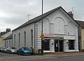
 Former United Church, Snodland.JPG 1,800 × 1,800; 510 KB
-
 Freemasons Arms, Snodland - geograph.org.uk - 4937624.jpg 3,264 × 2,448; 1.25 MB
-
 Gateway, Holborough Park - geograph.org.uk - 3160446.jpg 640 × 408; 112 KB
-
 Godden Road, Snodland - geograph.org.uk - 4937476.jpg 3,264 × 2,448; 1.82 MB
-
 Gravel Track - geograph.org.uk - 6469881.jpg 4,032 × 3,024; 4.98 MB
-
 Greatpark Wood - geograph.org.uk - 3129573.jpg 640 × 430; 142 KB
-
 Greatpark Wood - geograph.org.uk - 3133640.jpg 640 × 430; 148 KB
-
 Greatpark Wood - geograph.org.uk - 3133654.jpg 640 × 430; 108 KB
-
 Greatpark Wood - geograph.org.uk - 3133661.jpg 640 × 430; 141 KB
-
 Greatpark Wood - geograph.org.uk - 3133666.jpg 640 × 430; 132 KB
-
 Greatpark Wood - geograph.org.uk - 3155814.jpg 640 × 430; 114 KB
-
 Green Tunnel on Holly Hill - geograph.org.uk - 5087484.jpg 1,600 × 1,067; 804 KB
-
 Harvel Hike towards Wrangling Lane - geograph.org.uk - 1119452.jpg 640 × 481; 72 KB
-
 Harvested field off Pilgrims Way - geograph.org.uk - 2530675.jpg 640 × 480; 187 KB
-
 Hedge and fence - geograph.org.uk - 3148445.jpg 640 × 430; 87 KB
-
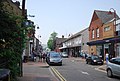 High St, Snodland - geograph.org.uk - 2512565.jpg 640 × 430; 74 KB
-
 High Street - geograph.org.uk - 4344381.jpg 640 × 480; 88 KB
-
 High Street in Snodland - geograph.org.uk - 6469941.jpg 4,032 × 3,024; 4.02 MB
-
 High Street, Snodland - geograph.org.uk - 1467256.jpg 640 × 480; 85 KB
-
 High Street, Snodland - geograph.org.uk - 3063557.jpg 4,000 × 3,000; 4.06 MB


