Category:Snow depth maps
Jump to navigation
Jump to search
See also:
- Category:Snowfall maps (amount of snow precipitation)
- Category:Snow cover duration maps (days of cover)
Media in category "Snow depth maps"
The following 9 files are in this category, out of 9 total.
-
February 18, 2021 North America snow and ice cover.gif 512 × 512; 19 KB
-
Guix de neu 8 de març de 2010.png 1,039 × 823; 255 KB
-
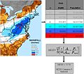
NESIS description NCDC.jpg 660 × 578; 59 KB
-
Northernhemispheresnowcoverfeb152009.gif 512 × 512; 24 KB
-
Snowfall 2.jpg 3,840 × 2,160; 2.27 MB
-
Terremotoblanco.jpg 8,000 × 1,500; 903 KB
-
गढ़ माता वैली चम्बा हिमाचल प्रदेश.jpg 3,840 × 2,160; 2.84 MB
-
रोनियाहार गढ़.jpg 3,840 × 2,160; 3.06 MB
-
हिमाचल प्रदेश बर्फबारी.jpg 4,160 × 3,120; 2.34 MB


