Category:Sonitpur district
Jump to navigation
Jump to search
district of Assam, India .svg) | |||||
| Upload media | |||||
| Instance of | |||||
|---|---|---|---|---|---|
| Location | North Assam division, Assam, India | ||||
| Capital | |||||
| Population |
| ||||
| Area |
| ||||
| Elevation above sea level |
| ||||
| official website | |||||
 | |||||
Subcategories
This category has the following 9 subcategories, out of 9 total.
Media in category "Sonitpur district"
The following 35 files are in this category, out of 35 total.
-
 A vast track of wetland in Dhandi, Gohpur.jpg 3,264 × 2,197; 2.53 MB
-

-
 Assam Sonitpur locator map Assamese.svg 419 × 565; 318 KB
-
 Assam Sonitpur locator map.svg 419 × 565; 317 KB
-
 Baresohoriya Bhauna project Jamugurihat.jpg 4,016 × 2,256; 2.7 MB
-
 Beautiful gamiripal.jpg 3,238 × 1,404; 272 KB
-
 Beauty of gamiripal.jpg 3,238 × 1,416; 1.13 MB
-
 Burhagushai Dewaloi Nandikeshwar Jamugurihat Assam.jpg 4,080 × 2,296; 4.53 MB
-
 Chariduar Railway station.jpg 3,472 × 4,340; 4.33 MB
-
 Dah Parvatiya.jpg 4,160 × 3,120; 5.61 MB
-
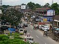
 Dhekaijuli bus stand.JPG 2,304 × 1,728; 796 KB
-
 Dhekiajuli LIC.JPG 2,304 × 1,728; 814 KB
-
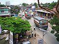 Dhekiajuli Town.JPG 2,304 × 1,728; 830 KB
-
 Dhekiajuli2.JPG 2,304 × 1,728; 874 KB
-
 Dhekiajuli3.JPG 2,304 × 1,728; 880 KB
-
 Entrance of Barechahariya Bhaona Mahotsav.jpg 960 × 720; 98 KB
-
 Gamiri.jpg 2,340 × 3,419; 3.8 MB
-
 Jamugurihat.jpg 3,864 × 2,716; 3.08 MB
-
 Kanaklata Park, Sonitpur.jpg 4,624 × 2,136; 6.06 MB
-
 Karan Daimary.jpg 3,264 × 1,836; 1.66 MB
-
 Khadoi chuck petrol pump.jpg 9,580 × 2,588; 7.27 MB
-
 Nagsankar Mandir.jpg 1,080 × 883; 399 KB
-
 Nagshankar Temple, Jamuguri, Sonitpur.jpg 4,608 × 3,456; 4.5 MB
-
 Nilachal Men's Hostel - panoramio.jpg 5,261 × 1,626; 2.69 MB
-
 Paddyfield of Chariduar, Sonitpur.jpg 4,000 × 3,000; 3.63 MB
-
 Person going to earn for the family.jpg 1,227 × 1,227; 301 KB
-
 Pink land.jpg 1,200 × 1,599; 334 KB
-
 Singori gupteswar mandir, Dhekiajuli.jpg 3,000 × 4,000; 6.22 MB
-
 Sonitpur Assam India.jpg 4,288 × 2,848; 2.28 MB
-
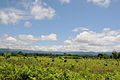
 Tea garden in Sonitpur district of Assam, India.jpg 2,048 × 1,536; 2.09 MB
-
 Tea plantation in Sonitpur district of Assam, India.jpg 2,048 × 1,536; 2.5 MB
-
 The Lake 3.jpg 3,200 × 2,400; 2.35 MB
-
-
 বানাহ.JPG 3,872 × 2,592; 4.66 MB
-
 সৌভাগ্য মাধৱ দেৱালয় জামুগুৰিহাট.jpg 3,748 × 2,268; 2.4 MB


