Category:South Kesteven District
Перайсьці да навігацыі
Перайсьці да пошуку
non-metropolitan district in Lincolnshire, England   | |||||
| Загрузіць мэдыя | |||||
| Асобны выпадак панятку | |||||
|---|---|---|---|---|---|
| Цяперашняе месцазнаходжаньне | Лінкальншыр, Усходні Мідлэнд, Ангельшчына | ||||
| Сталіца | |||||
| Заканадаўчы орган |
| ||||
| Складаецца з | |||||
| Дата заснаваньня / стварэньня |
| ||||
| Колькасьць насельніцтва |
| ||||
| Плошча |
| ||||
| афіцыйны вэб-сайт | |||||
 | |||||
Падкатэгорыі
Гэтая катэгорыя зьмяшчае наступныя 10 падкатэгорыяў з 10 агулам.
Файлы ў катэгорыі «South Kesteven District»
Паказаныя 38 файлаў гэтай катэгорыі з 38.
-
 1 and 2 Church Street, Grantham (geograph 7337218).jpg 1024 × 768; 222 кб
-
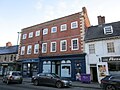
 10 Brownlow Street, Grantham (geograph 7338669).jpg 1024 × 742; 178 кб
-
 21 Swinegate, Grantham (geograph 7338646).jpg 1024 × 782; 130 кб
-
 41 Church Trees, Grantham (geograph 7341146).jpg 1024 × 768; 245 кб
-
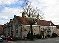
 7 to 9 Westgate, Grantham (geograph 7337970).jpg 1024 × 768; 167 кб
-
 Arms of South Kesteven District Council.svg 400 × 490; 307 кб
-

-
 Castlegate House, Grantham (geograph 7337957).jpg 1024 × 768; 136 кб
-
 Castlegate, Grantham (geograph 7337743).jpg 1024 × 768; 128 кб
-
 Castlegate, Grantham (geograph 7342208).jpg 1024 × 768; 208 кб
-
 Fields with dry stone walls - geograph.org.uk - 2683535.jpg 1280 × 960; 330 кб
-
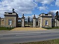 Gate lodges to former Uffington House (geograph 3397224).jpg 4248 × 3142; 5,11 Мб
-
 Granta Hall, Grantham (geograph 7341590).jpg 768 × 1024; 168 кб
-
 Harrowby Mill House (geograph 7336910).jpg 1024 × 768; 158 кб
-

-
 Houses, Manthorpe Road, Grantham (geograph 7338676).jpg 1024 × 718; 162 кб
-

-
 Rutland Terrace (geograph 4051581).jpg 1600 × 1067; 651 кб
-
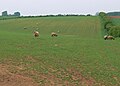 Sheep near Wyville - geograph.org.uk - 807940.jpg 640 × 460; 69 кб
-
 Skillington in the distance - geograph.org.uk - 805798.jpg 640 × 413; 67 кб
-

-
 Swinegate, Grantham (geograph 7338645).jpg 1024 × 768; 170 кб
-
 The Beehive, Grantham (geograph 7342206).jpg 1024 × 768; 178 кб
-

-
 The Drift heading into Sewstern - geograph.org.uk - 805143.jpg 640 × 393; 81 кб
-
 The Drift near Hill Top Farm - geograph.org.uk - 808236.jpg 640 × 444; 94 кб
-
 The flat West Lincolnshire farmland - geograph.org.uk - 1031381.jpg 640 × 449; 89 кб
-
 The former Lee and Grinling's maltings (geograph 6363212).jpg 1024 × 768; 108 кб
-
 The George of Stamford - UK - panoramio.jpg 1857 × 1356; 555 кб
-
 The Kings Arms, Grantham (geograph 7337965).jpg 1024 × 768; 160 кб
-
 The Old Station House, Stamford (geograph 2433238).jpg 1280 × 960; 648 кб
-
 The rear of Spittlegate Lodge (geograph 6296635).jpg 1024 × 768; 136 кб
-
 The road to Grantham - geograph.org.uk - 807982.jpg 640 × 456; 73 кб
-
 The road to Hungerton - geograph.org.uk - 807928.jpg 640 × 366; 62 кб
-
 Touched by sudden sunshine (geograph 4770147).jpg 5197 × 3465; 6,7 Мб
-
 View towards Normanton Airfield - geograph.org.uk - 1031659.jpg 640 × 489; 79 кб
-
 View towards Skillington Church - geograph.org.uk - 805804.jpg 640 × 454; 96 кб
-
 View towards the turkey farm - geograph.org.uk - 1031353.jpg 640 × 442; 106 кб
.jpg)
.jpg)
.jpg)
.jpg)
.jpg)

.jpg)
.jpg)
.jpg)

.jpg)
.jpg)
.jpg)
.jpg)
.jpg)

.jpg)


.jpg)
.jpg)


.jpg)

.jpg)
.jpg)
.jpg)


.jpg)


