Category:South Wigston
Jump to navigation
Jump to search
English: South Wigston is a suburb of Leicester in England. It is outside of the city boundary, forming part of the Oadby and Wigston district of Leicestershire.
suburb of Leicester, England | |||||
| Upload media | |||||
| Instance of | |||||
|---|---|---|---|---|---|
| Location | Oadby and Wigston, Leicestershire, East Midlands, England | ||||
 | |||||
Subcategories
This category has the following 6 subcategories, out of 6 total.
C
M
T
Media in category "South Wigston"
The following 20 files are in this category, out of 20 total.
-
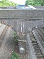 Aylestone Lane road bridge - geograph.org.uk - 457450.jpg 480 × 640; 146 KB
-
-
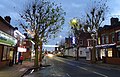 Christmas lights on Blaby Road in South Wigston (geograph 5616713).jpg 800 × 513; 145 KB
-
 Crow Mills Bridge, South Wigston - geograph.org.uk - 401114.jpg 640 × 467; 110 KB
-
 Glen Parva Junction - geograph.org.uk - 401100.jpg 640 × 547; 152 KB
-
 Premier Drums (geograph 7292194).jpg 1,168 × 1,760; 388 KB
-
 Premier Drums (geograph 7292196).jpg 1,760 × 1,168; 467 KB
-
 Premier Drums - South Wigston (geograph 6348010).jpg 1,024 × 680; 141 KB
-

-
 Ervin's Lock, South Wigston - geograph.org.uk - 1419802.jpg 640 × 480; 71 KB
-
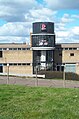
 Fairfield Primary School South Wigston - geograph.org.uk - 357825.jpg 640 × 480; 112 KB
-
 Frogs and Spawn - geograph.org.uk - 367070.jpg 640 × 480; 80 KB
-
 Goldhill Adventure Playground, Leicester - geograph.org.uk - 457903.jpg 640 × 439; 143 KB
-
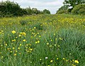
 Grand Union Canal south of Leicester - geograph.org.uk - 401671.jpg 640 × 480; 138 KB
-
 Grand Union Canal south of Leicester - geograph.org.uk - 401685.jpg 640 × 377; 79 KB
-

-
 Playground William Gunning Park - geograph.org.uk - 357852.jpg 640 × 480; 74 KB
-
 Saffron Road, South Wigston, Leicester - geograph.org.uk - 179327.jpg 640 × 427; 145 KB
-
 Shackerdale Road, Leicester - geograph.org.uk - 401776.jpg 640 × 402; 94 KB
-
 William Gunning Park South Wigston - geograph.org.uk - 357844.jpg 640 × 480; 73 KB


.jpg)


.jpg)
.jpg)
.jpg)


