Category:Southall
Jump to navigation
Jump to search
suburban district in London Borough of Ealing, UK  | |||||
| Upload media | |||||
| Instance of | |||||
|---|---|---|---|---|---|
| Location | London Borough of Ealing, Greater London, London, England | ||||
 | |||||
English: Southall is a suburb and Postal Town in the London Borough of Ealing, West London. It is situated 10.7 miles (17.2 km) west of Charing Cross. Neighbouring places include Yeading, Hayes, Hanwell, Heston, Hounslow, Greenford and Northolt.
ਪੰਜਾਬੀ: ਸਾਊਥਾਲ
Subcategories
This category has the following 33 subcategories, out of 33 total.
A
- AEC Southall Works (4 F)
- St Anselm's Church, Southall (8 F)
C
D
E
- Ealing Hospital (30 F)
F
- Southall F.C. (7 F)
- Featherstone High School (1 F)
- Southall (firearms) (3 F)
G
- Southall Gas Works (26 F)
- St George's Church, Southall (6 F)
H
J
K
- Kings Hall, Southall (8 F)
M
- Southall Market (10 F)
P
- Southall Park (20 F)
R
- Southall Railway Centre (5 F)
S
- Southall Library (2 F)
- Southall Manor House (13 F)
- Southall rail crash (1 F)
- Southall Town Hall (4 F)
- Southall War Memorial (4 F)
- St. Bernard's Gatehouse (4 F)
T
W
- Southall Water Tower (15 F)
Media in category "Southall"
The following 182 files are in this category, out of 182 total.
-
 A cottage in Allenby Road, Southall - geograph.org.uk - 1239579.jpg 640 × 426; 130 KB
-
 A dull autumn day in Hortus Road - geograph.org.uk - 1524550.jpg 480 × 640; 62 KB
-

-

-
 A surprising sight in Hammond Road - geograph.org.uk - 1523664.jpg 481 × 640; 58 KB
-

-
 Adelaide Dock (geograph.org.uk 3135425).jpg 640 × 480; 92 KB
-

-

-
 Autumn in Knowsley Avenue - geograph.org.uk - 1528775.jpg 640 × 480; 70 KB
-
 Bankside, Southall - geograph.org.uk - 835222.jpg 640 × 480; 53 KB
-
 Bankside, Southall and Grand Union Canal - geograph.org.uk - 368217.jpg 640 × 480; 123 KB
-
 Barges moored near Hanwell locks - geograph.org.uk - 93715.jpg 640 × 480; 107 KB
-
 Bhai Avtar Singh & others. Southall. 1972. Pic Ajit S Chaggar.jpg 2,058 × 1,381; 447 KB
-
 Bhai Avtar Singh & others. Southall. 1972.. Pic Ajit S Chaggar.jpg 2,187 × 1,516; 418 KB
-

-
 Boyd Avenue, Southall - geograph.org.uk - 368303.jpg 640 × 480; 114 KB
-
 Bus in Montague Waye - geograph.org.uk - 1523497.jpg 480 × 640; 58 KB
-
 Bus stop in Montague Waye - geograph.org.uk - 1523476.jpg 480 × 640; 46 KB
-
-
 Canal boat mooring near Three Bridges - geograph.org.uk - 92924.jpg 640 × 398; 71 KB
-

-
 Car Engines in Hortus Road - geograph.org.uk - 1524556.jpg 640 × 480; 61 KB
-
 Charter Court in the Uxbridge Road - geograph.org.uk - 1528894.jpg 640 × 480; 89 KB
-
 Church hall in Lancaster Road - geograph.org.uk - 1526170.jpg 640 × 480; 59 KB
-
 Colourful TKC van in Southall.jpg 4,032 × 3,024; 6.35 MB
-
 Convent Way Southall - panoramio - Maxwell Hamilton.jpg 3,648 × 2,736; 2.58 MB
-
 Convent Way Southall - panoramio.jpg 3,648 × 2,736; 1.37 MB
-

-

-
 Des Pardes in The Crescent - geograph.org.uk - 1520241.jpg 480 × 640; 65 KB
-
 EalingSouthall2007Constituency.svg 427 × 337; 612 KB
-
 EalingSouthallConstituency.svg 400 × 310; 272 KB
-
 Ebenezer Gospel Hall in Hortus Road - geograph.org.uk - 1524551.jpg 640 × 480; 88 KB
-
 Entrance to Featherstone High School - geograph.org.uk - 1523493.jpg 640 × 480; 48 KB
-

-

-
-
 Et tu Queen's Head^ - geograph.org.uk - 1521606.jpg 480 × 640; 63 KB
-

-
 FGWL 165109 viewed from HST 01.jpg 1,600 × 1,200; 742 KB
-
-
-

-
 From The Road Bridge at Windmill Lane Southall - panoramio.jpg 3,602 × 2,674; 1.99 MB
-
 Garage in The Crescent - geograph.org.uk - 1520243.jpg 640 × 480; 85 KB
-
 Gasholder, Southall Gasworks - geograph.org.uk - 173008.jpg 640 × 480; 128 KB
-
 Glassy Junction building in Southall.jpg 4,032 × 3,024; 2.8 MB
-
 Gospel hall in Hammond Road - geograph.org.uk - 1523660.jpg 480 × 640; 70 KB
-

-
 Grand Union Canal Walk - geograph.org.uk - 3952766.jpg 640 × 430; 80 KB
-
 Grand Union Canal Walk, Southall - geograph.org.uk - 3966878.jpg 640 × 430; 67 KB
-
 Grand Union Canal Walk, Southall - geograph.org.uk - 3966881.jpg 640 × 430; 98 KB
-
 Grand Union Canal Walk, Southall - geograph.org.uk - 3966888.jpg 640 × 430; 109 KB
-
 Grand Union Canal, Southall, London - geograph.org.uk - 3585265.jpg 3,872 × 2,592; 4 MB
-

-
 Hambrough Civil Defence bunker.jpg 3,024 × 4,032; 3.29 MB
-
 Hanwell bridge.jpg 3,112 × 2,064; 7.87 MB
-

-

-

-
 Heritage canal lock in Southall, Middlesex.jpg 768 × 1,024; 421 KB
-
 Hindu and Sikh symbols.jpg 800 × 600; 93 KB
-

-
 Houses in Mornington Road, Greenford - geograph.org.uk - 22994.jpg 640 × 480; 110 KB
-
 Housing Estate, Southall - geograph.org.uk - 835208.jpg 640 × 480; 67 KB
-
 HSBC in Montague Waye - geograph.org.uk - 1523528.jpg 480 × 640; 56 KB
-
 Joseph Mallord William Turner 014.jpg 3,176 × 2,354; 410 KB
-
 King Street, Southall (geograph 3120103).jpg 2,480 × 1,531; 4.12 MB
-
 Lamppost in Dominion Road - geograph.org.uk - 1521449.jpg 480 × 640; 68 KB
-
 Lamppost in Longford Avenue - geograph.org.uk - 1528804.jpg 480 × 640; 65 KB
-

-
 Le Pain Croustillant Ltd - geograph.org.uk - 1165071.jpg 640 × 480; 76 KB
-
 Le Pain Croustillant Ltd - geograph.org.uk - 1165073.jpg 640 × 480; 78 KB
-
 Le Pain Croustillant Ltd - geograph.org.uk - 1185082.jpg 640 × 480; 37 KB
-
 Lewis Road - geograph.org.uk - 1527710.jpg 640 × 480; 61 KB
-
 Lock at Hanwell - geograph.org.uk - 310647.jpg 435 × 640; 58 KB
-
 Lock at Hanwell on The Grand Union Canal - panoramio.jpg 3,644 × 2,730; 1.74 MB
-
 Lock on The Grand Union Canal at Hanwell - panoramio.jpg 3,596 × 2,666; 2.62 MB
-
 Lock on The Grand union Canal at Norwood Green Southall - panoramio.jpg 3,632 × 2,714; 1.79 MB
-

-
 Looking down Hanwell Locks - geograph.org.uk - 396142.jpg 640 × 508; 83 KB
-

-
 Looking north-east up Queens Road - geograph.org.uk - 1521626.jpg 640 × 480; 75 KB
-

-
 Looking northwards up Tudor Road - geograph.org.uk - 1527221.jpg 640 × 409; 68 KB
-
 Looking southwards down The Crescent - geograph.org.uk - 1520218.jpg 640 × 480; 74 KB
-

-
 Magasins de bijoux indiens.jpg 3,172 × 2,223; 1.91 MB
-
 Magasins de vêtements indiens.jpg 800 × 600; 127 KB
-
 Meri Marzi bus cafe.jpg 3,618 × 2,581; 3.17 MB
-
 Metroline West DE1899 on Route 95, Southall North (13231488715).jpg 3,264 × 2,448; 2.59 MB
-

-
 Mosaics in Southall.jpg 4,032 × 3,024; 5.68 MB
-
 Mosque in Montague Waye - geograph.org.uk - 1523517.jpg 480 × 640; 48 KB
-
 Multi-storey car park in Punjab Lane - geograph.org.uk - 1529095.jpg 480 × 640; 59 KB
-
 Mural at Hambrough Primary School - geograph.org.uk - 1519927.jpg 640 × 480; 107 KB
-
 Naval Gun Southall AF83.jpeg 3,228 × 2,200; 6.68 MB
-
 No blue plaque (2) - geograph.org.uk - 1528778.jpg 640 × 480; 66 KB
-

-
 Norwood Green in spring - geograph.org.uk - 92956.jpg 640 × 480; 171 KB
-
 Norwood Green, London Borough of Ealing, UB2 (3103192609).jpg 2,848 × 2,136; 2.6 MB
-
 Norwood Lower Lock, Grand Union Canal - geograph.org.uk - 398182.jpg 640 × 503; 119 KB
-
 Norwood Top Lock No 90, Grand Union Canal - geograph.org.uk - 398191.jpg 640 × 493; 102 KB
-
 Park View Road - geograph.org.uk - 1528881.jpg 640 × 480; 95 KB
-
 Pavement decorations in Southall.jpg 4,032 × 3,024; 6.93 MB
-
 Pigeons in Western Road - geograph.org.uk - 1523695.jpg 640 × 480; 105 KB
-
 Playpark in The Crescent - geograph.org.uk - 1520224.jpg 640 × 480; 108 KB
-

-
 Postbox in the Uxbridge Road - geograph.org.uk - 1528815.jpg 450 × 640; 49 KB
-
 Postbox in Western Road - geograph.org.uk - 1523455.jpg 480 × 640; 93 KB
-
-

-

-
 Rear of the State Bank of India - geograph.org.uk - 1521328.jpg 640 × 480; 69 KB
-

-
 Right angled bend in Grange Road - geograph.org.uk - 1527667.jpg 640 × 480; 79 KB
-
 Roadworks in Oakwood Avenue - geograph.org.uk - 1528827.jpg 640 × 480; 74 KB
-

-

-

-
 Sculpture in Western Road - geograph.org.uk - 1523698.jpg 480 × 640; 109 KB
-

-

-
 Shops in Abbotts Road - geograph.org.uk - 1527694.jpg 640 × 480; 72 KB
-
 Shops in Beaconsfield Road - geograph.org.uk - 1527708.jpg 640 × 480; 78 KB
-
 Small shop in Dudley Road - geograph.org.uk - 1521556.jpg 640 × 480; 93 KB
-
 Southall and Greenford from the air - geograph.org.uk - 3994419.jpg 640 × 332; 149 KB
-
 Southall and West London College - geograph.org.uk - 1527747.jpg 640 × 482; 70 KB
-
 Southall Community Centre - geograph.org.uk - 1165218.jpg 640 × 480; 59 KB
-
 Southall Community Centre - geograph.org.uk - 1165219.jpg 640 × 480; 61 KB
-
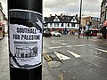 Southall for Palestine flyer.jpg 4,032 × 3,024; 2.49 MB
-
 Southall from the air - geograph.org.uk - 5892263.jpg 1,600 × 1,065; 768 KB
-
 Southall from the air - geograph.org.uk - 5892277.jpg 1,600 × 1,065; 633 KB
-
 Southall gas holder from the air - geograph.org.uk - 3894740.jpg 640 × 480; 168 KB
-
 Southall gas holders from the air - geograph.org.uk - 3994404.jpg 640 × 480; 224 KB
-
 Southall gasometer - geograph.org.uk - 2127270.jpg 1,047 × 626; 99 KB
-
 Southall Gasometer and Water Towers - geograph.org.uk - 1165222.jpg 640 × 526; 80 KB
-
 Southall Gasometer and Water Towers - geograph.org.uk - 1165224.jpg 640 × 480; 92 KB
-
 Southall Gasometer and Water Towers - geograph.org.uk - 1165226.jpg 456 × 640; 69 KB
-
 Southall Gasometer and Water Towers - geograph.org.uk - 1165227.jpg 640 × 480; 80 KB
-
 Southall Gasometer and Water Towers - geograph.org.uk - 1165229.jpg 640 × 480; 75 KB
-
 Southall Gasometer and Water Towers - geograph.org.uk - 1165231.jpg 640 × 480; 79 KB
-

-
 Southall Recreation Ground, London Borough of Ealing, UB2 (3103189999).jpg 1,600 × 1,200; 874 KB
-
 Southall riots, 23 April 1979.png 1,197 × 632; 533 KB
-

-
 Southall Sports Centre - geograph.org.uk - 1527714.jpg 640 × 480; 69 KB
-
 Southall St Marylebone School.jpg 3,010 × 1,962; 1.48 MB
-
 Southall Watertower - geograph.org.uk - 173011.jpg 640 × 480; 112 KB
-
 Southall, Main line railway - geograph.org.uk - 205224.jpg 640 × 480; 111 KB
-
 Southall, UK - panoramio.jpg 2,592 × 1,944; 1.97 MB
-
 Southall. 1981.jpg 1,181 × 816; 624 KB
-
 Southall.20211113 153203.jpg 4,032 × 3,024; 2.31 MB
-
 St George's Church behind McDonald's - geograph.org.uk - 1527204.jpg 480 × 640; 61 KB
-

-
 Sunny Gill's House - panoramio.jpg 960 × 720; 87 KB
-
 Sunset at Southall.jpg 3,671 × 4,271; 1.57 MB
-
 Texaco petrol station - geograph.org.uk - 1066382.jpg 640 × 480; 100 KB
-
 The last stop^ - geograph.org.uk - 286909.jpg 458 × 640; 113 KB
-
 The less famous Shahi Nan Kebab - geograph.org.uk - 1529000.jpg 480 × 640; 75 KB
-
 The name's the same^ - geograph.org.uk - 1521351.jpg 640 × 480; 79 KB
-
 The State Bank of India - geograph.org.uk - 1521339.jpg 640 × 480; 78 KB
-
-
 Traffic lights in Western Road - geograph.org.uk - 1523424.jpg 640 × 480; 75 KB
-
 Travel agents in The Crescent - geograph.org.uk - 1524590.jpg 640 × 480; 81 KB
-

-
 Tudor Primary School - geograph.org.uk - 1527225.jpg 640 × 480; 92 KB
-
 UB-postcode-area versus traditional terms.svg 589 × 587; 671 KB
-
 Valve House - geograph.org.uk - 1165012.jpg 640 × 480; 86 KB
-
 Valve House - geograph.org.uk - 1165014.jpg 640 × 480; 81 KB
-
 Valve House - geograph.org.uk - 1165038.jpg 640 × 480; 114 KB
-
 Valve House - geograph.org.uk - 1165039.jpg 640 × 480; 113 KB
-
 Valve House - geograph.org.uk - 1165040.jpg 640 × 480; 95 KB
-
 Valve House - geograph.org.uk - 1165041.jpg 640 × 480; 103 KB
-
 Waste ground behind Southall Station - geograph.org.uk - 1524582.jpg 480 × 640; 85 KB
-
 West Middlesex golf course - geograph.org.uk - 1165067.jpg 640 × 480; 92 KB
-

-
 Wires on show in Grange Road - geograph.org.uk - 1527685.jpg 640 × 480; 87 KB
-

-
 Woodlands Road, Southall - geograph.org.uk - 368259.jpg 640 × 480; 135 KB
-
 Zebra crossing in Montague Waye - geograph.org.uk - 1523549.jpg 640 × 480; 71 KB


.jpg)


.jpg)


.jpg)


_-_geograph.org.uk_-_1528778.jpg)


.jpg)


.jpg)


