Category:Spatter and scoria cones of Lanzarote
Jump to navigation
Jump to search
Subcategories
This category has the following 4 subcategories, out of 4 total.
- Spatter cones of Lanzarote (2 F)
C
- Caldera de los Cuervos (37 F)
M
- Montaña Tahiche (7 F)
- Montaña Tinamala (4 F)
Media in category "Spatter and scoria cones of Lanzarote"
The following 19 files are in this category, out of 19 total.
-
 Blick auf einen jungen Schlackekegel im Timanfaya-Nationalpark, Lanzarote.jpg 3,888 × 2,592; 8.04 MB
-
 Blick von der Küste an der Südwestecke von Lanzarote nordostwärts.jpg 3,888 × 2,592; 4.73 MB
-
 Blick von Süden auf einen Schlackekegel auf Lanzarote mit Regensammelfläche.jpg 3,826 × 2,499; 6.27 MB
-
 Dramatische Wolken über dramatischer Landschaft, Lanzarote II.jpg 3,835 × 2,512; 4.65 MB
-
 Dramatische Wolken über dramatischer Landschaft, Lanzarote.jpg 3,888 × 2,592; 4.42 MB
-
 Durch Erosion oder Flankenkollaps freigelegtes Inneres eines Vulkankegels, Lanzarote.jpg 3,888 × 2,141; 4.83 MB
-
 Einer der zahlreichen Vulkankegel zwischen Yaiza und Caldera Blanca, Lanzarote.jpg 3,888 × 2,592; 4.59 MB
-
 Höhlen an der Südwestflanke eines Schlackenkegels bei Máguez, Lanzarote.jpg 3,888 × 2,592; 7.94 MB
-
 Kraterwand nordwestlich von Máguez, Lanzarote.jpg 3,888 × 2,592; 7.66 MB
-
 Landeanflug auf Lanzarote II.jpg 3,888 × 2,592; 5.31 MB
-
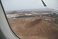
 Landeanflug auf Lanzarote III.jpg 3,888 × 2,592; 5.53 MB
-
 Landeanflug auf Lanzarote IV.jpg 3,888 × 2,592; 4.63 MB
-
 Schlackekegel auf Lanzarote bei La Asomada II.jpg 3,888 × 2,592; 7.06 MB
-
 Schlackekegel auf Lanzarote mit Regensammelfläche.jpg 3,888 × 2,592; 4.05 MB
-
 Südwestflanke eines Schlackenkegels bei Máguez, Lanzarote II.jpg 3,888 × 2,592; 7.43 MB
-
 Südwestflanke eines Schlackenkegels bei Máguez, Lanzarote.jpg 3,888 × 2,592; 7.3 MB
-
 Vulkanische Landschaft im Norden von Lanzarote.jpg 3,888 × 2,592; 6.5 MB
-
 Vulkankrater nordnordwestlich von Máguez, Lanzarote.jpg 3,888 × 2,592; 7.32 MB
-
 Zentrales Weinbaugebiet von Lanzarote.jpg 3,888 × 2,592; 5.65 MB


