Category:Spring in Northumberland
Jump to navigation
Jump to search
Ceremonial counties of England: Bedfordshire · Berkshire · Buckinghamshire · Cambridgeshire · Cheshire · Cornwall · Cumbria · Derbyshire · Devon · Dorset · Durham · East Sussex · Essex · Gloucestershire · Greater London · Hampshire · Herefordshire · Hertfordshire · Kent · Lancashire · Lincolnshire · Norfolk · North Yorkshire · Northumberland · Nottinghamshire · Oxfordshire · Shropshire · Somerset · South Yorkshire · Staffordshire · Suffolk · Surrey · Warwickshire · West Sussex · West Yorkshire · Wiltshire · Worcestershire
City-counties: Bristol · City of London
Former historic counties:
Other former counties:
City-counties: Bristol · City of London
Former historic counties:
Other former counties:
Subcategories
This category has the following 3 subcategories, out of 3 total.
Media in category "Spring in Northumberland"
The following 45 files are in this category, out of 45 total.
-

-
 Anderson's Plantation - geograph.org.uk - 734889.jpg 640 × 427; 97 KB
-
 Anti-tank defences at Drurridge Bay - geograph.org.uk - 1125666.jpg 640 × 480; 60 KB
-
 Birkey Burn - geograph.org.uk - 1308733.jpg 640 × 480; 160 KB
-
 Bridge over Birkey Burn - geograph.org.uk - 1308724.jpg 640 × 480; 123 KB
-
 Chibburn Links - geograph.org.uk - 149363.jpg 640 × 480; 77 KB
-
 Chibburn Mouth - geograph.org.uk - 253345.jpg 640 × 480; 70 KB
-

-
 Daffodils at Mollersteads - geograph.org.uk - 236912.jpg 640 × 480; 129 KB
-

-
 Dusk falls over Weetwood Moor - geograph.org.uk - 1248911.jpg 640 × 480; 95 KB
-
 Edge of forest on Wholhope Hill - geograph.org.uk - 1214191.jpg 640 × 480; 82 KB
-
 Forestry road near Wholehope Knowe - geograph.org.uk - 1221878.jpg 640 × 480; 82 KB
-

-
 Gate on Garleigh Moor - geograph.org.uk - 1193034.jpg 640 × 273; 46 KB
-

-
 Glacial meltwater channel (e) - geograph.org.uk - 821005.jpg 640 × 480; 82 KB
-

-
 Head of Coquetdale - geograph.org.uk - 1129.jpg 640 × 480; 57 KB
-
 Head of the Allerhope Burn - geograph.org.uk - 1214283.jpg 480 × 640; 103 KB
-
 Kirkharle - Geograph-1869828-by-Andrew-Curtis.jpg 1,024 × 768; 248 KB
-
 Langlee Crags, Harthope Valley. - geograph.org.uk - 384498.jpg 640 × 480; 119 KB
-
 Meanders on the River Aln - geograph.org.uk - 1203410.jpg 640 × 480; 112 KB
-
 Mellow Yellow - geograph.org.uk - 392118.jpg 640 × 480; 174 KB
-
 Moorland near St David's Cairn 1 - geograph.org.uk - 453537.jpg 640 × 480; 99 KB
-
 North-east from Cochrane Pike - geograph.org.uk - 1801444.jpg 1,024 × 576; 149 KB
-
 Observation Bunker, Hadston Links - geograph.org.uk - 153901.jpg 640 × 480; 67 KB
-
 Rivergreen Mill on the River Wansbeck - geograph.org.uk - 403256.jpg 640 × 480; 96 KB
-

-

-
 Silverton Hill - geograph.org.uk - 1222117.jpg 640 × 480; 108 KB
-
 St David's Cairn - geograph.org.uk - 1213948.jpg 640 × 480; 73 KB
-
 St Mungo's Well, Holystone - geograph.org.uk - 780204.jpg 640 × 480; 108 KB
-

-
 Timber Stacks - geograph.org.uk - 743496.jpg 640 × 427; 97 KB
-
 Track above Alwinton - geograph.org.uk - 1221935.jpg 640 × 480; 116 KB
-
 Track and copse - geograph.org.uk - 399968.jpg 640 × 480; 101 KB
-
 Track towards Longhirst - geograph.org.uk - 770036.jpg 640 × 480; 97 KB
-
 Trig Point on Garleigh Hill - geograph.org.uk - 1193003.jpg 640 × 480; 71 KB
-

-
 View towards Dipton Wood - geograph.org.uk - 1763863.jpg 600 × 450; 255 KB
-
 Wagon way Newburn - geograph.org.uk - 440425.jpg 640 × 480; 167 KB
-
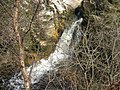 Waterfall, Ridge End Burn - geograph.org.uk - 1273247.jpg 640 × 480; 151 KB
-
 Watersmeet - geograph.org.uk - 1254483.jpg 640 × 480; 84 KB
-
 Wild goats on the Cheviots - geograph.org.uk - 1221654.jpg 640 × 480; 68 KB


_-_geograph.org.uk_-_821005.jpg)


_-_geograph.org.uk_-_1308666.jpg)


