Category:St Albans, Nottinghamshire
Jump to navigation
Jump to search
English: St Albans is a civil parish in the Gedling district, in the county of Nottinghamshire, England.
civil parish in Gedling, Nottinghamshire, England | |||||
| Upload media | |||||
| Instance of | |||||
|---|---|---|---|---|---|
| Location |
| ||||
 | |||||
Subcategories
This category has the following 2 subcategories, out of 2 total.
B
E
- Emmanuel church, Bestwood (7 F)
Media in category "St Albans, Nottinghamshire"
The following 81 files are in this category, out of 81 total.
-
 Along Woodchurch Road - geograph.org.uk - 2005069.jpg 1,280 × 854; 231 KB
-
 Bench mark, Bewcastle Road - geograph.org.uk - 2004959.jpg 854 × 1,280; 311 KB
-
 Bestwood Country Park Vicinity, Notts, NG5 - geograph.org.uk - 4253228.jpg 3,041 × 2,397; 1.54 MB
-
 Bestwood Country Park Vicinity, Notts. NG5 - geograph.org.uk - 4253165.jpg 2,227 × 2,319; 1.05 MB
-
 Bestwood Country Park Vicinity, Notts. NG5 - geograph.org.uk - 4253177.jpg 2,774 × 2,083; 1.04 MB
-
 Bestwood Country Park Vicinity, Notts. NG5 - geograph.org.uk - 4253191.jpg 2,509 × 3,316; 1.82 MB
-
 Bestwood Country Park Vicinity, Notts. NG5 - geograph.org.uk - 4253211.jpg 3,238 × 2,485; 1.7 MB
-
 Bestwood Country Park Vicinity, Notts. NG5 - geograph.org.uk - 4253220.jpg 3,470 × 2,284; 1.47 MB
-
 Bestwood Country Park Vicinity, Notts. NG5 - geograph.org.uk - 4253316.jpg 2,925 × 2,442; 1.76 MB
-
 Bestwood Country Park, NG5, Notts - geograph.org.uk - 4253685.jpg 2,926 × 2,570; 1.28 MB
-
 Bestwood Country Park, NG5, Notts. - geograph.org.uk - 4253572.jpg 4,032 × 2,353; 1.83 MB
-
 Bestwood Country Park, NG6, Notts - geograph.org.uk - 4253581.jpg 3,197 × 2,057; 1.12 MB
-
 Bestwood Country Park, NG6, Notts - geograph.org.uk - 4253599.jpg 2,361 × 2,711; 1.11 MB
-
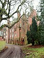
 Bestwood Lodge - geograph.org.uk - 2005044.jpg 1,280 × 863; 212 KB
-
 Bestwood Lodge - geograph.org.uk - 4782503.jpg 3,264 × 2,448; 3.93 MB
-
 Bestwood Lodge Drive - geograph.org.uk - 2005079.jpg 1,280 × 854; 313 KB
-
 Bestwood Lodge Drive, Bestwood Country Park - geograph.org.uk - 3665452.jpg 1,024 × 768; 182 KB
-
 Bestwood Lodge Drive, NG5, Notts - geograph.org.uk - 4253713.jpg 3,395 × 2,174; 1.52 MB
-
 Bestwood Lodge Drive, NG5, Notts - geograph.org.uk - 4253726.jpg 3,729 × 2,316; 1.58 MB
-
 Bestwood Lodge Drive, NG5, Notts - geograph.org.uk - 4253735.jpg 3,074 × 2,170; 1.03 MB
-
 Bestwood Lodge Drive, Notts, NG5 - geograph.org.uk - 4253708.jpg 3,635 × 2,412; 1.84 MB
-
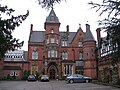
 Bestwood Lodge Hotel - geograph.org.uk - 1817412.jpg 640 × 426; 92 KB
-
 Bestwood Lodge Hotel, Bestwood, NG5, Notts - geograph.org.uk - 4253774.jpg 3,919 × 3,023; 2.59 MB
-
 Bestwood Lodge, Bestwood, NG5, Notts - geograph.org.uk - 4253649.jpg 2,575 × 3,365; 1.55 MB
-
 Bestwood Lodge, Bestwood, NG5, Notts - geograph.org.uk - 4253672.jpg 2,274 × 3,299; 1.3 MB
-
 Bestwood Lodge, Bestwood, NG5, Notts. - geograph.org.uk - 4253692.jpg 3,737 × 2,355; 1.61 MB
-
 Bewcastle Road - geograph.org.uk - 2004948.jpg 1,280 × 854; 280 KB
-
 Bewcastle Road - geograph.org.uk - 2004987.jpg 1,280 × 854; 272 KB
-
 Big Wood School - geograph.org.uk - 2004979.jpg 1,280 × 854; 231 KB
-
 Big Wood School, Bestwood, NG5, Notts - geograph.org.uk - 4253640.jpg 3,523 × 2,281; 1.64 MB
-
 Cedar Tree Road - geograph.org.uk - 2005054.jpg 1,280 × 854; 252 KB
-
 Deer Park Drive - geograph.org.uk - 2005096.jpg 1,280 × 854; 195 KB
-
 Deer Park Drive - geograph.org.uk - 2005101.jpg 1,280 × 854; 241 KB
-
 Electricity sub station - geograph.org.uk - 3826989.jpg 640 × 480; 115 KB
-
 Emmanuel Church - geograph.org.uk - 2004994.jpg 854 × 1,280; 257 KB
-
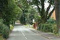
 Finsbury Road - geograph.org.uk - 2004977.jpg 1,280 × 854; 187 KB
-
 Footpath at Ruthwell Gardens - geograph.org.uk - 2004969.jpg 1,280 × 854; 347 KB
-
 Footpath near Bestwood Lodge - geograph.org.uk - 2005041.jpg 854 × 1,280; 305 KB
-
 Former bus turning circle, Warren Hill - geograph.org.uk - 3648371.jpg 1,024 × 768; 120 KB
-
 Former lych gate, Emmanuel Church - geograph.org.uk - 2005023.jpg 854 × 1,280; 316 KB
-
 Garages on Bewcastle Road - geograph.org.uk - 2004955.jpg 1,280 × 854; 286 KB
-
 Grampian Drive - geograph.org.uk - 2004981.jpg 1,280 × 854; 246 KB
-
 Hadrian Gardens - geograph.org.uk - 2004966.jpg 1,280 × 854; 303 KB
-
 Lambeth Road - geograph.org.uk - 2004974.jpg 1,280 × 854; 184 KB
-
 Lodge Gardens, Bestwood Lodge, NG5, Notts - geograph.org.uk - 4253777.jpg 2,403 × 3,673; 1.69 MB
-
 Lodge Gardens, Bestwood Lodge, NG5, Notts - geograph.org.uk - 4253781.jpg 3,163 × 2,445; 1.46 MB
-
 Lodge Gardens, Bestwood Lodge, NG5, Notts - geograph.org.uk - 4253784.jpg 3,537 × 2,719; 1.73 MB
-
 Lodge Gardens, Bestwood Lodge, NG5, Notts - geograph.org.uk - 4253790.jpg 2,990 × 2,564; 1.56 MB
-
 Lodge Gardens, Bestwood Lodge, NG5, Notts. - geograph.org.uk - 4253754.jpg 2,505 × 2,423; 1.14 MB
-
 Lodge Gardens, Bestwood Lodge, NG5, Notts. - geograph.org.uk - 4253770.jpg 3,833 × 2,853; 1.89 MB
-
 Muirfield Road - geograph.org.uk - 2004945.jpg 1,280 × 846; 205 KB
-
 Muirfield Road - geograph.org.uk - 2004985.jpg 1,280 × 854; 224 KB
-
 New Farm vicinity, NG5, Notts. - geograph.org.uk - 3850336.jpg 4,032 × 3,024; 2.61 MB
-
 New Farm vicinity, Redhill NG5, Notts. - geograph.org.uk - 3850326.jpg 3,007 × 2,182; 1.31 MB
-
 New Farm vicinity, Redhill NG5, Notts. - geograph.org.uk - 3850345.jpg 3,097 × 2,739; 1.9 MB
-
 New Farm vicinity, Redhill NG5, Notts. - geograph.org.uk - 3850405.jpg 3,222 × 2,514; 1.49 MB
-
 New Farm vicinity, Redhill, NG5, Notts. - geograph.org.uk - 3850454.jpg 3,267 × 2,481; 1.73 MB
-
 New Farm vicinity, Redhill, NG5, Notts. - geograph.org.uk - 3850503.jpg 3,117 × 2,943; 1.53 MB
-
 New Farm, Redhill, NG5, Notts. - geograph.org.uk - 3850517.jpg 3,110 × 2,299; 1.44 MB
-
 Northern names - geograph.org.uk - 2004962.jpg 1,280 × 851; 229 KB
-
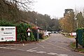
 Nottingham - NG5 (Bestwood) - geograph.org.uk - 2947459.jpg 640 × 480; 91 KB
-
 Nottingham - NG5 (Bestwood) - geograph.org.uk - 2947493.jpg 640 × 480; 85 KB
-
 Nottingham - NG5 (Bestwood) - geograph.org.uk - 2947530.jpg 640 × 480; 123 KB
-
 Nottingham - NG5 (Bestwood) - geograph.org.uk - 2947951.jpg 640 × 480; 154 KB
-
 Nottingham - NG5 (Bestwood) - geograph.org.uk - 2947959.jpg 640 × 480; 134 KB
-
 Nottingham - NG5 (Bestwood) - geograph.org.uk - 2947967.jpg 640 × 480; 141 KB
-
 Nottingham - NG5 (Bestwood) - geograph.org.uk - 2948468.jpg 640 × 480; 115 KB
-
 Nottingham - NG5 (Bestwood) - geograph.org.uk - 2948488.jpg 640 × 480; 98 KB
-
 Nottingham - NG5 (Bestwood) - geograph.org.uk - 2948512.jpg 640 × 480; 77 KB
-
 Nottingham - NG5 (Gedling) - geograph.org.uk - 2947415.jpg 640 × 480; 81 KB
-
 Parkland near Bestwood Lodge - geograph.org.uk - 2005056.jpg 1,280 × 854; 298 KB
-
 Potato field - geograph.org.uk - 2005094.jpg 1,280 × 854; 366 KB
-
 Recreation ground, Robin Hood Road - geograph.org.uk - 3903431.jpg 1,280 × 833; 178 KB
-
 Robin Hood Road, Bestwood Park - geograph.org.uk - 3665435.jpg 1,024 × 768; 127 KB
-
 Substation on Woodchurch Road - geograph.org.uk - 2005072.jpg 1,280 × 854; 271 KB
-
 The Old Lodge - geograph.org.uk - 2005077.jpg 1,280 × 854; 259 KB
-
 Tithe Gardens - geograph.org.uk - 2004952.jpg 1,280 × 841; 153 KB
-
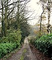
 Track through Bestwood Country Park (2) - geograph.org.uk - 5337767.jpg 1,024 × 768; 341 KB
-
 Undulating field near Bestwood Country Park - geograph.org.uk - 3665463.jpg 1,024 × 768; 139 KB
-
 Woodchurch Road - geograph.org.uk - 2005091.jpg 1,280 × 854; 254 KB
-
 Woodland in winter - geograph.org.uk - 4782506.jpg 3,264 × 2,448; 4.14 MB


_-_geograph.org.uk_-_2947459.jpg)
_-_geograph.org.uk_-_2947493.jpg)
_-_geograph.org.uk_-_2947530.jpg)
_-_geograph.org.uk_-_2947951.jpg)
_-_geograph.org.uk_-_2947959.jpg)
_-_geograph.org.uk_-_2947967.jpg)
_-_geograph.org.uk_-_2948468.jpg)
_-_geograph.org.uk_-_2948488.jpg)
_-_geograph.org.uk_-_2948512.jpg)
_-_geograph.org.uk_-_2947415.jpg)


_-_geograph.org.uk_-_5337767.jpg)


