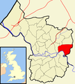
Category:St George East (ward)
Jump to navigation
Jump to search
former electoral ward in Bristol, United Kingdom | |||||
| Upload media | |||||
| Instance of |
| ||||
|---|---|---|---|---|---|
| Location | City of Bristol, South West England, England | ||||
 | |||||
Media in category "St George East (ward)"
The following 62 files are in this category, out of 62 total.
-
'The Lord Raglan', St George - geograph.org.uk - 6871705.jpg 1,024 × 768; 140 KB
-
A handy list of do's and don'ts - geograph.org.uk - 6556911.jpg 2,472 × 3,296; 1.69 MB
-
A pond in Conham Vale - geograph.org.uk - 6558270.jpg 2,472 × 3,296; 1.72 MB
-
Autopoint on Two Mile Hill - geograph.org.uk - 6177650.jpg 1,842 × 1,150; 1.3 MB
-
Avon Panorama - geograph.org.uk - 5556036.jpg 3,968 × 2,976; 3.55 MB
-
Bristol stgeorge.png 702 × 780; 148 KB
-
Car Wash on Speedwell Road, Two Mile Hill - geograph.org.uk - 6174356.jpg 1,920 × 1,280; 1.75 MB
-
Chapel Conversion on Crew's Hill Road - geograph.org.uk - 6871695.jpg 1,024 × 766; 178 KB
-
Charlton Road at the junction of Two Mile Hill - geograph.org.uk - 6177649.jpg 1,854 × 1,174; 1.31 MB
-
Co op on Ingleside Road, Two Mile Hill - geograph.org.uk - 6174363.jpg 1,920 × 1,280; 1,024 KB
-
Converted Chapel on Air Balloon Road - geograph.org.uk - 6871745.jpg 1,024 × 768; 171 KB
-
Converted Wesleyan Chapel, Crew's Hole - geograph.org.uk - 6871683.jpg 1,024 × 768; 235 KB
-
Descending Lamb Hill - geograph.org.uk - 6490532.jpg 4,886 × 3,257; 6.96 MB
-
Disused quarry - geograph.org.uk - 6490321.jpg 3,212 × 2,376; 3.74 MB
-
Downhill path - geograph.org.uk - 6490524.jpg 4,896 × 3,264; 6.74 MB
-
Dundridge Lane - geograph.org.uk - 6556885.jpg 3,296 × 2,472; 1.86 MB
-
Dundridge Park information board - geograph.org.uk - 6558262.jpg 3,296 × 2,472; 1.93 MB
-
Dundridge Park open space - geograph.org.uk - 6556909.jpg 3,296 × 2,472; 1.88 MB
-
Dundridge Park Playing Fields - geograph.org.uk - 6556905.jpg 3,296 × 2,472; 1.82 MB
-
Fairies live here - geograph.org.uk - 6556917.jpg 2,472 × 3,296; 1.88 MB
-
Footpath entrance - geograph.org.uk - 6490515.jpg 4,821 × 3,214; 6.69 MB
-
Housing development - geograph.org.uk - 6490314.jpg 3,992 × 2,855; 3.78 MB
-
In the Woods - geograph.org.uk - 6490287.jpg 4,896 × 3,264; 5.91 MB
-
Jeffries Hill Bottom - geograph.org.uk - 6556881.jpg 3,296 × 2,472; 1.85 MB
-
Kennet ^ Avon Canal Walk - geograph.org.uk - 6052524.jpg 640 × 480; 101 KB
-
Leaning Chimney - geograph.org.uk - 6490307.jpg 3,070 × 4,331; 6.85 MB
-
Magpie Bottom Nature Reserve - Hanham - geograph.org.uk - 6302874.jpg 640 × 480; 112 KB
-
Nags Head Hill - geograph.org.uk - 5579348.jpg 6,000 × 4,000; 7.41 MB
-
No bikes or guns^ - geograph.org.uk - 6556956.jpg 2,472 × 3,296; 1.79 MB
-
Old industrial chimney on Trooper's Hill Road - geograph.org.uk - 6871699.jpg 1,024 × 768; 168 KB
-
Paddling stood up - geograph.org.uk - 6557091.jpg 3,296 × 2,472; 1.79 MB
-
Path on Trooper's Hill - geograph.org.uk - 6870805.jpg 1,024 × 768; 318 KB
-
Private car park on Blackhorse Road, Kingswood - geograph.org.uk - 6171917.jpg 1,920 × 1,280; 1.47 MB
-
Quayside Village Bristol.jpg 640 × 424; 70 KB
-
River Avon - downstream - geograph.org.uk - 6490547.jpg 3,122 × 2,150; 3.77 MB
-
River Avon - upstream - geograph.org.uk - 6490566.jpg 4,896 × 3,264; 5.28 MB
-
River Avon at Crew's Hole - geograph.org.uk - 6871692.jpg 1,024 × 768; 237 KB
-
Sainsbury's Local and petrol station - geograph.org.uk - 5579323.jpg 5,604 × 3,816; 3.5 MB
-
Speedwell Road, Bristol - geograph.org.uk - 6174355.jpg 1,854 × 1,172; 1.02 MB
-
St Aidan with St George - geograph.org.uk - 5579340.jpg 6,000 × 4,000; 7.33 MB
-
St George East Bristol UK ward map.svg 1,138 × 1,266; 709 KB
-
Steep ascent - geograph.org.uk - 6490263.jpg 4,765 × 3,177; 6.46 MB
-
The Lord Raglan - geograph.org.uk - 5579370.jpg 5,604 × 3,816; 3.46 MB
-
The only cure for litter - geograph.org.uk - 6554286.jpg 2,472 × 3,296; 1.77 MB
-
The Stradbrook - geograph.org.uk - 6556925.jpg 3,296 × 2,472; 3.18 MB
-
The summit - geograph.org.uk - 6490300.jpg 3,995 × 2,790; 3.84 MB
-
The Trooper - geograph.org.uk - 5579276.jpg 6,000 × 4,000; 7 MB
-
To the Hilltop - geograph.org.uk - 6490268.jpg 3,562 × 2,326; 4.8 MB
-
Towards Lamb Hill - geograph.org.uk - 6490275.jpg 4,896 × 3,264; 6.43 MB
-
Trooper's Hill chimney - geograph.org.uk - 269867.jpg 480 × 640; 53 KB
-
Troopers Hill 24.07.2012 01.jpg 1,920 × 1,275; 3.39 MB
-
Troopers Hill 24.07.2012 02.jpg 1,920 × 1,275; 3.91 MB
-
Troopers Hill 24.07.2012 03.jpg 1,920 × 1,275; 2.58 MB
-
Troopers Hill 24.07.2012 04.jpg 1,275 × 1,920; 3.22 MB
-
Troopers Hill 24.07.2012 05.jpg 1,275 × 1,920; 3.04 MB
-
Troopers Hill 24.07.2012 06.jpg 1,275 × 1,920; 4.13 MB
-
Woodland Path - geograph.org.uk - 6490259.jpg 4,794 × 3,196; 6.09 MB
-
Yeo-Lyn - geograph.org.uk - 6556927.jpg 3,296 × 2,472; 1.78 MB


