Category:St Martin's, Shropshire
Jump to navigation
Jump to search
Cymraeg: Mae Llanfarthin (Saesneg: St Martins) yn bentre a phlwyf yn Swydd Amwythig ar y ffin Lloegr, gyda'r Afon Ceiriog a'r Afon Dyfrdwy yn ffurfio’r ffin.
English: The border village and parish of St Martin's is in Shropshire, England, just north of Oswestry and east of Chirk.

village and civil parish in Shropshire, UK  | |||||
| Upload media | |||||
| Instance of | |||||
|---|---|---|---|---|---|
| Location | Shropshire, West Midlands, England | ||||
| Different from | |||||
 | |||||
Subcategories
This category has the following 4 subcategories, out of 4 total.
P
- Pen-y-Bryn, Shropshire (2 F)
W
- Wigginton, Shropshire (1 F)
Media in category "St Martin's, Shropshire"
The following 169 files are in this category, out of 169 total.
-
 'Constance Irene' and 'Spider' (the work boat) - geograph.org.uk - 5399369.jpg 4,896 × 3,672; 5.63 MB
-
 A5 (A483) - the Ceiriog viaduct - geograph.org.uk - 2248898.jpg 640 × 480; 49 KB
-

-
 A5 (A483) at the footpath bridge - geograph.org.uk - 2248888.jpg 640 × 480; 46 KB
-

-

-
 A5 Chirk by-pass looking south - geograph.org.uk - 2172094.jpg 640 × 488; 107 KB
-
 A5 on Ceiriog Viaduct - geograph.org.uk - 4486054.jpg 1,600 × 1,200; 1.2 MB
-
 A5 southbound at Moreton Bridge - geograph.org.uk - 3951538.jpg 640 × 480; 50 KB
-
 A5 viaduct near Chirk - geograph.org.uk - 3133993.jpg 640 × 430; 64 KB
-
 A5, Chirk bypass - geograph.org.uk - 3134000.jpg 640 × 430; 71 KB
-
 All the time in the World - geograph.org.uk - 2830299.jpg 640 × 480; 109 KB
-
 Approaching bridge 15A, Llangollen Canal - geograph.org.uk - 5399373.jpg 640 × 480; 321 KB
-

-
 B5069 from Flannog Lane - geograph.org.uk - 2171993.jpg 640 × 480; 90 KB
-
 B5069 passed Ifton Heath School - geograph.org.uk - 2171985.jpg 640 × 480; 80 KB
-

-
 Bank Top Industrial Estate - geograph.org.uk - 5274433.jpg 1,600 × 1,200; 251 KB
-

-
 Barn, Plas Wigginton.jpg 640 × 480; 96 KB
-
 Belmont Bridge east of Weston Rhyn, Shropshire - geograph.org.uk - 5458873.jpg 1,280 × 960; 1.12 MB
-
 Belmont Bridge east of Weston Rhyn, Shropshire - geograph.org.uk - 5458880.jpg 1,280 × 960; 1.07 MB
-
 Boat on land - geograph.org.uk - 1766590.jpg 640 × 468; 58 KB
-
 Bridge 13W, Llangollen Canal - geograph.org.uk - 4296722.jpg 3,264 × 2,448; 3.44 MB
-
 Bridge 14W, Llangollen Canal - geograph.org.uk - 4296724.jpg 3,264 × 2,448; 3.12 MB
-
 Bridge 16W on the Llangollen Canal - geograph.org.uk - 5399370.jpg 640 × 480; 286 KB
-
 Bridge 16W, Llangollen Canal - geograph.org.uk - 4296728.jpg 3,264 × 2,448; 2.9 MB
-
 Bridge over the Afon Ceiriog - geograph.org.uk - 5868545.jpg 1,024 × 768; 1.22 MB
-
 Bridge over the river Ceriog - geograph.org.uk - 3616697.jpg 1,600 × 1,200; 755 KB
-
 Bryngwilla Lodge - geograph.org.uk - 5077718.jpg 1,600 × 1,200; 330 KB
-

-
 Bryngwilla Lodge, St Martin's - geograph.org.uk - 4613638.jpg 2,048 × 1,536; 915 KB
-
 Building a wall at Gledrid Farm - geograph.org.uk - 5856578.jpg 4,000 × 3,000; 2.34 MB
-
 Buildings at Chirk Bridge - geograph.org.uk - 2287291.jpg 640 × 480; 65 KB
-
 Canal approaching St Martin's Moor, Shropshire - geograph.org.uk - 4852157.jpg 1,280 × 886; 814 KB
-

-

-
 Ceiriog viaduct - geograph.org.uk - 4966629.jpg 1,600 × 1,161; 365 KB
-
 Chirk Aqueduct - geograph.org.uk - 5856548.jpg 4,000 × 3,000; 2.91 MB
-
 Chirk Bridge.jpg 2,000 × 1,500; 1.46 MB
-
 Church Row St. Martins - geograph.org.uk - 200751.jpg 640 × 480; 102 KB
-
 Cycle and foot path by A5 and sign for restaurant - geograph.org.uk - 4486049.jpg 1,600 × 1,068; 1.35 MB
-
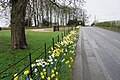 Daffodil display outside Bryngwilla Lodge - geograph.org.uk - 4892057.jpg 6,000 × 4,000; 4.21 MB
-
 Derelict buildings at Gledrid Farm - geograph.org.uk - 3428339.jpg 1,600 × 1,200; 508 KB
-
 Display at Moreton Park Garden Centre - geograph.org.uk - 1204612.jpg 640 × 480; 130 KB
-
 Disused field access track, St Martin's - geograph.org.uk - 4613611.jpg 2,048 × 1,536; 729 KB
-
 Dumping area next to Moreton Park Garden Centre - geograph.org.uk - 4892120.jpg 6,000 × 4,000; 3.94 MB
-
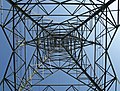 Electricity Pylon - geograph.org.uk - 1974500.jpg 640 × 488; 109 KB
-
 Entrance to Brynkinalt House from B5070 - geograph.org.uk - 2423010.jpg 640 × 485; 101 KB
-
 Farm track and field entrance near Bryngwilla Lodge - geograph.org.uk - 4892088.jpg 6,000 × 4,000; 4.77 MB
-
 Farmland near Rhosygadfa in Shropshire - geograph.org.uk - 4851626.jpg 1,024 × 768; 661 KB
-
 Farmland south of St Martin's, Shropshire - geograph.org.uk - 4852104.jpg 1,280 × 811; 672 KB
-
 Field west of Lower House Farm - geograph.org.uk - 3617645.jpg 1,600 × 1,200; 462 KB
-
 Fields west of Ifton Hall - geograph.org.uk - 3617675.jpg 3,264 × 2,448; 4.74 MB
-
 Filling station by the A5 - geograph.org.uk - 3134006.jpg 640 × 430; 50 KB
-
 Fine copper beech near Gledrid Farm - geograph.org.uk - 5856534.jpg 4,000 × 3,000; 2.69 MB
-
 Flannog Lane at Street Dinas - geograph.org.uk - 2171995.jpg 640 × 480; 86 KB
-
 Former Church School, St Martins - geograph.org.uk - 5752520.jpg 640 × 463; 61 KB
-

-

-
 Glanyrafon Woods - geograph.org.uk - 5856527.jpg 4,000 × 3,000; 2.84 MB
-
 Gledrid Services - geograph.org.uk - 5869074.jpg 1,280 × 865; 369 KB
-
 Gledrid Terrace - geograph.org.uk - 4892006.jpg 6,000 × 4,000; 4.28 MB
-

-
 Hairdressers, formerly a baker shop - geograph.org.uk - 1964358.jpg 640 × 485; 84 KB
-
 Hay Field, Rhyn Park - geograph.org.uk - 5044166.jpg 2,592 × 1,728; 1.05 MB
-
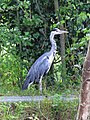 Heron on the prowl - geograph.org.uk - 2751223.jpg 480 × 640; 122 KB
-
-
 Ifton Miners Welfare - geograph.org.uk - 4804612.jpg 1,600 × 1,200; 194 KB
-

-
 Land surrounding Tenement and Pont-y-blew Farm - geograph.org.uk - 3617639.jpg 3,264 × 2,448; 4.78 MB
-
 Lane at Glendrid Farm, St Martin's - geograph.org.uk - 4613561.jpg 2,048 × 1,536; 1.16 MB
-
 Lane off the Ellesmere Road, St Martin's - geograph.org.uk - 4613596.jpg 2,048 × 1,536; 751 KB
-
 Lane to the east of Gledrid Farm, St Martin's - geograph.org.uk - 4613585.jpg 2,048 × 1,536; 1.01 MB
-
 Lane under the A5 near Gledrid Farm, St Martin's - geograph.org.uk - 4613579.jpg 2,048 × 1,536; 1.07 MB
-
 Lion Quays basin - geograph.org.uk - 5399366.jpg 640 × 480; 181 KB
-
 Llangollen Canal - Chirk Bank - geograph.org.uk - 130763.jpg 640 × 429; 107 KB
-
 Llangollen Canal at St Martin's Moor, Shropshire - geograph.org.uk - 4852478.jpg 1,280 × 960; 1.02 MB
-
 Llangollen Canal at St. Martins Moor - geograph.org.uk - 51920.jpg 640 × 480; 114 KB
-
 Llangollen Canal east of Preesgweene, Shropshire - geograph.org.uk - 5459599.jpg 960 × 1,280; 1.35 MB
-
 Llangollen Canal east of Preesgweene, Shropshire - geograph.org.uk - 5459601.jpg 1,280 × 960; 1.35 MB
-
 Llangollen Canal near St Martin's - geograph.org.uk - 1006569.jpg 640 × 428; 82 KB
-
 Llangollen Canal near St Martin's Moor, Shropshire - geograph.org.uk - 4852187.jpg 960 × 1,280; 1.08 MB
-

-
 Llangollen Canal on the Border Marches - geograph.org.uk - 51921.jpg 640 × 480; 121 KB
-

-

-
 Llangollen Canal, St Martin's Moor - geograph.org.uk - 5344418.jpg 1,280 × 851; 513 KB
-

-

-
 M ^ S Simply Food at Gledrid Services - geograph.org.uk - 6090268.jpg 4,000 × 3,000; 2.38 MB
-
 Maelor Way - geograph.org.uk - 5856533.jpg 4,000 × 3,000; 2.89 MB
-
 Maelor Way goes under the A5 - geograph.org.uk - 5856565.jpg 4,000 × 3,000; 2.84 MB
-
 Maelor Way near Glanyrafon woods - geograph.org.uk - 5856518.jpg 4,000 × 3,000; 2.9 MB
-
 Maelor Way, through a field of maize - geograph.org.uk - 5856516.jpg 4,000 × 3,000; 2.67 MB
-
-
 Minor lane past Lower House Farm - geograph.org.uk - 3617654.jpg 3,264 × 2,448; 4.36 MB
-
 Minor road junction by New House Farm - geograph.org.uk - 3617690.jpg 3,264 × 2,448; 4.57 MB
-
 Moreton Park Garden Centre, Chirk - geograph.org.uk - 5826320.jpg 640 × 427; 118 KB
-
 Narrowboats above New Marton Locks, Shropshire - geograph.org.uk - 4851464.jpg 1,280 × 960; 959 KB
-
 Narrowboats near St Martin's Moor, Shropshire - geograph.org.uk - 4852267.jpg 1,280 × 914; 870 KB
-
 New Marton Bridge north of Hindford, Shropshire - geograph.org.uk - 4851485.jpg 1,280 × 960; 874 KB
-
 New Marton Bridge south of St Martin's, Shropshire - geograph.org.uk - 5459608.jpg 1,280 × 805; 1,021 KB
-
 New Marton Top Lock in Shropshire - geograph.org.uk - 5459618.jpg 1,280 × 960; 1.02 MB
-
 New Marton Top Lock, Shropshire - geograph.org.uk - 4851455.jpg 768 × 1,024; 711 KB
-
 New Marton Top Lock, Shropshire - geograph.org.uk - 4851457.jpg 1,280 × 960; 832 KB
-
 New row of shops, St. Martins - geograph.org.uk - 4243983.jpg 1,024 × 726; 109 KB
-
 Oak tree in hedge - geograph.org.uk - 6100654.jpg 1,080 × 810; 213 KB
-
 Old barn at Plas Wiggin - geograph.org.uk - 5752894.jpg 640 × 480; 91 KB
-
 Old Canal Warehouse - geograph.org.uk - 1712654.jpg 480 × 640; 88 KB
-
 Ordnance Survey Cut Mark - geograph.org.uk - 5231419.jpg 4,000 × 3,000; 4.28 MB
-

-
 Pasture south of St Martin's in Shropshire - geograph.org.uk - 4851619.jpg 1,280 × 765; 1.06 MB
-
 Pasture south of St Martin's, Shropshire - geograph.org.uk - 4851605.jpg 1,280 × 870; 904 KB
-
 Pasture south of St Martin's, Shropshire - geograph.org.uk - 4852117.jpg 1,280 × 867; 765 KB
-
 Pheasant rearing sheds in a field of maize stubble - geograph.org.uk - 3428304.jpg 1,600 × 1,200; 397 KB
-
 Plaque, 1-4 Church Terrace - geograph.org.uk - 5752524.jpg 640 × 480; 86 KB
-
 Pond in a field - geograph.org.uk - 3618201.jpg 1,024 × 768; 343 KB
-
 Preesgweene, BP petrol station - geograph.org.uk - 6130528.jpg 6,815 × 4,543; 5.35 MB
-
 Prepared field near Brook House Farm - geograph.org.uk - 4892043.jpg 6,000 × 4,000; 5.84 MB
-

-
 Sarn Bridge, Llangollen Canal - geograph.org.uk - 1006590.jpg 640 × 428; 115 KB
-
 Sarn Bridge, Llangollen Canal - geograph.org.uk - 5344433.jpg 1,280 × 851; 504 KB
-
 Saw Mill Farm - geograph.org.uk - 5856524.jpg 4,000 × 3,000; 2.48 MB
-
 Semis on the B5070 at Chirk Bank - geograph.org.uk - 5856543.jpg 4,000 × 3,000; 2.21 MB
-
 Seventh Heaven near Chirk - geograph.org.uk - 4285136.jpg 800 × 721; 187 KB
-
 Sinking Boat at St Martin's Moor - geograph.org.uk - 1758743.jpg 640 × 480; 119 KB
-
 Small coppice in the middle of a large field - geograph.org.uk - 3428295.jpg 1,600 × 1,200; 442 KB
-
 Spar shop at BP petrol station - geograph.org.uk - 3526070.jpg 2,592 × 1,936; 1.62 MB
-

-
 St Martin's Moor Bridge, Shropshire - geograph.org.uk - 4852273.jpg 1,280 × 960; 911 KB
-
 St Martin's Moor Bridge, Shropshire - geograph.org.uk - 4852276.jpg 1,280 × 960; 809 KB
-
 St Martin's Parish Church - geograph.org.uk - 6100644.jpg 1,080 × 810; 165 KB
-
 St Martin's Parish Church Tower - geograph.org.uk - 5752848.jpg 480 × 640; 90 KB
-
 St Martins Centre, St Martins - geograph.org.uk - 1562181.jpg 640 × 480; 93 KB
-
 St Martins Pinfold - geograph.org.uk - 1550783.jpg 640 × 510; 110 KB
-
 St Martins Post Office (geograph 1964362).jpg 640 × 485; 61 KB
-
 St Martins Post Office in mourning (geograph 2307041).jpg 640 × 480; 40 KB
-
 Start of footpath to Ifton Farm - geograph.org.uk - 2171981.jpg 640 × 480; 111 KB
-
 Start of public footpath through fields - geograph.org.uk - 3618208.jpg 1,600 × 1,200; 362 KB
-
 Steep hill heading towards Pont-y-Blew - geograph.org.uk - 5856445.jpg 4,000 × 3,000; 2.91 MB
-
 Steep woodland beside the Llwybr Maelor Way - geograph.org.uk - 3617703.jpg 3,264 × 2,448; 5.61 MB
-
 Stile leading to two footpaths across Ryhn Park, St Martin's - geograph.org.uk - 4613620.jpg 2,048 × 1,536; 1.06 MB
-
 Stmartins canal.jpg 400 × 477; 159 KB
-

-
 The Bridge Inn, Chirk Bank - geograph.org.uk - 5856545.jpg 4,000 × 3,000; 2.4 MB
-
 The Ceiriog valley from the A5 - geograph.org.uk - 3562473.jpg 3,872 × 2,592; 2.62 MB
-
 The Church of St Martin in St Martin's - geograph.org.uk - 5231427.jpg 4,000 × 3,000; 2.98 MB
-

-
 The hidden Post Box at St Martins Moor - geograph.org.uk - 1915020.jpg 558 × 640; 152 KB
-
 The Llangollen Canal by Lion Quays - geograph.org.uk - 5399362.jpg 640 × 480; 232 KB
-
 The Llwybr Maelor Way - geograph.org.uk - 3617712.jpg 1,600 × 1,200; 745 KB
-
 The Llwybr Maelor Way - geograph.org.uk - 3618212.jpg 1,600 × 1,200; 646 KB
-

-
 Thistle seedheads - geograph.org.uk - 5856525.jpg 4,000 × 3,000; 2.48 MB
-

-
 Track leading past Ddol Farm - geograph.org.uk - 3616714.jpg 1,024 × 768; 249 KB
-
 View over the maize field to Bryngwilla Lodge - geograph.org.uk - 5856532.jpg 4,000 × 3,000; 2.41 MB
-
 Wat's Dyke Way at Rhyn Lane - geograph.org.uk - 5856512.jpg 4,000 × 3,000; 2.52 MB
-
 Welcome to England, A5 - geograph.org.uk - 3133998.jpg 640 × 430; 80 KB
-
 Wheat fields, Rhyn Park - geograph.org.uk - 5044157.jpg 5,133 × 3,422; 5.74 MB
-
 Woodland from A5 bridge - geograph.org.uk - 2408517.jpg 640 × 480; 96 KB
-
 A5 Ceiriog Viaduct - geograph.org.uk - 130761.jpg 640 × 429; 122 KB
-
 B5070 heading south - geograph.org.uk - 801355.jpg 640 × 480; 46 KB
-
 Bank Top Industrial Estate - geograph.org.uk - 165762.jpg 640 × 480; 74 KB
-
 Cross Keys Inn - geograph.org.uk - 165772.jpg 640 × 480; 79 KB
-
 Gatehouse to Brynkinalt - geograph.org.uk - 165751.jpg 640 × 480; 106 KB
-
 Gledrid Truck Stop - geograph.org.uk - 149872.jpg 640 × 424; 74 KB
-
 Lane at Nefod near St. Martins Moor - geograph.org.uk - 166139.jpg 640 × 480; 121 KB
_-_geograph.org.uk_-_5399369.jpg)
_-_the_Ceiriog_viaduct_-_geograph.org.uk_-_2248898.jpg)
_approaching_Gledrid_roundabout_-_geograph.org.uk_-_2248869.jpg)
_at_the_footpath_bridge_-_geograph.org.uk_-_2248888.jpg)
_at_the_Llangollen_Canal_bridge_-_geograph.org.uk_-_2248865.jpg)
_north_of_Gledrid_roundabout_-_geograph.org.uk_-_2248883.jpg)


.jpg)


.jpg)
.jpg)


