Category:St. Augustine, Florida in the 1760s
Jump to navigation
Jump to search
|
Media in category "St. Augustine, Florida in the 1760s"
The following 4 files are in this category, out of 4 total.
-
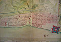 Elixio de la Puente Map of St. Augustine.jpg 800 × 546; 180 KB
-
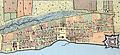
 Plan of the Town and Harbour of St. Augustine, 1762.jpg 700 × 497; 118 KB
-
 St. Augustine Map 1763.jpg 464 × 213; 80 KB
-
 Thomas Jeffrey's Map St. Augustine.jpg 465 × 337; 84 KB


