Category:St. Helen Without
Jump to navigation
Jump to search
English: St Helen Without is a civil parish in the Vale of White Horse district in the English county of Oxfordshire. In 1974 it was transferred from Berkshire. It is situated to the west of Abingdon and covers the settlements of Shippon, Cothill, Sandford. According to the 2001 census it had a population of 2,623.
civil parish in Vale of White Horse district, Oxfordshire, England, UK | |||||
| Upload media | |||||
| Instance of | |||||
|---|---|---|---|---|---|
| Location | Vale of White Horse, Oxfordshire, South East England, England | ||||
 | |||||
 | |||||


Subcategories
This category has the following 4 subcategories, out of 4 total.
Media in category "St. Helen Without"
The following 157 files are in this category, out of 157 total.
-
 'Dry Sandford Old School', Cothill Road - geograph.org.uk - 4763526.jpg 1,024 × 683; 131 KB
-
 'The Mill House', Cothill Road - geograph.org.uk - 4763620.jpg 1,024 × 683; 197 KB
-
 A34 Abingdon - geograph.org.uk - 2716586.jpg 640 × 480; 39 KB
-
 A34 at Marcham - geograph.org.uk - 3294994.jpg 640 × 427; 357 KB
-
 A34 crossing Wootton Road - geograph.org.uk - 4532732.jpg 1,024 × 753; 196 KB
-
 A34 near Ock Meadow - geograph.org.uk - 3103535.jpg 640 × 481; 50 KB
-
 A34 nears Marcham Interchange - geograph.org.uk - 3103527.jpg 640 × 480; 65 KB
-
 A34 northbound - geograph.org.uk - 3341434.jpg 640 × 480; 38 KB
-
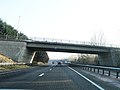 A34 northbound - geograph.org.uk - 3341439.jpg 640 × 480; 50 KB
-
 A34 northbound - geograph.org.uk - 3341444.jpg 640 × 480; 44 KB
-
 A34 northbound - geograph.org.uk - 5637610.jpg 640 × 428; 79 KB
-
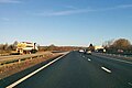 A34 northbound - geograph.org.uk - 5637613.jpg 640 × 428; 74 KB
-
 A34 northbound - geograph.org.uk - 5637618.jpg 640 × 428; 79 KB
-
 A34 northbound - geograph.org.uk - 5637619.jpg 640 × 428; 75 KB
-
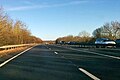 A34 northbound - geograph.org.uk - 5637623.jpg 640 × 428; 87 KB
-
 A34 northbound at the A415 junction - geograph.org.uk - 4688614.jpg 1,600 × 1,200; 483 KB
-
 A34 slip road to Marcham Road Interchange - geograph.org.uk - 2534033.jpg 3,643 × 2,538; 1.11 MB
-
 A34 Southbound near Dalton Barracks - geograph.org.uk - 6263369.jpg 640 × 440; 74 KB
-

-
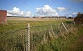 Abingdon Airfield - geograph.org.uk - 2676221.jpg 3,520 × 2,168; 893 KB
-
 Abingdon Airfield crash vehicle exit, Honeybottom Lane - geograph.org.uk - 6232626.jpg 4,000 × 3,000; 4.67 MB
-
 Avon Road from Long Tow, Shippon - geograph.org.uk - 4978433.jpg 2,304 × 1,728; 834 KB
-
 Barrow Road at the junction of Faringdon Road - geograph.org.uk - 4971182.jpg 2,216 × 1,602; 1.37 MB
-
 Barrow Road at the junction of Faringdon Road - geograph.org.uk - 4978438.jpg 2,304 × 1,728; 834 KB
-
 Barrow Road at the junction of Faringdon Road - geograph.org.uk - 4978439.jpg 2,304 × 1,728; 1.11 MB
-
 Barrow Road at the junction of Faringdon Road - geograph.org.uk - 4979161.jpg 2,176 × 1,540; 1.19 MB
-
 Barrow Road, Shippon - geograph.org.uk - 4978436.jpg 2,304 × 1,728; 1.47 MB
-
 Barrow Road, Shippon - geograph.org.uk - 4978437.jpg 2,304 × 1,728; 846 KB
-
 Bench overlooking Cothill Fen - geograph.org.uk - 5120723.jpg 1,500 × 1,125; 366 KB
-
 Benchmark on 'Dry Sandford Old School' - geograph.org.uk - 4763497.jpg 683 × 1,024; 314 KB
-
 Benchmark on 'The Mill House' - geograph.org.uk - 4763595.jpg 624 × 1,024; 266 KB
-
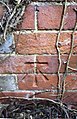 Benchmark on building at Dunmore Court - geograph.org.uk - 3358020.jpg 662 × 1,024; 226 KB
-
-
 Benchmark On Dry Sandford School - geograph.org.uk - 4762005.jpg 670 × 1,024; 203 KB
-

-
 Benchmark on letter box, Faringdon Road - geograph.org.uk - 2726749.jpg 683 × 1,024; 217 KB
-
 Benchmark on milestone, Faringdon Road - geograph.org.uk - 2726507.jpg 683 × 1,024; 290 KB
-
 Benchmark on St Helen's Church - geograph.org.uk - 4763282.jpg 658 × 1,024; 261 KB
-
 Benchmark on ^1 Sycamore Close - geograph.org.uk - 2726994.jpg 683 × 1,024; 172 KB
-
 Benchmark on ^3 Lashford Lane - geograph.org.uk - 4763332.jpg 643 × 1,024; 202 KB
-
 Benchmark on ^52 Faringdon Road - geograph.org.uk - 4782138.jpg 1,024 × 683; 337 KB
-
 Benchmark on ^98 Church Street - geograph.org.uk - 4763353.jpg 662 × 1,024; 264 KB
-
 Boardwalk to the hide - geograph.org.uk - 2311693.jpg 1,500 × 979; 366 KB
-
-
 Bridge carrying footpath over A34 - geograph.org.uk - 6371442.jpg 1,024 × 768; 111 KB
-
 Buildings at Dunmore Court - geograph.org.uk - 3358096.jpg 1,024 × 683; 220 KB
-
 Burrowing Into The Past - geograph.org.uk - 2676380.jpg 3,888 × 2,592; 2.09 MB
-
 Chapel House, Cothill - geograph.org.uk - 6233049.jpg 4,000 × 3,000; 5.05 MB
-
 Cholswell Road, Shippon - geograph.org.uk - 2675445.jpg 3,252 × 2,736; 1.34 MB
-
 Cholswell Road, Shippon - geograph.org.uk - 4978434.jpg 2,304 × 1,728; 1.41 MB
-
 Communication Masts at Dunmore Farm - geograph.org.uk - 1281636.jpg 640 × 436; 76 KB
-
 Cones on the Runway - geograph.org.uk - 4960714.jpg 4,000 × 3,000; 2.73 MB
-
 Cothill Fen - geograph.org.uk - 5126630.jpg 1,500 × 1,125; 454 KB
-
 Cothill Fen National Nature Reserve - geograph.org.uk - 2214215.jpg 2,560 × 1,920; 1.26 MB
-
 Cothill House School - geograph.org.uk - 6233045.jpg 4,000 × 3,000; 4.59 MB
-
 Cricket pitch, Cothill House School - geograph.org.uk - 6269602.jpg 800 × 600; 110 KB
-
 Danger. Keep out^ - geograph.org.uk - 1404669.jpg 640 × 427; 76 KB
-
 Darley Grange Drive - geograph.org.uk - 2880129.jpg 3,648 × 2,736; 2.65 MB
-

-
 Driving a Tank - geograph.org.uk - 4986771.jpg 1,600 × 1,200; 367 KB
-
 Dry Sandford - geograph.org.uk - 2880157.jpg 3,820 × 2,232; 2.14 MB
-

-
 Entering Cothill - geograph.org.uk - 6269598.jpg 800 × 600; 112 KB
-
 Entrance to Dalton Barracks - geograph.org.uk - 60907.jpg 640 × 480; 77 KB
-
 Faringdon Road at the junction of Choleswell Road - geograph.org.uk - 4978435.jpg 2,166 × 1,524; 1.38 MB
-
 Faringdon Road, Shippon - geograph.org.uk - 4979165.jpg 2,304 × 1,728; 836 KB
-
 Fen, Dry Sandford Pit Nature Reserve - geograph.org.uk - 6233086.jpg 4,000 × 3,000; 4.8 MB
-
 Field by Dalton Barracks - geograph.org.uk - 4971194.jpg 2,304 × 1,728; 814 KB
-
 Field Near Shippon - geograph.org.uk - 5658632.jpg 640 × 480; 128 KB
-
 Fields near Cothill - geograph.org.uk - 60929.jpg 640 × 480; 38 KB
-
 Fifth air fayre at RAF Abingdon - geograph.org.uk - 2296484.jpg 3,072 × 2,048; 2.88 MB
-
 Flock of sheep near Hitch Copse - geograph.org.uk - 6233108.jpg 4,000 × 3,000; 4.8 MB
-
 Footpath in Dry Sandford Nature Reserve - geograph.org.uk - 5126636.jpg 1,500 × 1,125; 451 KB
-
 Footpath round Cothill Fen - geograph.org.uk - 5126629.jpg 1,125 × 1,500; 339 KB
-
-

-

-
 Former school, Honeybottom Lane - geograph.org.uk - 6233097.jpg 4,000 × 3,000; 4.91 MB
-
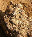 Fossils, Dry Sandford Pit - geograph.org.uk - 2676351.jpg 2,496 × 2,890; 831 KB
-
 Gate on the footpath - geograph.org.uk - 5126635.jpg 1,500 × 1,125; 311 KB
-
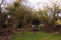 Gate to Lashford Lane Fen - geograph.org.uk - 2311680.jpg 1,500 × 1,000; 353 KB
-
 Gate to the hide - geograph.org.uk - 2311689.jpg 1,500 × 978; 455 KB
-
 Green Lane - geograph.org.uk - 6232995.jpg 4,000 × 3,000; 4.63 MB
-
 Hangar block at RAF Abingdon - geograph.org.uk - 2296443.jpg 2,540 × 1,560; 618 KB
-
 Honeybottom Lane at entrance to Dry Sandford - geograph.org.uk - 3356927.jpg 1,024 × 683; 267 KB
-
 Honeybottom Lane towards Oxford - geograph.org.uk - 6269607.jpg 800 × 600; 95 KB
-
 Honeybottom Lane towards Oxford - geograph.org.uk - 6269633.jpg 800 × 600; 127 KB
-
 House on Barrow Road, Shippon - geograph.org.uk - 4979041.jpg 2,304 × 1,728; 798 KB
-
 House on Barrow Road, Shippon - geograph.org.uk - 4979157.jpg 2,304 × 1,728; 830 KB
-
 Hut by the Hedge - geograph.org.uk - 3826316.jpg 1,600 × 1,086; 515 KB
-
 Junction in Faringdon Road - geograph.org.uk - 2726551.jpg 1,024 × 683; 205 KB
-
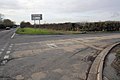
-
 Large building near Cothill School - geograph.org.uk - 6233040.jpg 3,756 × 2,776; 3.23 MB
-
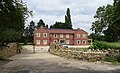 Large house on Cothill Road - geograph.org.uk - 6269596.jpg 800 × 485; 127 KB
-
 Lashford Lane - geograph.org.uk - 6232986.jpg 4,000 × 3,000; 4.57 MB
-
 Lashford Lane in Wootton - geograph.org.uk - 2311672.jpg 1,500 × 1,000; 126 KB
-
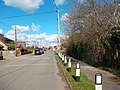 Lashford Lane, Dry Sandford - geograph.org.uk - 2943332.jpg 1,600 × 1,200; 650 KB
-
 Limestone Outcrop in Dry Sandford Pit - geograph.org.uk - 2676316.jpg 3,968 × 2,232; 1.32 MB
-
 Long Tow at the junction of Wootton Road - geograph.org.uk - 4971176.jpg 2,304 × 1,728; 860 KB
-

-
 Marcham Interchange approaching - geograph.org.uk - 6371917.jpg 1,024 × 768; 112 KB
-
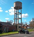 MG and Water Tank - geograph.org.uk - 2880212.jpg 945 × 1,024; 251 KB
-
 Mill House, Cothill - geograph.org.uk - 4383948.jpg 4,320 × 3,240; 2.87 MB
-
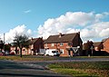 Nene Road, Shippon - geograph.org.uk - 2675439.jpg 3,608 × 2,548; 854 KB
-
 North along Wootton Road in Whitecross - geograph.org.uk - 4532737.jpg 1,024 × 641; 199 KB
-

-
 Northbound A34, Abingdon - geograph.org.uk - 3295037.jpg 640 × 427; 356 KB
-
 Northbound A34, Layby near Abingdon - geograph.org.uk - 3295044.jpg 640 × 427; 363 KB
-
 Nos. 52 and 50 Faringdon Road - geograph.org.uk - 4782152.jpg 1,024 × 695; 165 KB
-
 Old Airfield Huts - geograph.org.uk - 3061035.jpg 3,168 × 2,444; 2.22 MB
-
 Old Control Tower at RAF Abingdon - geograph.org.uk - 2676233.jpg 3,888 × 2,592; 1.73 MB
-
 Old Hut, RAF Abingdon - geograph.org.uk - 3815250.jpg 1,600 × 1,067; 387 KB
-
 One way to avoid the traffic^ - geograph.org.uk - 2297134.jpg 3,072 × 2,048; 3.02 MB
-
 Path to the A420 - geograph.org.uk - 5651373.jpg 640 × 480; 79 KB
-
 Pond, Dry Sandford Pit - geograph.org.uk - 2677965.jpg 3,888 × 2,592; 1.78 MB
-
 Quarry Face, Dry Sandford Pit - geograph.org.uk - 2676397.jpg 3,888 × 2,592; 1.53 MB
-
 RAF Abingdon, Far Side - geograph.org.uk - 2676415.jpg 3,724 × 2,232; 1.15 MB
-
 Reeds in Lashford Lane Fen - geograph.org.uk - 2311704.jpg 1,500 × 1,000; 340 KB
-
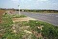 Road junction near Barrow Farm - geograph.org.uk - 5178330.jpg 1,024 × 683; 258 KB
-
 Road to Hitchcopse Farm - geograph.org.uk - 2305203.jpg 1,500 × 1,000; 300 KB
-
 Row of cottages, Cothill - geograph.org.uk - 6233055.jpg 4,000 × 3,000; 5.05 MB
-
 Sandford Brook in Dry Sandford Pit NR - geograph.org.uk - 2676283.jpg 3,888 × 2,592; 2 MB
-
 Sign for the Merry Miller, Cothill - geograph.org.uk - 6269606.jpg 593 × 800; 83 KB
-
 Silo and Masts at Dunmore Farm - geograph.org.uk - 2676121.jpg 3,092 × 2,532; 720 KB
-
 Sports Field - geograph.org.uk - 5651370.jpg 640 × 480; 66 KB
-
 St Helen's Church - geograph.org.uk - 4763300.jpg 1,024 × 683; 128 KB
-
 St Helen's church, Dry Sandforth - geograph.org.uk - 4383966.jpg 4,320 × 3,240; 2.91 MB
-
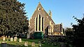 St Helen's, Dry Sandford - geograph.org.uk - 5357616.jpg 640 × 360; 71 KB
-
 St Mary Magdalene Church - geograph.org.uk - 5178307.jpg 1,024 × 683; 163 KB
-
 Stowford House Care Home, Shippon - geograph.org.uk - 2889503.jpg 1,600 × 1,200; 482 KB
-
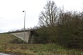 The A34 exit for Abingdon - geograph.org.uk - 6086936.jpg 1,920 × 1,280; 1.7 MB
-
 The A415 - geograph.org.uk - 5658630.jpg 640 × 427; 171 KB
-
 The B4017, Wootton Road, from the A34 - geograph.org.uk - 2655232.jpg 800 × 600; 208 KB
-
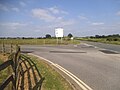 The entrance to Dalton Barracks, Shippon - geograph.org.uk - 4971247.jpg 2,304 × 1,728; 816 KB
-
 The entrance to Manor Farm on Barrow Road - geograph.org.uk - 4979033.jpg 2,230 × 1,624; 1.61 MB
-
 The hide in Lashford Lane Fen - geograph.org.uk - 2311697.jpg 1,500 × 1,000; 311 KB
-
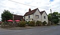 The Merry Miller, Cothill - geograph.org.uk - 6269604.jpg 800 × 460; 78 KB
-
 The old control tower near Cothill - geograph.org.uk - 1404703.jpg 640 × 421; 64 KB
-
 The porch of St Helen's Church - geograph.org.uk - 2307867.jpg 1,000 × 1,500; 301 KB
-
 The Prince of Wales, Shippon - geograph.org.uk - 2880203.jpg 3,648 × 2,736; 2.25 MB
-
 The quarry edge in Dry Sandford Pit - geograph.org.uk - 5120717.jpg 1,500 × 1,125; 400 KB
-
 The quarry edge in Dry Sandford Pit - geograph.org.uk - 5126628.jpg 1,500 × 1,125; 255 KB
-
 Track off Honeybottom Lane - geograph.org.uk - 6269632.jpg 800 × 600; 98 KB
-
 Trees by the bridleway - geograph.org.uk - 2305204.jpg 1,000 × 1,500; 190 KB
-
 Tyne Road, Shippon - geograph.org.uk - 4978432.jpg 2,256 × 1,662; 1.06 MB
-
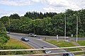 Vale of White Horse , Marcham Road A415 - geograph.org.uk - 4060787.jpg 3,351 × 2,225; 4.53 MB
-
 Vale of White Horse , The A34 - geograph.org.uk - 4050891.jpg 4,288 × 2,848; 6.15 MB
-
 Vale of White Horse , The A34 - geograph.org.uk - 4050892.jpg 4,288 × 2,848; 5.47 MB
-
 Vale of White Horse , The A34 - geograph.org.uk - 4050893.jpg 4,070 × 2,703; 6.21 MB
-
 Vale of White Horse , The A34 - geograph.org.uk - 4050894.jpg 4,157 × 2,760; 5.51 MB
-
 Waiting for something to happen - geograph.org.uk - 4960704.jpg 4,000 × 3,000; 3.04 MB
-
 Wood Pig - geograph.org.uk - 2943338.jpg 2,085 × 1,383; 913 KB
-
 Woodland and Rock, Dry Sandford Pit - geograph.org.uk - 2676325.jpg 3,968 × 2,232; 1.08 MB
-
 Woodlands by Wootton Road, Shippon - geograph.org.uk - 5257389.jpg 2,244 × 1,646; 2.03 MB
-
 ^1 Sycamore Close - geograph.org.uk - 2727004.jpg 1,024 × 683; 204 KB
-
 ^3 Lashford Lane - geograph.org.uk - 4763344.jpg 1,024 × 683; 172 KB
-
 ^98 Church Lane - geograph.org.uk - 4763389.jpg 1,024 × 683; 144 KB


_with_road_to_Shippon_-_geograph.org.uk_-_3334033.jpg)


