Category:St. Hubert (Süsterseel)
Jump to navigation
Jump to search
| Object location | | View all coordinates using: OpenStreetMap |
|---|
This is the category for an architectural monument.
It is on the list of cultural monuments of Selfkant, no. 14.
It is on the list of cultural monuments of Selfkant, no. 14.
  | |||||
| Upload media | |||||
| Instance of | |||||
|---|---|---|---|---|---|
| Location | Süsterseel, Selfkant, Heinsberg, Cologne Government Region, North Rhine-Westphalia, Germany | ||||
| Heritage designation | |||||
 | |||||
Media in category "St. Hubert (Süsterseel)"
The following 9 files are in this category, out of 9 total.
-
 Hubertuskerk.jpg 4,598 × 3,442; 4.58 MB
-

-
 Süsterseel Kirche St. Hubert Außenansicht.jpg 800 × 1,200; 69 KB
-
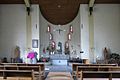 Süsterseel Kirche St. Hubert Innenansicht.JPG 1,200 × 800; 103 KB
-
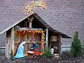 Süsterseel Kirche St. Hubert Krippe.JPG 2,400 × 1,800; 543 KB
-
 Süsterseel Kirche St. Hubert Maria mit Kind.JPG 800 × 1,200; 90 KB
-
 Süsterseel Kirche St. Hubert Orgel.JPG 1,200 × 800; 96 KB
-
 Süsterseel Kirche St. Hubert Schutzpatron.JPG 800 × 1,200; 69 KB
-
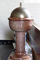 Süsterseel Kirche St. Hubert Taufbecken.JPG 800 × 1,200; 73 KB

.jpg)


