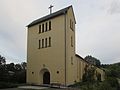
Category:St. Josef (Jeserig)
Jump to navigation
Jump to search
| Object location | | View all coordinates using: OpenStreetMap |
|---|
church building in Germany  | |||||
| Upload media | |||||
| Instance of | |||||
|---|---|---|---|---|---|
| Named after | |||||
| Location |
| ||||
| Heritage designation | |||||
 | |||||
This is the category of the Brandenburger Baudenkmal (cultural heritage monument) with the ID 09191020 (Wikidata)
|
Media in category "St. Josef (Jeserig)"
The following 2 files are in this category, out of 2 total.
-
 Groß Kreutz Jerserig kath Kirche.jpg 3,872 × 2,592; 1.39 MB
-
 St josef jeserig.jpg 2,434 × 1,824; 2.22 MB
