Category:St. Kenelm's Church, Sapperton, Gloucestershire
Jump to navigation
Jump to search
This is a category about listed building number 1089678. |
| Object location | | View all coordinates using: OpenStreetMap |
|---|
church in Sapperton, Gloucestershire, England  | |||||
| Upload media | |||||
| Instance of | |||||
|---|---|---|---|---|---|
| Dedicated to | |||||
| Location | Sapperton, Cotswold, Gloucestershire, South West England, England | ||||
| Heritage designation |
| ||||
 | |||||
Subcategories
This category has only the following subcategory.
Media in category "St. Kenelm's Church, Sapperton, Gloucestershire"
The following 30 files are in this category, out of 30 total.
-
 Arthur Ernest Barnsley grave plaque, Sapperton.jpg 5,472 × 3,648; 14.06 MB
-
 Arthur Ernest Barnsley grave, Sapperton.jpg 3,648 × 5,472; 12 MB
-
 Baldwin Memorial, Sappleton churchyard Geograph-4182301-by-Philip-Pankhurst.jpg 1,882 × 1,173; 1.81 MB
-
 Baldwin Tomb detail, Sapperton.jpg 5,472 × 3,648; 10.21 MB
-
 Baldwin Tomb, Sapperton.jpg 5,472 × 3,648; 14.63 MB
-
 Churchyard cross, Sapperton.jpg 3,648 × 5,472; 11.61 MB
-
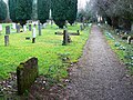
 Churchyard, Church of St Kenelm - geograph.org.uk - 2274472.jpg 1,440 × 1,080; 793 KB
-
 Ernest Gimson grave plaque, Sapperton.jpg 3,648 × 5,472; 12.72 MB
-
 Ernest Gimson grave, Sapperton.jpg 3,648 × 5,472; 12.59 MB
-
 Gargoyle, Church of St Kenelm - geograph.org.uk - 2274478.jpg 1,440 × 1,440; 749 KB
-
 Graffiti, Church of St Kenelm, Sapperton (1 of 2) - geograph.org.uk - 2274490.jpg 1,440 × 1,080; 926 KB
-
 Graffiti, Church of St Kenelm, Sapperton (2 of 2) - geograph.org.uk - 2274491.jpg 1,440 × 1,080; 959 KB
-
 Sapperton church - geograph.org.uk - 1776158.jpg 640 × 480; 111 KB
-
 Sapperton church - geograph.org.uk - 464946.jpg 640 × 477; 102 KB
-
 Sapperton church - geograph.org.uk - 77098.jpg 640 × 427; 108 KB
-
 Sapperton Church - geograph.org.uk - 787950.jpg 426 × 640; 67 KB
-
 Sidney Howard Barnsley grave plaque, Sapperton.jpg 3,648 × 5,472; 14.3 MB
-
 Sidney Howard Barnsley grave, Sapperton.jpg 3,648 × 5,472; 13.74 MB
-
 South into Sapperton Cemetery - geograph.org.uk - 2274504.jpg 1,440 × 1,080; 1.02 MB
-
 St Kenelm's church, Sapperton - geograph.org.uk - 1133624.jpg 640 × 480; 130 KB
-
 St Kenelm, Sapperton - geograph.org.uk - 4176870.jpg 5,415 × 3,620; 3.93 MB
-
 St Kenelm, Sapperton - geograph.org.uk - 4182276.jpg 6,016 × 4,000; 4.96 MB
-
 St Kenelm, Sapperton - geograph.org.uk - 4183173.jpg 6,016 × 4,000; 5.39 MB
-
 St Kenelm.jpg 3,072 × 2,304; 1.17 MB
-
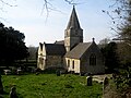
 St. Kenelm's Church, Sapperton, Gloucestershire.jpg 5,472 × 3,648; 9.39 MB
-
 Stained glass window, Church of St Kenelm - geograph.org.uk - 2274180.jpg 749 × 1,440; 430 KB
-
 Stained glass window, Church of St Kenelm - geograph.org.uk - 2274188.jpg 1,080 × 1,440; 563 KB
-
 Thomas Yarnton grave plaque, Sapperton.jpg 5,472 × 3,648; 12.81 MB
-

-


_-_geograph.org.uk_-_2274490.jpg)
_-_geograph.org.uk_-_2274491.jpg)


Categories:
- 12th-century churches in Gloucestershire
- Anglican churches in Gloucestershire
- Churches Conservation Trust
- Churches in the Diocese of Gloucester
- Cruciform churches in Gloucestershire
- Grade I listed churches in Gloucestershire
- Saint Kenelm churches in Gloucestershire
- Sapperton, Gloucestershire
- Stone churches in Gloucestershire
- Aisleless churches in Gloucestershire