Category:St Botolph's, Burton Hastings
Jump to navigation
Jump to search
| Object location | | View all coordinates using: OpenStreetMap |
|---|
church in Burton Hastings, Warwickshire, United Kingdom  | |||||
| Upload media | |||||
| Instance of | |||||
|---|---|---|---|---|---|
| Dedicated to | |||||
| Location | Burton Hastings, Rugby, Warwickshire, West Midlands, England | ||||
| Diocese | |||||
| Heritage designation |
| ||||
| Religion or worldview | |||||
 | |||||
Media in category "St Botolph's, Burton Hastings"
The following 5 files are in this category, out of 5 total.
-
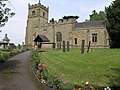 St Botolph's, Burton Hastings, Warks - geograph.org.uk - 186801.jpg 640 × 480; 113 KB
-
 Burton Hastings Church - geograph.org.uk - 4010667.jpg 1,024 × 768; 167 KB
-
 Saint Botolph church tower in Burton Hastings - geograph.org.uk - 4226772.jpg 1,600 × 1,155; 490 KB
-
 St Botolph's Church, Burton Hastings - geograph.org.uk - 5303527.jpg 640 × 480; 80 KB
-
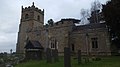 St Botolph's Church, Burton Hastings.jpg 2,560 × 1,440; 1.27 MB


Categories:
- 14th-century churches in Warwickshire
- 16th-century church towers in England
- Anglican churches in Warwickshire
- Burton Hastings
- Churches in the Diocese of Coventry
- Grade II* listed churches in Warwickshire
- Saint Botolph churches in Warwickshire
- Stone churches in Warwickshire
- Aisleless churches in Warwickshire