Category:St Edmund, Egleton
Jump to navigation
Jump to search
| Object location | | View all coordinates using: OpenStreetMap |
|---|
church in Egleton, Rutland, England, UK  | |||||
| Upload media | |||||
| Instance of | |||||
|---|---|---|---|---|---|
| Dedicated to | |||||
| Location | Egleton, Rutland, East Midlands, England | ||||
| Diocese | |||||
| Heritage designation |
| ||||
| Inception |
| ||||
| Religion or worldview | |||||
 | |||||
Media in category "St Edmund, Egleton"
The following 79 files are in this category, out of 79 total.
-
 Bench mark, St Edmund's Church, Egleton - geograph.org.uk - 4825006.jpg 960 × 1,280; 526 KB
-
 Church of Saint Edmund - geograph.org.uk - 5134298.jpg 2,000 × 1,330; 303 KB
-
 Church of St Edmund, Egleton - geograph.org.uk - 4824960.jpg 1,280 × 1,280; 623 KB
-
 Church of St Edmund, Egleton - geograph.org.uk - 4824963.jpg 1,280 × 961; 351 KB
-
 Church of St Edmund, Egleton - geograph.org.uk - 4824964.jpg 960 × 1,280; 394 KB
-
 Church of St Edmund, Egleton - geograph.org.uk - 4824965.jpg 960 × 1,280; 416 KB
-
 Church of St Edmund, Egleton - geograph.org.uk - 4824966.jpg 1,280 × 1,003; 270 KB
-
 Church of St Edmund, Egleton - geograph.org.uk - 4824969.jpg 1,280 × 960; 217 KB
-
 Church of St Edmund, Egleton - geograph.org.uk - 4824973.jpg 1,280 × 1,030; 242 KB
-
 Church of St Edmund, Egleton - geograph.org.uk - 4824974.jpg 1,280 × 960; 223 KB
-
 Church of St Edmund, Egleton - geograph.org.uk - 4824975.jpg 1,280 × 960; 281 KB
-
 Church of St Edmund, Egleton - geograph.org.uk - 4824976.jpg 1,280 × 960; 326 KB
-
 Church of St Edmund, Egleton - geograph.org.uk - 4824980.jpg 1,280 × 925; 233 KB
-
 Church of St Edmund, Egleton - geograph.org.uk - 4824983.jpg 864 × 1,280; 238 KB
-
 Church of St Edmund, Egleton - geograph.org.uk - 4824986.jpg 960 × 1,280; 237 KB
-
 Church of St Edmund, Egleton - geograph.org.uk - 4824987.jpg 960 × 1,280; 198 KB
-
 Church of St Edmund, Egleton - geograph.org.uk - 4824991.jpg 1,280 × 960; 269 KB
-
 Church of St Edmund, Egleton - geograph.org.uk - 4824993.jpg 1,280 × 960; 257 KB
-
 Church of St Edmund, Egleton - geograph.org.uk - 4824996.jpg 992 × 1,280; 255 KB
-
 Church of St Edmund, Egleton - geograph.org.uk - 4825001.jpg 960 × 1,280; 601 KB
-
 Church of St Edmund, Egleton - geograph.org.uk - 4825008.jpg 897 × 1,280; 252 KB
-
 Church of St Edmund, Egleton - geograph.org.uk - 4825011.jpg 960 × 1,280; 484 KB
-
 Church of St Edmund, Egleton - geograph.org.uk - 4825013.jpg 1,280 × 975; 408 KB
-
 Church of St Edmund, Egleton - geograph.org.uk - 4826081.jpg 973 × 1,280; 643 KB
-
 Church of St Edmund, Egleton - geograph.org.uk - 5713379.jpg 3,776 × 2,520; 2.67 MB
-
 St Edmund, Egleton - geograph.org.uk - 2556.jpg 640 × 430; 241 KB
-
 Egleton Church - geograph.org.uk - 4002214.jpg 1,600 × 1,200; 544 KB
-
 Egleton Church - geograph.org.uk - 4011306.jpg 1,600 × 1,200; 487 KB
-

-
 Egleton, St Edmund - geograph.org.uk - 3877906.jpg 1,024 × 1,024; 1.5 MB
-
 Egleton, St Edmund - interior - geograph.org.uk - 3878267.jpg 637 × 800; 748 KB
-

-
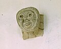
 Egleton, St Edmund - Norman carving - geograph.org.uk - 3878249.jpg 709 × 800; 951 KB
-
 Egleton, St Edmund - Norman south door - geograph.org.uk - 3878284.jpg 612 × 800; 770 KB
-
 Egleton, St Edmund - the parson's view - geograph.org.uk - 3878080.jpg 628 × 800; 733 KB
-
 Egleton, St Edmund - tympanum - geograph.org.uk - 3878068.jpg 800 × 607; 673 KB
-
 Egleton, St. Edmund's Church - geograph.org.uk - 4456813.jpg 3,655 × 2,415; 4.69 MB
-

-
 Egleton, St. Edmund's Church, Boards in the entrance porch - geograph.org.uk - 4456953.jpg 3,928 × 2,831; 4.51 MB
-

-

-

-
 Egleton, St. Edmund's Church, North facing chancel window - geograph.org.uk - 4456979.jpg 3,603 × 2,617; 5.38 MB
-

-
 Egleton, St. Edmund's Church, Piscina in the chancel - geograph.org.uk - 4456880.jpg 3,678 × 2,456; 3.15 MB
-
 Egleton, St. Edmund's Church, Sedilia - geograph.org.uk - 4456878.jpg 3,678 × 2,455; 3.82 MB
-
 Egleton, St. Edmund's Church, The east facing chancel window - geograph.org.uk - 4456984.jpg 3,679 × 2,456; 4.97 MB
-
 Egleton, St. Edmund's Church, The font - geograph.org.uk - 4456922.jpg 3,425 × 2,431; 4.53 MB
-
 Egleton, St. Edmund's Church, The font - geograph.org.uk - 4456931.jpg 4,131 × 3,350; 6.08 MB
-
 Egleton, St. Edmund's Church, The nave and chancel - geograph.org.uk - 4456943.jpg 5,120 × 3,146; 7.05 MB
-
 Egleton, St. Edmund's Church, The Norman chancel arch - geograph.org.uk - 4456889.jpg 3,760 × 3,651; 7.25 MB
-
 Egleton, St. Edmund's Church, The Norman chancel arch - geograph.org.uk - 4456894.jpg 3,459 × 3,474; 5.4 MB
-
 Egleton, St. Edmund's Church, The Norman chancel arch - geograph.org.uk - 4456898.jpg 5,398 × 3,488; 7.45 MB
-
 Egleton, St. Edmund's Church, The Norman chancel arch - geograph.org.uk - 4456903.jpg 3,678 × 3,640; 5.19 MB
-
 Egleton, St. Edmund's Church, The Norman chancel arch - geograph.org.uk - 4456907.jpg 4,107 × 2,836; 5.92 MB
-

-

-

-

-
 Egleton, St. Edmund's Church, The south doorway - geograph.org.uk - 4456819.jpg 2,451 × 1,853; 2.18 MB
-
 Egleton, St. Edmund's Church, The south doorway - geograph.org.uk - 4456825.jpg 5,482 × 3,624; 6.81 MB
-
 Egleton, St. Edmund's Church, The south doorway - geograph.org.uk - 4456832.jpg 5,520 × 2,907; 6.51 MB
-
 Egleton, St. Edmund's Church, The south doorway - geograph.org.uk - 4456844.jpg 3,678 × 2,456; 3.92 MB
-
 Egleton, St. Edmund's Church, The south doorway - geograph.org.uk - 4456851.jpg 3,934 × 2,684; 5.19 MB
-
 Egleton, St. Edmund's Church, The south doorway - geograph.org.uk - 4456856.jpg 3,906 × 2,727; 4.82 MB
-
 Egleton, St. Edmund's Church, The tower - geograph.org.uk - 4456992.jpg 3,678 × 2,456; 4.94 MB
-

-
 EgletonStEdmund 01.jpg 4,000 × 6,000; 8 MB
-
 EgletonStEdmund 02.jpg 6,000 × 4,000; 9.16 MB
-
 EgletonStEdmund 03.jpg 3,883 × 6,000; 16.23 MB
-
 St Edmund churchyard in Egleton - geograph.org.uk - 3723370.jpg 1,600 × 1,081; 800 KB
-
 St Edmund's Church in the village of Egleton - geograph.org.uk - 3971592.jpg 1,600 × 1,318; 614 KB
-
 St Edmund's Church, Egleton.jpg 4,000 × 3,000; 3.34 MB
-
 St Edmunds Church in Egleton - geograph.org.uk - 5178433.jpg 619 × 800; 289 KB
-
 St Edmunds Church, Egleton - geograph.org.uk - 3017154.jpg 480 × 640; 56 KB
-
 St Edmunds Church, Egleton - geograph.org.uk - 3293301.jpg 3,591 × 2,329; 2.38 MB
-
 St Edmunds Church, Egleton - geograph.org.uk - 3723330.jpg 1,600 × 1,308; 789 KB
-
 St Edmunds Church, Egleton - geograph.org.uk - 5571353.jpg 637 × 800; 178 KB
-
 Village sign and church - geograph.org.uk - 3723381.jpg 1,600 × 1,582; 1.41 MB


