Category:St John's Chapel, County Durham
Jump to navigation
Jump to search
| Object location | | View all coordinates using: OpenStreetMap |
|---|
village in County Durham, England, UK  | |||||
| Upload media | |||||
| Instance of | |||||
|---|---|---|---|---|---|
| Location | Stanhope, County Durham, North East England, England | ||||
 | |||||
Subcategories
This category has the following 10 subcategories, out of 10 total.
B
G
- Golden Lion, St John's Chapel (10 F)
H
- Huntshield Ford (16 F)
P
R
- Rigg House, St John's Chapel (2 F)
T
- St John's Chapel Town Hall (13 F)
Media in category "St John's Chapel, County Durham"
The following 23 files are in this category, out of 23 total.
-
 Broken Way - geograph.org.uk - 2647695.jpg 640 × 549; 114 KB
-
 False Oxlip, St John's Chapel - geograph.org.uk - 1854343.jpg 1,024 × 770; 284 KB
-
 Front Street, St John's Chapel - geograph.org.uk - 1035601.jpg 640 × 480; 66 KB
-
 High Rigg House Farm, St John's Chapel - geograph.org.uk - 1852876.jpg 1,024 × 768; 186 KB
-

-
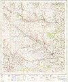
 Ordnance Survey One-Inch Sheet 84 Teesdale, Published 1947.jpg 10,936 × 12,785; 16.06 MB
-
 Ordnance Survey One-Inch Sheet 84 Teesdale, Published 1964.jpg 8,230 × 9,875; 11.42 MB
-
 Post Office and Newsagents - geograph.org.uk - 2647692.jpg 640 × 415; 86 KB
-
 Prospect of St John's Chapel - geograph.org.uk - 1807207.jpg 640 × 480; 75 KB
-

-
 Sheepfold in Longstaffs Allotment - geograph.org.uk - 682051.jpg 640 × 480; 95 KB
-
 Sheepfold on Harthope Moor - geograph.org.uk - 612109.jpg 640 × 480; 63 KB
-
 Sheltering sheep - geograph.org.uk - 507860.jpg 640 × 480; 416 KB
-
 Small gate - geograph.org.uk - 683865.jpg 640 × 449; 342 KB
-
 Snowed field east of St. John's Chapel - geograph.org.uk - 2075326.jpg 2,000 × 1,234; 1.92 MB
-
 St John's Chapel, Weardale from above New House - geograph.org.uk - 1846619.jpg 1,024 × 582; 173 KB
-
 St.Johns Chapel.jpg 2,272 × 1,504; 1.69 MB
-

-
 Towards St John's Chapel - geograph.org.uk - 2643532.jpg 640 × 470; 84 KB
-
 Towards St John's Chapel - geograph.org.uk - 2647685.jpg 640 × 473; 66 KB
-
 Towards St John's Chapel - geograph.org.uk - 2647686.jpg 640 × 426; 105 KB
-
 Towards St John's Chapel - geograph.org.uk - 2647715.jpg 640 × 487; 116 KB
-
 Towards St John's Chapel - geograph.org.uk - 2647716.jpg 640 × 477; 137 KB


_-_geograph.org.uk_-_1394182.jpg)


