Category:St John the Baptist's church, Huntley, Gloucestershire
Jump to navigation
Jump to search
| Object location | | View all coordinates using: OpenStreetMap |
|---|
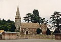
Grade I listed church in Forest of Dean, United Kingdom  | |||||
| Upload media | |||||
| Instance of | |||||
|---|---|---|---|---|---|
| Dedicated to | |||||
| Location | Huntley, Forest of Dean, Gloucestershire, South West England, England | ||||
| Diocese | |||||
| Heritage designation |
| ||||
| Inception |
| ||||
| Religion or worldview | |||||
 | |||||
Subcategories
This category has the following 2 subcategories, out of 2 total.
Media in category "St John the Baptist's church, Huntley, Gloucestershire"
The following 15 files are in this category, out of 15 total.
-
 Church near Huntley garden centre - geograph.org.uk - 701666.jpg 640 × 480; 105 KB
-
 Church of St John the Baptist, Huntley - geograph.org.uk - 4034642.jpg 3,872 × 2,592; 3.92 MB
-

-

-
 Notice board St.John the Baptist's Church - geograph.org.uk - 486709.jpg 640 × 528; 463 KB
-

-
 St John the Baptist Church, Huntley - geograph.org.uk - 64137.jpg 426 × 640; 120 KB
-
 St John the Baptist, Huntley - geograph.org.uk - 3332977.jpg 2,114 × 1,738; 671 KB
-

-

-

-
 St John, Huntley - geograph.org.uk - 3307416.jpg 831 × 575; 610 KB
-
 St John, Huntley - Stained glass window - geograph.org.uk - 3307433.jpg 703 × 575; 747 KB
-
 St. John the Baptist's church, Huntley - geograph.org.uk - 2234090.jpg 800 × 600; 441 KB
-
 St. John the Baptist's church, Huntley - geograph.org.uk - 6014976.jpg 1,600 × 901; 713 KB


