Category:St Mary Magdalene, Baunton
Jump to navigation
Jump to search
| Object location | | View all coordinates using: OpenStreetMap |
|---|
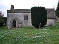
church in Baunton, Cotswold, UK  | |||||
| Upload media | |||||
| Instance of | |||||
|---|---|---|---|---|---|
| Dedicated to | |||||
| Location | Baunton, Cotswold, Gloucestershire, South West England, England | ||||
| Diocese | |||||
| Heritage designation |
| ||||
| Religion or worldview | |||||
 | |||||
Media in category "St Mary Magdalene, Baunton"
The following 2 files are in this category, out of 2 total.
-
 Baunton Church (winter^) - geograph.org.uk - 211535.jpg 640 × 413; 141 KB
-
 St Mary Magdalene, Baunton-geograph.org.uk-3356847.jpg 640 × 480; 165 KB
_-_geograph.org.uk_-_211535.jpg)