Category:St Michael's on Wyre
Jump to navigation
Jump to search
English: St Michael's on Wyre is a village on the Fylde, but within the Borough of Wyre, in Lancashire, England; it lies on the River Wyre. The village is centred on the church of St Michael's which was founded before AD 640. It is in the civil parish of Upper Rawcliffe with Tarnacre, which has a population of 604.
village in the United Kingdom  | |||||
| Upload media | |||||
| Instance of |
| ||||
|---|---|---|---|---|---|
| Location | Upper Rawcliffe-with-Tarnacre, Wyre, Lancashire, North West England, England | ||||
 | |||||
Subcategories
This category has only the following subcategory.
S
Media in category "St Michael's on Wyre"
The following 27 files are in this category, out of 27 total.
-
 Bridge at St. Michael's - geograph.org.uk - 1570315.jpg 640 × 480; 95 KB
-
 Bridge Over Drain - geograph.org.uk - 1759494.jpg 800 × 600; 243 KB
-
 Bridge over the River Wyre - geograph.org.uk - 1081898.jpg 640 × 480; 109 KB
-
 Club house St.Michael's Tennis Club - geograph.org.uk - 1778050.jpg 640 × 426; 314 KB
-
 Four fledging swallows - geograph.org.uk - 193927.jpg 640 × 480; 107 KB
-
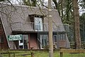
 Hall near St. Michael's on Wyre - geograph.org.uk - 1043642.jpg 640 × 479; 86 KB
-
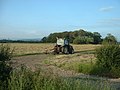 Haymaking near Buttfield Wood - geograph.org.uk - 193956.jpg 640 × 480; 98 KB
-
 Not Now Convenience - geograph.org.uk - 1208182.jpg 640 × 427; 55 KB
-

-
 River Wyre - geograph.org.uk - 1570310.jpg 640 × 480; 65 KB
-
 River Wyre, near St Michael's on Wyre.jpg 640 × 480; 90 KB
-
 River Wyre, St Michael's - geograph.org.uk - 869242.jpg 640 × 480; 76 KB
-
 Road bridge at St.Michael's on Wyre - geograph.org.uk - 1041088.jpg 640 × 479; 113 KB
-
 Sharples Lane in winter - geograph.org.uk - 1136309.jpg 640 × 480; 71 KB
-
 Sharples Lane, looking east - geograph.org.uk - 1136316.jpg 640 × 480; 99 KB
-
 St Michael's Bridge and Church - geograph.org.uk - 18890.jpg 640 × 480; 133 KB
-
 St. Michael's on Wyre tennis courts - geograph.org.uk - 1043644.jpg 640 × 479; 131 KB
-
 Stile and gate on Sharple's Lane - geograph.org.uk - 1041113.jpg 640 × 479; 116 KB
-
 Substantial Stiles - geograph.org.uk - 1759448.jpg 754 × 564; 176 KB
-
 The end of Sharple's Lane - geograph.org.uk - 1041112.jpg 640 × 479; 94 KB
-

-
 Three Toadstools, Two Barrels - geograph.org.uk - 1759477.jpg 800 × 600; 342 KB
-
 Wall plaque.jpg 3,024 × 4,032; 2.19 MB
-
 Weir on the River Wyre - geograph.org.uk - 869245.jpg 640 × 480; 102 KB
-
 Farmland near Wildboar Farm - geograph.org.uk - 18894.jpg 640 × 480; 110 KB
-
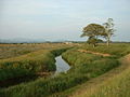 River Brock near St Michael's - geograph.org.uk - 194446.jpg 640 × 480; 83 KB
-
 Tarnacre Hall Farm - geograph.org.uk - 193961.jpg 640 × 480; 102 KB


