Category:St Olaf's Church, Lunda Wick
Jump to navigation
Jump to search
| Object location | | View all coordinates using: OpenStreetMap |
|---|
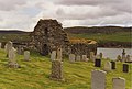
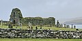
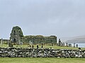
Ruins of medieval church in Lund, Unst, Shetland Islands, Scotland, UK  | |||||
| Upload media | |||||
| Instance of | |||||
|---|---|---|---|---|---|
| Location |
| ||||
| Connects with |
| ||||
| Heritage designation |
| ||||
 | |||||
Media in category "St Olaf's Church, Lunda Wick"
The following 11 files are in this category, out of 11 total.
-
 Lund kirk - geograph.org.uk - 319300.jpg 600 × 399; 141 KB
-
-

-
 St Olaf's Church - Lunda Wick - tombstone 1573.jpg 409 × 600; 191 KB
-
 St Olaf's Church - Lunda Wick.jpg 768 × 382; 157 KB
-
 St Olaf's Kirk from Lund beach - geograph.org.uk - 2484348.jpg 800 × 533; 238 KB
-
 St Olaf's Kirk, Lund, from Underhoull, Westing - geograph.org.uk - 5539186.jpg 1,024 × 684; 199 KB
-
 St Olafs 1 (cropped).jpg 4,002 × 2,035; 2.18 MB
-
 St Olafs 1.jpg 4,032 × 3,024; 2.55 MB
-
 St Olaf’s 2.jpg 1,536 × 2,048; 1.07 MB
-
 St Olaf’s 3.jpg 4,032 × 3,024; 4.14 MB


.jpg)

