Category:St Olaf's Church, Voe
Jump to navigation
Jump to search
| Object location | | View all coordinates using: OpenStreetMap |
|---|
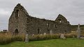
church building and churchyard in Shetland Islands, Scotland, UK _20080822_01.jpg) | |||||
| Upload media | |||||
| Instance of | |||||
|---|---|---|---|---|---|
| Location |
| ||||
| Heritage designation |
| ||||
 | |||||
Media in category "St Olaf's Church, Voe"
The following 2 files are in this category, out of 2 total.
-
 St Olaf's Church (Voe) 20080822 01.jpg 768 × 436; 147 KB
-
 St Olaf's Church (Voe) 20080822 02.jpg 768 × 416; 166 KB
_20080822_02.jpg)