Category:St Swithun's Church, Worcester
Jump to navigation
Jump to search
English: Media related to the former parish church of St Swithun, Worcester, England
| Object location | | View all coordinates using: OpenStreetMap |
|---|
Grade I listed church in the United Kingdom  | |||||
| Upload media | |||||
| Instance of | |||||
|---|---|---|---|---|---|
| Dedicated to | |||||
| Location | |||||
| Architectural style | |||||
| Heritage designation |
| ||||
| Inception |
| ||||
| official website | |||||
 | |||||
Media in category "St Swithun's Church, Worcester"
The following 24 files are in this category, out of 24 total.
-
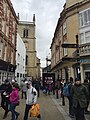
 Church Street, Worcester - geograph.org.uk - 2172739.jpg 480 × 640; 73 KB
-
 Clock on St Swithun's Church, Worcester - geograph.org.uk - 2356637.jpg 598 × 900; 360 KB
-
 Cut Mark found on St Swithin's Church - geograph.org.uk - 6262487.jpg 576 × 1,024; 221 KB
-
-
 Historic Church - geograph.org.uk - 4163592.jpg 768 × 1,024; 189 KB
-

-

-

-
 Mealcheapen Street (3281656098).jpg 3,072 × 2,304; 3.22 MB
-
 Mealcheapen Street, Worcester - geograph.org.uk - 351438.jpg 640 × 426; 113 KB
-
 Partially obstructed church, Worcester, England - DSCF0713.JPG 3,000 × 4,000; 2.83 MB
-
 St Swithin's Church from the East - geograph.org.uk - 217959.jpg 427 × 640; 57 KB
-
 St Swithin's Church, Worcester. - geograph.org.uk - 6262478.jpg 576 × 1,024; 131 KB
-

-
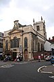
 St Swithun church, Worcester - geograph.org.uk - 195484.jpg 426 × 640; 79 KB
-
 St Swithun's Church Worcester.jpg 3,840 × 2,160; 3.49 MB
-
 St Swithun's Church, Worcester - geograph.org.uk - 1534018.jpg 480 × 640; 70 KB
-
 St Swithun's Church, Worcester - geograph.org.uk - 4348466.jpg 480 × 640; 76 KB
-
 St Swithun, Worcester - geograph.org.uk - 1610159.jpg 426 × 640; 110 KB
-
 St Swithuns (3281728184).jpg 3,072 × 2,304; 2.57 MB
-
 Tower of St Swithun's church - geograph.org.uk - 4825511.jpg 768 × 1,024; 152 KB
-
 Tower of St Swithun's Church, Worcester - geograph.org.uk - 2351966.jpg 598 × 900; 443 KB
-
 Worcester , Small Lane ^ St Swithun's Church - geograph.org.uk - 3965732.jpg 2,848 × 4,288; 7.95 MB
-
 Worcester , The Shambles - geograph.org.uk - 3965981.jpg 4,288 × 2,848; 5.26 MB


_-_looking_towards_the_altar,_Church_Street,_Worcester_-_geograph.org.uk_-_3244970.jpg)
_-_looking_towards_the_organ,_Church_Street,_Worcester_-_geograph.org.uk_-_3244974.jpg)
_-_the_three_decker_pulpit,_Church_Street,_Worcester_-_geograph.org.uk_-_3248723.jpg)
.jpg)


.jpg)


Categories:
- 18th-century churches in Worcestershire
- Anglican churches in Worcestershire
- Churches Conservation Trust
- Churches in England built in 1736
- Churches in the Anglican Diocese of Worcester
- Churches in Worcester, England
- Georgian churches in Worcestershire
- Grade I listed churches in Worcestershire
- Saint Swithin churches in England
- St Swithin Street, Worcester
- Aisleless churches in Worcestershire