Category:Stamps of the postal area Oberbefehlshaber Ost
Jump to navigation
Jump to search

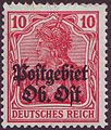
The postal area of the civil administration of the "Oberbefehlhaber Ost" (= "Supreme commander - East", shortly "Ober-Ost") was created in November 1915, a self-contained postal administration with own stamps began their works on the 15th of January, 1916. The postal area of the German-occupated territory encompassed ca. 108,808 km² in the northwestern territory of the then Russian Empire under embedding of:
- - the area of the later Lithuania
- - the area of the later Latvia (South Courland, from 1918 also North Courland and Livonia)
- - the area of the later Estonia (from 1918)
- - the area of the then Russian district of Augustow (contemporary Augustow in Poland)
- - the area of the then Russian district of Suwalki (contemporary Suwalki in Poland)
- - any areas in the contemporary Belarus
The stamps of the postal area Oberbefehlshaber Ost were valid to the 28th of December 1918, as all post offices of the German "Landespost im Baltikum" were closed.
Media in category "Stamps of the postal area Oberbefehlshaber Ost"
The following 15 files are in this category, out of 15 total.
-
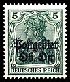
 DR 1916 OberOst MiNr01 Mitau B002.jpg 353 × 414; 65 KB
-
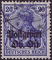
 Postgebiet Ob. Ost Mi. 2.jpg 533 × 627; 116 KB
-
 Postgebietobost5pf1916.jpg 190 × 222; 46 KB
-
 Postgebiet Ob. Ost Mi. 4.jpg 533 × 632; 140 KB
-
 DR 1916 OberOst MiNr020a B002.jpg 353 × 413; 72 KB
-
 DR 1916 OberOst MiNr09 B002.jpg 376 × 435; 76 KB
-
 DR 1916 OberOst MiNr10b B002.jpg 367 × 429; 80 KB
-
 1916 50pfg OberbefehlshaberOst Mi11.jpg 373 × 443; 201 KB
-
 1917 15pfg violet OberbefehlshaberOst Libau Mi7.jpg 359 × 429; 193 KB
-
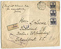 CoverRiga1918.jpg 921 × 743; 494 KB
-
 Ober Ost.JPG 408 × 212; 27 KB
-
 Postcard Ober-Ost 1917.jpg 1,644 × 1,038; 409 KB
-
 PostcardGermany1918(Dorpat).jpg 856 × 541; 331 KB
-
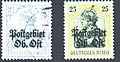
 Postgebiet Ob. Ost Mi. 1.jpg 535 × 632; 89 KB
-
 Postgebiet Ob. Ost Mi. 5.jpg 535 × 631; 115 KB


.jpg)

