Category:Stationslaan, Breda
Jump to navigation
Jump to search
| Camera location | | View all coordinates using: OpenStreetMap |
|---|
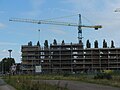
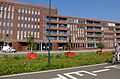
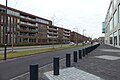
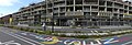
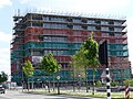
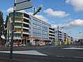
Nederlands: Afbeeldingen van de Stationslaan nabij het centrum van Breda. De Stationlaan is een doorgaande straat nabij het Station Breda in de wijk Belcrum in de provincie Noord-Brabant in het zuiden van Nederland. De Stationslaan is onder meer bereikbaar via de straten de Belcrumweg, Terheijdenstraat en de Doornboslaan (https://breda-en-omgeving.nl/fotos-breda-noord-deel-4.htm)
street in Breda, the Netherlands | |||||
| Upload media | |||||
| Instance of | |||||
|---|---|---|---|---|---|
| Location | Breda, North Brabant, Netherlands | ||||
| Street address |
| ||||
 | |||||
Subcategories
This category has only the following subcategory.
G
Media in category "Stationslaan, Breda"
The following 64 files are in this category, out of 64 total.
-
 Aanlegplaatsen Breda 1070478.jpg 4,000 × 2,672; 5.91 MB
-
 Aanlegplaatsen de Mark P1070469.jpg 4,000 × 2,672; 6.08 MB
-
 Appartementen P1620777.jpg 4,000 × 3,000; 6.07 MB
-
 Appartementgebouw Belcrum DSCF4759.jpg 1,536 × 2,048; 1.49 MB
-
 Appartementgebouw Belcrum DSCF4761.jpg 2,048 × 1,536; 1.45 MB
-
 Belcrum DSCF8716.JPG 2,816 × 2,112; 2.64 MB
-
 Belcrum DSCF8717.JPG 2,816 × 2,112; 2.8 MB
-
 Belcrum DSCF8825.JPG 2,816 × 2,112; 2.64 MB
-
 Belcrum DSCF8826.JPG 2,816 × 2,112; 2.62 MB
-
 Belcrum DSCF8827.JPG 2,816 × 2,112; 2.57 MB
-
 Belcrum DSCF9055.jpg 2,816 × 1,864; 2.5 MB
-
 Belcrumkant Nieuwe Station Breda DSCF7162.jpg 2,816 × 1,864; 2.47 MB
-
 Breda Vooruit DSCF6066.jpg 2,816 × 1,864; 2.59 MB
-
 Breda Vooruit DSCF6067.jpg 2,816 × 1,864; 2.53 MB
-
 Breda Vooruit DSCF6068.jpg 2,816 × 1,864; 2.52 MB
-
 De Faam DSCF3164.JPG 2,816 × 2,112; 2.58 MB
-
 De Faam DSCF3165.JPG 2,816 × 2,112; 2.49 MB
-
 De Faam DSCF3166.JPG 2,816 × 2,112; 2.61 MB
-
 Fietspad P1620769.jpg 4,000 × 3,000; 6.31 MB
-
 Mark in Breda P1050493.jpg 4,000 × 2,672; 5.7 MB
-
 Nieuwe station Breda DSCF3175.JPG 2,816 × 2,112; 2.6 MB
-
 Nieuwe station Breda DSCF6600.JPG 2,816 × 2,112; 2.67 MB
-
 Nieuwe Station Breda DSCF8928.JPG 2,816 × 2,112; 2.73 MB
-
 Omgeving nieuwe station Breda DSCF6601.JPG 2,816 × 2,112; 2.68 MB
-
 Omgeving nieuwe station Breda DSCF6619.JPG 2,816 × 2,112; 2.66 MB
-
 Omgeving nieuwe station Breda DSCF6620.JPG 2,816 × 2,112; 2.61 MB
-
 Omgeving nieuwe station Breda DSCF6621.JPG 2,816 × 2,112; 2.68 MB
-
 Panorama P1320076.jpg 6,144 × 1,920; 6.37 MB
-
 Panorama P1320077.jpg 5,920 × 1,920; 6.06 MB
-
 Station Breda DCF5573.JPG 2,816 × 2,112; 2.65 MB
-
 Stationslaan Breda DSCF3105.jpg 2,816 × 2,112; 2.74 MB
-
 Stationslaan Breda DSCF3106.jpg 2,816 × 2,112; 2.61 MB
-
 Stationslaan Breda P1320081.jpg 4,000 × 2,672; 5.71 MB
-
 Stationslaan Breda P1320082.jpg 4,704 × 1,920; 5.26 MB
-
 Stationslaan Breda P1320083.jpg 4,000 × 2,672; 5.87 MB
-
 Stationslaan Breda P1320087.jpg 4,000 × 2,672; 5.64 MB
-
 Stationslaan Breda P1320089.jpg 4,000 × 2,672; 5.96 MB
-
 Stationslaan Breda P1320091.jpg 5,632 × 1,920; 6.3 MB
-
 Stationslaan Breda P1320092.jpg 4,000 × 2,672; 5.69 MB
-
 Stationslaan Breda P1420124.jpg 4,000 × 2,672; 6 MB
-
 Stationslaan Breda P1420125.jpg 4,000 × 2,672; 5.81 MB
-
 Stationslaan Breda P1420126.jpg 4,000 × 2,672; 5.85 MB
-
 Stationslaan, Breda DSCF0144.jpg 2,816 × 2,112; 2.77 MB
-
 Stationslaan, Breda P1070460.jpg 4,000 × 2,672; 5.94 MB
-
 Stationslaan, Breda P1340651.jpg 4,000 × 2,672; 5.77 MB
-
 Stationslaan, Breda P1360698.jpg 4,000 × 2,672; 6.26 MB
-
 Stationslaan, Breda P1360699.jpg 4,000 × 2,672; 6.08 MB
-
 Stationslaan, Breda P1360700.jpg 4,000 × 2,672; 5.91 MB
-
 Stationslaan, Breda P1360701.jpg 4,000 × 2,672; 5.71 MB
-
 Stationslaan, Breda P1360702.jpg 4,000 × 2,672; 5.9 MB
-
 Stationslaan, Breda P1360703.jpg 4,000 × 2,672; 5.71 MB
-
 Stationslaan, Breda P1620768.jpg 4,000 × 3,000; 6.34 MB
-
 Stationslaan, Breda P1620770.jpg 4,000 × 3,000; 6.13 MB
-
 Stationslaan, Breda P1620772.jpg 4,000 × 3,000; 5.82 MB
-
 Stationslaan, Breda P1620773.jpg 4,000 × 3,000; 6.36 MB
-
 Stationslaan, Breda P1620774.jpg 4,000 × 3,000; 6.1 MB
-
 Stationslaan, Breda P1620776.jpg 4,000 × 3,000; 6.54 MB
-
 Stationslaan, Breda P1620779.jpg 4,000 × 3,000; 6.16 MB
-
 Stationslaan, Breda P1620780.jpg 4,000 × 3,000; 6.1 MB
-
 Woningen Belcrum in aanbouw DSCF0076.JPG 2,816 × 2,112; 2.69 MB
-
 Woningen nabij Station Breda DSCF0073.JPG 2,816 × 2,112; 2.62 MB
-
 Woningen P1420122.jpg 4,000 × 2,672; 5.82 MB
-
 Woningen P1420123.jpg 4,000 × 2,672; 5.83 MB
-
 Zicht op station Breda DSCF0075.JPG 2,816 × 2,112; 2.62 MB


